Hanau in Main-Kinzig-Kreis, Hesse, Germany — Central Europe
Verlauf der Altstadtmauer
⎯⎯⎯
Course of the Old Town Wall

Photographed by Andrew Ruppenstein, May 26, 2024
1. Verlauf der Altstadtmauer / Course of the Old Town Wall Marker

An dieser Stelle verlief die Mauer der Altstadt Hanau mit dem Metzgertor
König Albrecht von Habsburg verlieh Hanau am 2. Februar 1303 Stadt- und Marktrechte. Damit verbunden war das Privileg, um die mittelalterliche Siedlung eine Stadtmauer zu errichten. Erstmals urkundlich erwähnt wird das Bauwerk im Jahre 1338. Die 800 Meter lange, aus Wilhelmsbader Basalt gestaltete Mauer schloss mit einem Wehrgang samt Schießscharten ab.
Als im 15. Jahrhundert die Vorstadt (heutige Hospitalstraße) entstand und ab 1527 die Grafen Philipp II. (1502-1529) und Balthasar (1508-1534) von Hanau- Münzenberg einen neuen Befestigungsring um die Altstadt bauten, verlor die Stadtmauer ihre Bedeutung und wurde beidseits mit Wohnhäusern bebaut.
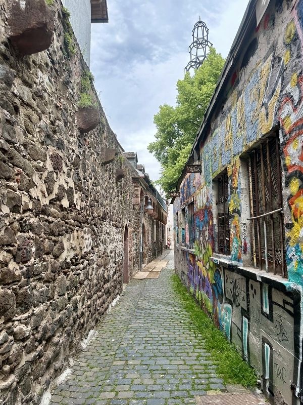
Gut erhaltene Reste sind in Hinterhöfen der Markt- und Großen Dechaneistraße, in der Nordstraße, an der Alten Johanneskirche und hier an der Schlender-/ Schlenkergasse erhalten.
Das Metzgertor, auch Metzgergassenpforte genannt und als Gefängnis genutzt, wurde 1771 unter Erbprinz Wilhelm von Hessen-Kassel abgerissen, um einen besseren Straßenverkehr
this page online
(English translation):
Course of the old town wall
At this point the Metzgertor (“Butcher Gate”) was located as part of the wall of the old town of Hanau
King Albrecht of Habsburg granted Hanau town and market rights on February 2, 1303. This included the privilege of building a town wall around the medieval settlement. The building was first mentioned in documents in 1338. The 800-meter-long wall, made of Wilhelmsbad basalt, ended with a battlement with loopholes.
When the suburb (today's Hospitalstrasse) was built in the 15th century and from 1527 onwards, the counts Philipp II (1502-1529) and Balthasar (1508-1534) of Hanau-Münzenberg built a new ring of fortifications around the old town, and the city wall lost its importance and was built up with residential buildings on both sides.
Well-preserved remains can be found in the backyards of Marktstrasse and Große Dechaneistrasse, in Nordstrasse, at the Alte Johanneskirche and here on Schlender-/ Schlenkergasse.
The Metzgertor, also called Metzgergassenpforte and used as
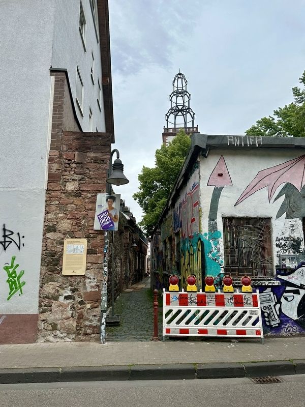
Photographed by Andrew Ruppenstein, May 26, 2024
2. Verlauf der Altstadtmauer / Course of the Old Town Wall Marker - wide view
Erected by Stadt Hanau.
Topics. This historical marker is listed in this topic list: Forts and Castles. A significant historical date for this entry is February 2, 1303.
Location. 50° 8.198′ N, 8° 54.988′ E. Marker is in Hanau, Hessen (Hesse), in Main-Kinzig-Kreis. It is at the intersection of Metzgerstraße and Schlendergasse, on the right when traveling west on Metzgerstraße. Touch for map. Marker is at or near this postal address: Metzgerstraße 18, Hanau HE 63450, Germany. Touch for directions.

Regionally, it is in Europe, the European Union, Atlantic Europe, Central Europe, the Schengen Area, Western Europe, and the Western World. Historically, it finds itself in what was once the Roman Empire, the Holy Roman Empire, and the former West Germany.
Other nearby markers. At least 8 other markers are within walking distance of this marker: „Männchen mit den großen Ohren“ / “Little Man with the Big Ears” (within shouting distance of this marker);
Photographed by Andrew Ruppenstein, May 26, 2024
3. Looking north on Schlendergasse, with the old town wall on the left
Also see . . . Stadtbefestigung Hanau (Wikipedia, in German).
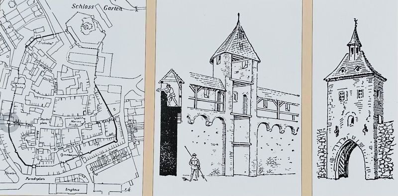
Excerpt (in translation): The Hanau city fortifications (later also known as Hanau Fortress) are the former fortifications of the two cities of Old and New Hanau. They were built between the 13th and 17th centuries in three consecutive main construction phases. The medieval city fortifications, built around 1300 and expanded around 1429, were supplemented from 1528 by a defensive structure designed by Reinhard zu Solms, which(Submitted on June 22, 2024.)made it possible to set up cannons. They included the old town of Hanau and the Hanau suburb that was built in the 15th century towards the Kinzig.courtesy Hanauer Geschichtsverein 1844 e.V.4. Marker illustrations1) Map of the old town wall, ring wall, and Metzgertor, 2) Reconstruction of the Metzgertor (Winkler/Mittelsdorf, 1897), and, 3) Reconstruction of the Metzgertor (Zimmerman, ca.1900)
Credits. This page was last revised on June 22, 2024. It was originally submitted on June 22, 2024, by Andrew Ruppenstein of Lamorinda, California. This page has been viewed 188 times since then and 19 times this year. Photos: 1, 2, 3, 4. submitted on June 22, 2024, by Andrew Ruppenstein of Lamorinda, California.
