Lebanon in Warren County, Ohio — The American Midwest (Great Lakes)
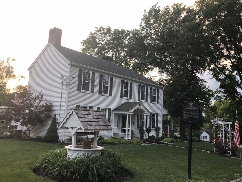
The Stoddard House

Photographed by Duane and Tracy Marsteller, May 27, 2024
1. The Stoddard House Marker, Side One
Situated at the western foot of the Floraville Historic District, for over 120 years this colonial farmhouse was the only residence on Keever Street. In 1878, when Abe Keever owned it, it was said to be on “Cincinnati Pike near Orchard Avenue.” The address in 1900 was considered simply “Keever Lane.” In March 1862, the Floraville Hill and the house were annexed by Lebanon.
Erected by Lebanon Rotary Club.
Topics and series. This historical marker is listed in this topic list: Notable Buildings. In addition, it is included in the Rotary International series list. A significant historical year for this entry is 1829.
Location. 39° 25.784′ N, 84° 12.864′ W. Marker is in Lebanon, Ohio, in Warren County. It is on Keever Street south of Cincinnati Avenue (U.S. 42), on the
this page online

Regionally, this marker is in Greater Cincinnati and in the Miami Valley. It is also in the American Midwest and in the Corn Belt. Globally, it is in North America, the Western Hemisphere, the Western World, and the Anglosphere. Historically, it finds itself in what was once the Haudenosaunee (Iroquois) Confederacy, the territory of the Mississippian Culture, and the Northwest Territory.
Other nearby markers. At least 8 other markers are within walking distance of this marker: The Hexagon House (about 300 feet away, measured in a direct line); Miami Valley Aerie No. 1395 (approx. ¼ mile away); The Corwin House (approx. 0.3 miles away); Thomas Corwin (approx. 0.3 miles away); Broadway Bridge (approx. 0.3 miles away); 1795 Beedle Log Cabin (approx. 0.4 miles away); The Lebanon Station (approx. 0.4 miles away); The Moore Inn (approx. 0.4 miles away). Touch for a list and map of all markers in Lebanon.
Another marker is no longer nearby. General Charles Clark

Photographed by Duane and Tracy Marsteller, May 27, 2024
2. The Stoddard House Marker, Side Two
Photographed by Duane and Tracy Marsteller, May 27, 2024
3. The Stoddard House Marker
Credits. This page was last revised on June 22, 2024. It was originally submitted on June 22, 2024, by Duane and Tracy Marsteller of Murfreesboro, Tennessee. This page has been viewed 401 times since then and 57 times this year. Photos: 1, 2, 3. submitted on June 22, 2024, by Duane and Tracy Marsteller of Murfreesboro, Tennessee.
