Anoka in Anoka County, Minnesota — The American Midwest (Upper Plains)
Main Street Bridge

Photographed by McGhiever, June 4, 2023
1. Main Street Bridge Marker
The first Main Street Bridge was built by Orin W. Rice as part of the Military Road project in 1853. The 140-foot wooden, single arch bridge served Anoka for more than 50 years. Around 1907, the wooden bridge was replaced with an iron bridge. In 1941 a concrete four-lane bridge replaced the iron bridge. It took more than a year to rebuild the spacious roadway that featured a median in the shape of a teardrop at the east end of the bridge.
This new concrete bridge was dedicated with a grand program on August 1, 1942. The Anoka Herald newspaper described the program and speculated that, even with the tire shortage due to the war, people would drive to Anoka to see the wonderful new bridge. The article concluded with: "Anoka's new structure is the finest to be had."
Anoka's traffic outgrew this bridge by the early 1980s. The bridge was widened by 34' in order to add a turn lane, an additional through lane in each direction, and a pedestrian tunnel under the bridge. The major reconstruction project was completed in 1985. In 1988 Short-Elliot-Hendrickson of St. Paul earned an Engineering Excellence Award for their efforts
this page online
[Captions:]
Grand Opening of Iron Bridge - circa 1907
Reconstruction of Main Street Bridge - 1985
Topics. This historical marker is listed in this topic list: Bridges & Viaducts. A significant historical year for this entry is 1853.
Location. 45° 11.935′ N, 93° 23.434′ W. Marker is in Anoka, Minnesota, in Anoka County. It is on the Rum River Regional Trail north of E. Main Street, on the left when traveling north. Touch for map. Marker is at or near this postal address: 2015 1st Avenue, Anoka MN 55303, United States of America. Touch for directions.

Regionally, this marker is in the Twin Cities Metropolitan Area. It is also in the American Midwest, in the Corn Belt, and in the Great River Road Region. Globally, it is in North America, the Western Hemisphere, the Western World, and the Anglosphere. Historically, it finds itself in what was once Rupert’s Land and also the territory of the Mississippian Culture.
Other nearby markers. At least 8 other markers are within
Photographed by McGhiever, June 4, 2023
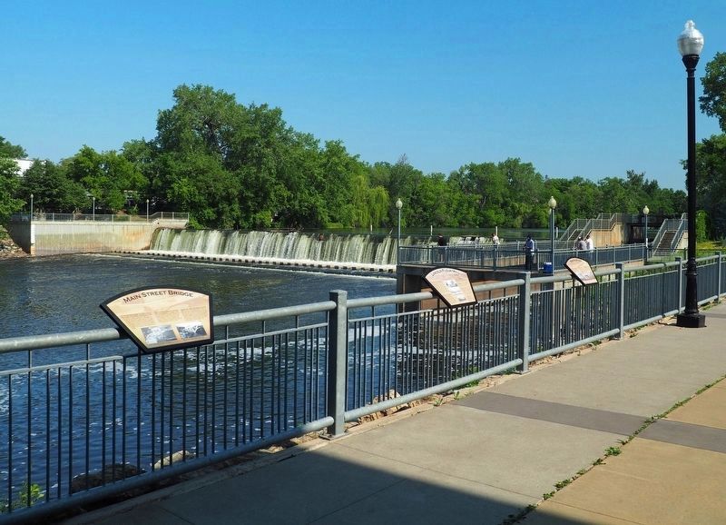
2. Main Street Bridge Marker (left) overlooking the Rum River Dam
Credits. This page was last revised on June 23, 2024. It was originally submitted on June 23, 2024, by McGhiever of Minneapolis, Minnesota. This page has been viewed 340 times since then and 31 times this year. Photos: 1. submitted on June 23, 2024, by McGhiever of Minneapolis, Minnesota. 2. submitted on June 21, 2024, by McGhiever of Minneapolis, Minnesota.
