Near Beardstown in Schuyler County, Illinois — The American Midwest (Great Lakes)
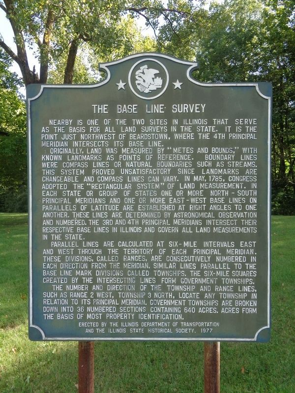
The Base Line Survey
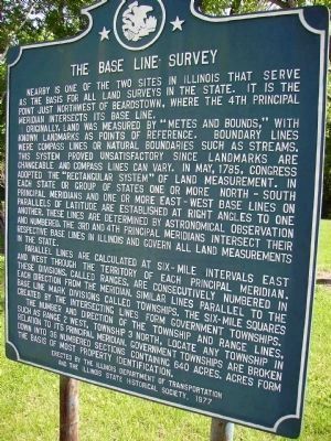
Originally, land was measured by "metes and bounds." with known landmarks as points of references. Boundary lines were compass lines or natural boundaries such as stream. This system proved unsatisfactory since landmarks are changeable and compass lines can vary. In May 1785, congress adopted the "rectangular system" of land measurement. In each state or group of states one or more north-south principal meridians and one or more east-west base lines on the parallels of latitude are established at right angles to on another. These lines are determined by astronomical observation and numbered. The 3rd and 4th principal meridians intersect their respective base lines in Illinois and govern all land measurements in the state.
Parallel lines are calculated at six-mile intervals east and west through the territory of each principal meridian. These divisions, called ranges, are consecutively numbered in each direction from the meridian. Similar lines parallel to the base line mark divisions called townships. The six miles squares created by the intersecting lines form government townships.
The number and direction of the township and range line, such as range 2 west, township 3 north, locate any township in relation to its principal meridian. Government townships are broken down into 36 numbered sections containing 640 acres. Acres form the basis of most property identification.
Erected 1977 by the Illinois Department of Transportation and the Illinois State Historical Society.
Topics and series. This historical marker is listed in this topic list: Government & Politics. In addition, it is included in the Illinois State Historical Society series list. A significant historical month for this entry is May 1785.
Location. 40° 3.025′ N, 90° 29.296′ W. Marker is near Beardstown, Illinois, in Schuyler County. Marker is on U.S. 67, on the right when traveling south. Touch for map. Marker is in this post office area: Frederick IL 62639, United States of America. Touch for directions.
Other nearby markers. At least 8 other markers are within 4 miles of this marker, measured as the crow flies. Lincoln and the River (approx. 3.6 miles away); Lincoln in Beardstown (approx. 3.6 miles away); Lincoln Photograph (approx. 3.6 miles away); Traveling to Beardstown (approx. 3.6 miles away); Beardstown Grand Opera House (approx. 3.7 miles away); Lincoln the Candidate (approx. 3.7 miles away); Site of Abraham Lincoln's Speech (approx. 3.7 miles away); Stephen A. Douglas Speech Site (approx. 3.7 miles away). Touch for a list and map of all markers in Beardstown.
Credits. This page was last revised on September 8, 2021. It was originally submitted on November 28, 2009, by Stephen Link of Canton, Illinois. This page has been viewed 1,878 times since then and 27 times this year. Photos: 1. submitted on September 8, 2021, by Jason Voigt of Glen Carbon, Illinois. 2. submitted on November 28, 2009, by Stephen Link of Canton, Illinois. 3. submitted on May 10, 2010, by Regina Gilson of Sugar Grove, Illinois. • Kevin W. was the editor who published this page.


