
Fairfield in Utah County, Utah — The American Mountains (Southwest)
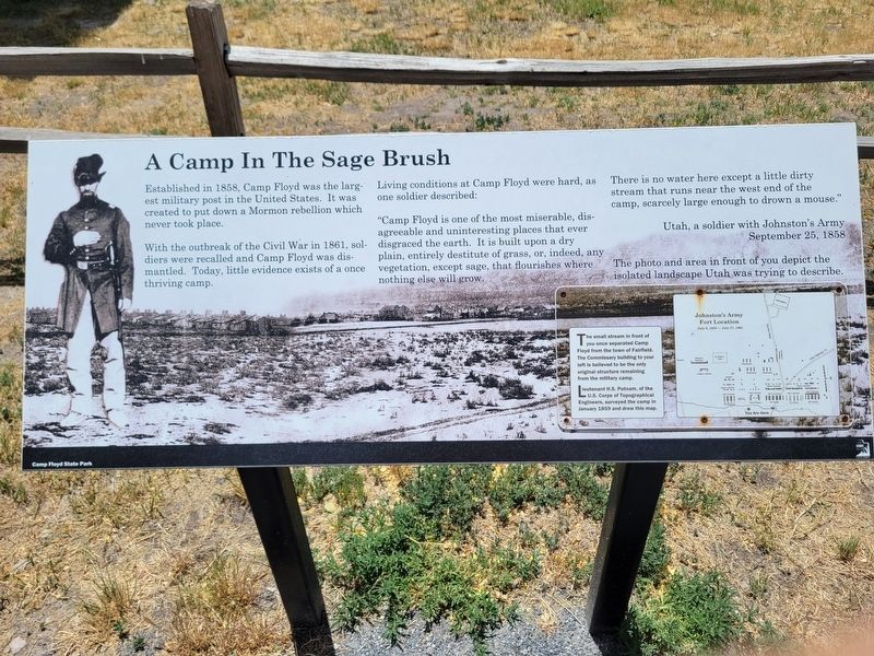
A Camp in the Sage Brush
Photographed by Jeremy Snow, June 23, 2024
1. A Camp in the Sage Brush Marker
Established in 1858, Camp Floyd was the largest military post in the United States. It was created to put down a Mormon rebellion which never took place.
With the outbreak of the Civil War in 1861, soldiers were recalled and Camp Floyd was dismantled. Today, little evidence exists of a once thriving camp.
Living conditions at Camp Floyd were hard, as one soldier described: "Camp Floyd is one of the most miserable, disagreeable and uninteresting places that ever disgraced the earth. It is built upon a dry plain, entirely destitute of grass, or, indeed, any vegetation, except sage, that flourishes where nothing else will grow. There is no water here except a little dirty stream that runs near the west end of the camp, scarcely large enough to drown a mouse." Utah, a soldier with Johnston's Army. September 25, 1858
The small stream in front of you once separated Camp Floyd from the town of Fairfield. The Commissary building to your left is believed to be the only original structure remaining fron the military camp.
The photo and area in front of you depict the isolated landscape Utah was trying to describe.
Lieutenant
this page online
Erected by Camp Floyd State Park.
Topics. This historical marker is listed in this topic list: Forts and Castles. A significant historical year for this entry is 1858.
Location. 40° 15.633′ N, 112° 5.579′ W. Marker is in Fairfield, Utah, in Utah County. It is on West Main Street, on the right when traveling east. Touch for map. Marker is at or near this postal address: 86 W Main St, Cedar Valley UT 84013, United States of America. Touch for directions.

Regionally, this marker is in the Wasatch Front and in Greater Provo. It is also in the American Mountain West and on the Colorado Plateau. Globally, it is in North America, the Rocky Mountains, the Western Hemisphere, the Western World, and the Anglosphere. Historically, it finds itself in what was once New Spain and also Mexico’s Alta California.
Other nearby markers. At least 8 other markers are within walking distance of this marker: Beginnings of the Walker Brothers Financial Empire (here, next to this marker); Col. Philip St. George Cooke (here, next to this marker); Historic Site in Journalism (here, next to this marker); Fairfield-Camp Floyd-Fort Crittenden / The Pony Express (a few steps from this marker); Fairfield Stagecoach Inn (a few steps from this marker); Lodging for Travelers of the American West (a few steps from this marker); Fairfield District School (about 700 feet away, measured in a direct line); Fairfield Schoolhouse (about 700 feet away). Touch for a list and map of all markers in Fairfield.
Credits. This page was last revised on July 7, 2024. It was originally submitted on June 25, 2024, by Jeremy Snow of Cedar City, Utah. This page has been viewed 393 times since then and 18 times this year. Photo 1. submitted on June 25, 2024, by Jeremy Snow of Cedar City, Utah. • J. Makali Bruton was the editor who published this page.
Editor’s want-list for this marker. A wide view photo of the marker and the surrounding area together in context. • Can you help?
