Death Valley National Park in Inyo County, California — The American West (Pacific Coastal)
McLean Spring

Photographed by Craig Baker
1. McLean Spring Marker
Also known as Jayhawker's Well or McLean's Spring.
It was here on December 27, 1849 that the Jayhawkers, the "Mississippi Boys" and the Briers learned from their scouts that no probable wagon route lay ahead. Their only alternative was to burn their wagons and dry ox meat. On December 28th the Georgians, or Bug Smashers arrived. Having previously dried all the ox meat they could carry on their backs, they gave their remaining oxen to the Briers. The Georgians camped one night and struck out, on foot, up a canyon on Tucki Mountain, past the Skidoo site, and over Towne Pass. On December 30th the remaining emigrants left the bulk of their possessions here and walked past where Stovepipe Wells Hotel now stands and up the alluvial fan toward snow-capped Towne Pass.
This spring is named for Mr. McLean, who supervised posting of Auto Club signs in Death Valley during the 1920's.
Erected 2013 by Mike Buettell.
Topics. This historical marker is listed in these topic lists: Exploration • Settlements & Settlers. A significant historical year for this entry is 1849.
Location. 36° 36.265′ N, 117° 1.213′ W.
this page online

Regionally, this marker is in the Sierra Nevada. It is also in the American Mountain West. Globally, it is in North America, on the Ring of Fire, on the Pacific Rim, in the Western Hemisphere, in the Western World, and in the Anglosphere. Historically, it finds itself in what was once New Spain and also Mexico’s Alta California.
Other nearby markers. At least 8 other markers are within 8 miles of this marker, measured as the crow flies: Devil’s Cornfield (approx. 3 miles away); Transportation Traces (approx. 5 miles away); Old Stovepipe Wells (approx. 5 miles away); Death Valley’s First Tourist Resort (approx. 6.9 miles away); Burned Wagons Point (approx. 7 miles away); Road To Adventure (approx. 7 miles away); Eichbaum Toll Road (approx. 7.1 miles away); Keane Wonder Mine (approx. 7.6 miles away). Touch for a list and map
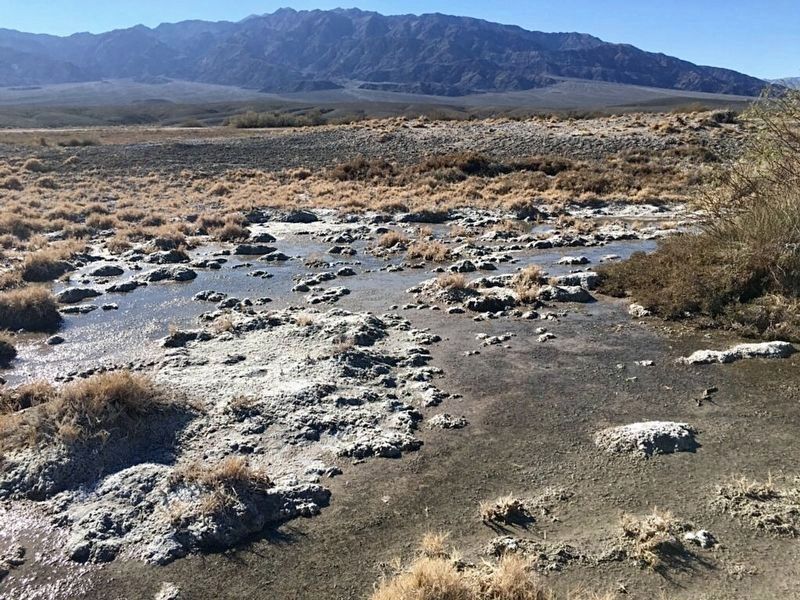
Photographed by Craig Baker
2. McLean Spring
Another marker is no longer nearby. Wagon Wheel History (was approx. 5 miles away).
Credits. This page was last revised on October 26, 2025. It was originally submitted on June 28, 2024, by Craig Baker of Sylmar, California. This page has been viewed 622 times since then and 77 times this year. Photos: 1, 2. submitted on June 28, 2024, by Craig Baker of Sylmar, California.
