Council Bluffs in Pottawattamie County, Iowa — The American Midwest (Upper Plains)
The Historic General Dodge House
Photographed by Charles T. Harrell, June 28, 2011
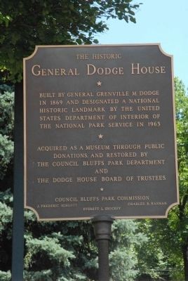
1. The Historic General Dodge House Marker
Built by General Grenville M. Dodge in 1869 and designated a National Historic Landmark by the United States Department of Interior of the National Park Service in 1963.
Acquired as a museum through public donations and restored by the Council Bluffs Park Department and the Dodge House Board of Trustees. Council Bluffs Park Commission. J. Frederic Schlott, Charles R. Hannan, Everett L. Shockey.
Erected by Council Bluffs Park Commission.
Topics and series. This historical marker is listed in this topic list: Notable Buildings. In addition, it is included in the National Historic Landmarks series list. A significant historical year for this entry is 1869.
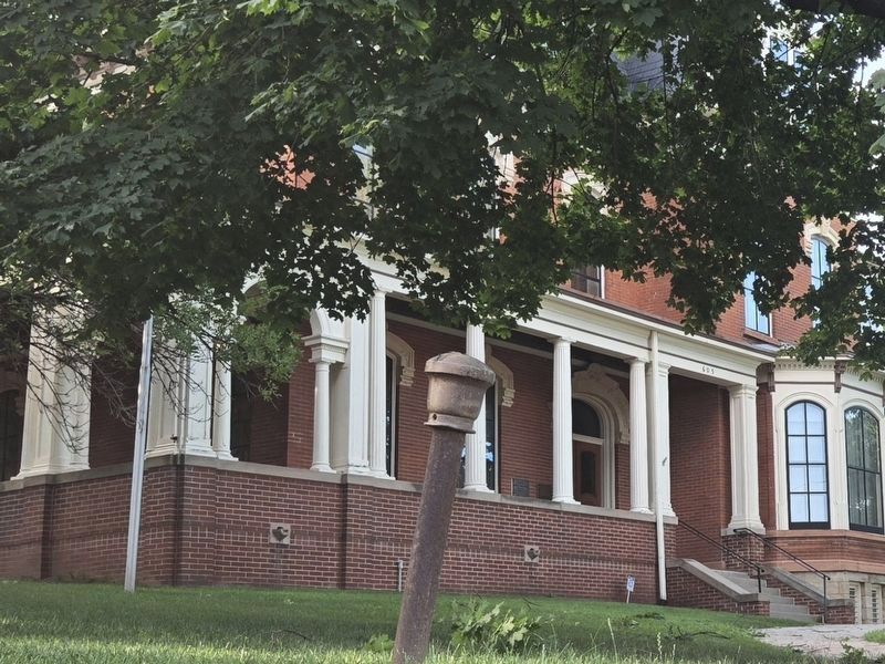
Location. Marker has been reported missing. It was located near 41° 15.316′ N, 95° 50.882′ W. Marker was in Council Bluffs, Iowa, in Pottawattamie County. It was at the intersection of 3rd Street and Story Street, on the right when traveling east on 3rd Street. Touch for map. Marker was at or near this postal address: 605 3rd Street, Council Bluffs IA 51503, United States of America. Touch for directions.

Regionally, this marker was in Western Iowa, in Loess Hills, and in Greater Omaha. It was also in the American Midwest, in the Lewis & Clark Corridor, and in the Corn Belt. Globally, it was in North America, the Western Hemisphere, the Western World, and the Anglosphere. Historically, it found itself in what was once the territory of the Mississippian Culture and also the Louisiana Purchase.
Other nearby markers. At least 8 other markers are within walking distance of this location: The National Humane Alliance Fountain (approx. 0.2 miles away); Grenville M. Dodge (approx. ¼ mile away); Squirrel Cage Jail (approx. ¼ mile away); Council Bluffs Free Public Library (approx. ¼ mile away); Council Bluffs Veterans Plaza (approx. 0.3 miles
this page online
Related marker. Click here for another marker that is related to this marker.
Photographed by Charles T. Harrell, June 28, 2011
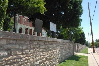
2. General Dodge House
Photographed by Paul Crumlish, July 10, 2010
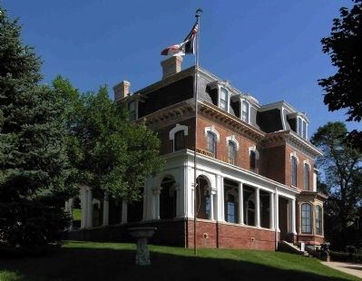
3. General Dodge House (1869)
The 14 room Victorian mansion has been restored by the Council Bluffs Parks Department and Historic General Dodge House Board of Trustees, and is now open as a museum.
Photographed by Mark Parker, June 26, 2024
4. The Historic General Dodge House Marker Missing
Credits. This page was last revised on July 1, 2024. It was originally submitted on July 21, 2011, by Charles T. Harrell of Woodford, Virginia. This page has been viewed 1,337 times since then and 21 times this year. Last updated on June 29, 2024, by Mark Parker of Hickory, North Carolina. Photos: 1, 2. submitted on July 21, 2011, by Charles T. Harrell of Woodford, Virginia. 3. submitted on July 20, 2010, by PaulwC3 of Northern, Virginia. 4. submitted on June 29, 2024, by Mark Parker of Hickory, North Carolina. • Devry Becker Jones was the editor who published this page.
