Hurricane in Washington County, Utah — The American Mountains (Southwest)
The Old Hurricane Bell
Photographed by Jeremy Snow, June 28, 2024
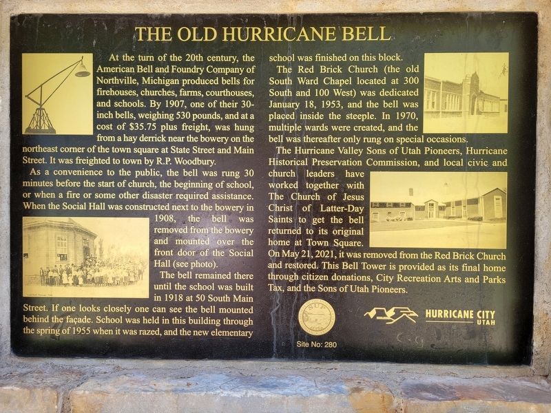
1. The Old Hurrinae Bell Marker
At the turn of the 20th century, the American Bell and Foundry Company of Northville, Michigan produced bells for firehouses, churches, farms, courthouses, and schools. By 1907, one of their 30-inch bells, weighing 530 pounds, and at a cost of $35.75 plus freight, was hung from a hay derrick near the bowery on the northeast corner of the town square at State Street and Main Street. It was freighted to town by R.P. Woodbury.
As a convenience to the public, the bell was rung 30 minutes before the start of church, the beginning of school, or when a fire or some other disaster required assistance. When the Social Hall was constructed next to the bowery in 1908, the bell was removed from the bowery and mounted over the front door of the Social Hall (see photo).
The bell remained there until the school was built in 1918 at 50 South Main Street. If one looks closely one can see the bell mounted behind the façade. School was held in this building through the spring of 1955 when it was razed, and the new elementary school was finished on this block.
The Red Brick Church (the old South Ward Chapel located at 300 South and
this page online
The Hurricane Valley Sons of Utah Pioneers, Hurricane Historical Preservation Commission, and local civic and church leaders have worked together with The Church of Jesus Christ of Latter-Day Saints to get the bell returned to its original home at Town Square. On May 21, 2021, it was removed from the Red Brick Church and restored. This Bell Tower is provided as its final home through citizen donations, City Recreation Arts and Parks Tax, and the Sons of Utah Pioneers.
SUP Site No: 280
Erected by Sons of Utah Pioneers. (Marker Number 280.)
Topics and series. This historical marker is listed in this topic list: Settlements & Settlers. In addition, it is included in the Historic Bells, and the Sons of Utah Pioneers series lists. A significant historical year for this entry is 1907.
Location. 37° 10.573′ N, 113° 17.369′ W. Marker is in Hurricane, Utah, in Washington County. It can be reached from State Street, on the right when traveling east. Touch for map.
Photographed by Jeremy Snow, June 28, 2024
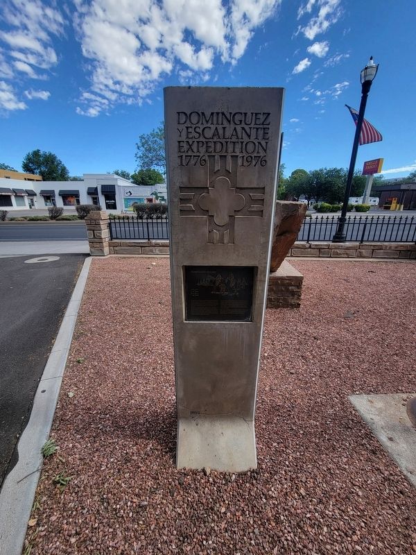
2. The Old Hurricane Bell Marker

Regionally, this marker is in Color Country. It is also in the American Southwest, in the Mountain West, and on the Colorado Plateau. Globally, it is in North America, the Rocky Mountains, the Western Hemisphere, the Western World, and the Anglosphere. Historically, it finds itself in what was once New Spain and also Mexico’s Alta California.
Other nearby markers. At least 8 other markers are within walking distance of this marker: Homeward Bound (within shouting distance of this marker); Isom's Corner (within shouting distance of this marker); Hurricane Library/City Hall (within shouting distance of this marker); Hurricane Pioneers (within shouting distance of this marker); The Roads to Utah’s Dixie (within shouting distance of this marker); Hurricane City (within shouting distance of this marker); Smith Mesa (within shouting distance of this marker); Early Day Wood Beam Walking Hand Plow (within shouting distance of this marker). Touch for a list and map of all markers in Hurricane.
Credits. This page was last revised on July 7, 2024. It was originally submitted on June 29, 2024, by Jeremy Snow of Cedar City, Utah. This page has been viewed 154 times since then and 14 times this year. Photos: 1, 2. submitted on June 29, 2024, by Jeremy Snow of Cedar City, Utah. • J. Makali Bruton was the editor who published this page.
