Kaat Benahid in Marrakesh, Marrakesh-Safi, Morocco — Africa (Northern Africa)
The Almoravid Dome

Photographed by J. Makali Bruton, May 28, 2024
1. The Almoravid Dome Marker

القبة المرابطية
1064م، وهي تمثل إحدى آخر معالم ثقافة المرابطين في مراكش وقد كانت مثلاً لوضع المصلين في مسجد الأمير المرابطي علي بن يوسف والذي كانت هذه القبة تشكل جزءا منه، وقد هدم توجد بجوار مسجد
this page online
Tamazight text was not transcribed
La Coupole Almoravide
Se trouve à côté de la mosquée Ibn Youssef dans la ville de Marrakech, construite en 1064. Elle représente l'une

Photographed by J. Makali Bruton, May 28, 2024
2. The Almoravid Dome and Marker
The Almoravid Dome
Is located next to the Ibn Youssef Mosque in the city of Marrakech, built in 1064 AD, it represents one of the last remains of Almoravid culture in Marrakech. It served as a place for the ablution of worshippers in the mosque of the Almoravid prince Ali Ibn Youssef, of which this dome was a part, and was demolished following the city's fall to the Almohads in 1130. It remained active for several centuries. Its water supply came from an underground system and was distributed through bronze pipes.
Topics. This historical marker is listed in this topic list: Religion & Religious Structures.
Location. 31° 37.894′ N, 7° 59.231′ W.
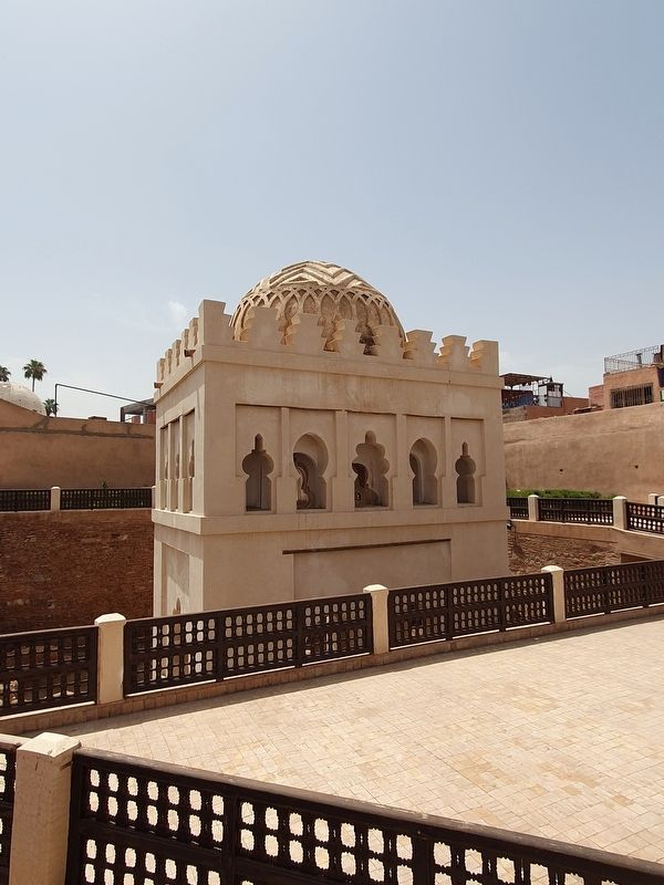
Photographed by J. Makali Bruton, May 28, 2024
3. The Almoravid Dome

Regionally, it is in Africa, North Africa, The Maghreb, and in a coastal Mediterranean country. Historically, it finds itself in what was once Portuguese colonies, a Spanish colony, and specifically a French colony.
Other nearby markers. At least 8 other markers are within walking distance of this marker: Ben Youssef Mosque (a few steps from this marker); Minaret of Ben Youssef (a few steps from this marker); Ben Youssef Square (within shouting distance of this marker); The Marrakech Museum Dar El Mnebhi (within shouting distance of this marker); Ben Youssef Medersa (within shouting distance of this marker); Dar Bellarj (within shouting distance of this marker); Souk Jeld (about 120 meters away, measured in a direct line); Zawiya Lahdar (about 120 meters away). Touch for a list and map of all markers in Marrakesh.
Also see . . . Almoravid Qubba (Dome) at Wikipedia. (Submitted on July 1, 2024.)
Credits. This page was last revised on July 1, 2024. It was originally submitted on July 1, 2024, by J. Makali Bruton of Washington, District of Columbia. This page has been viewed 190 times since then and 24 times this year. Photos: 1, 2, 3. submitted on July 1, 2024, by J. Makali Bruton of Washington, District of Columbia.
