Chester in Cheshire West and Chester, England, United Kingdom — Northwestern Europe (the British Isles)
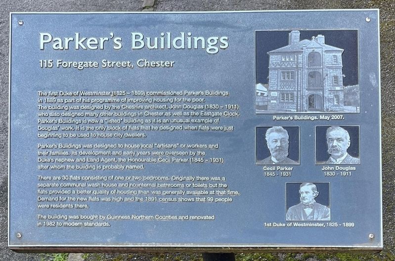
Parker's Buildings
115 Foregate Street, Chester
Photographed by Ray Gurganus, April 9, 2024
1. Parker's Buildings Marker
Parker's Buildings was designed to house local "artisans" or workers and their families. Its development and early years were overseen by the Duke's nephew and Land Agent, the Honourable Cecil Parker (1845-1931) after whom the building is probably named.
There are 30 flats consisting of one or two bedrooms. Originally there was a separate communal wash house and no internal bathrooms or toilets but the flats provided a better quality of housing than was generally available at that time. Demand for the new flats was high and the 1891 census shows that 99 people were residents there.
The building was bought by Guinness
this page online
Topics. This historical marker is listed in this topic list: Architecture. A significant historical year for this entry is 1889.
Location. 53° 11.506′ N, 2° 53.031′ W. Marker is in Chester, England, in Cheshire West and Chester. It is on Foregate Street, on the left when traveling east. Touch for map. Marker is at or near this postal address: 113-115 Foregate Street, Chester, England CH1 1HE, United Kingdom. Touch for directions.

Regionally, this marker is in North West England. Globally, it is on the Atlantic Ocean, in the North Atlantic Region, in Europe, in Atlantic Europe, on one of the British Isles, in the Western World, and in the Anglosphere. Historically, it finds itself in what was once the Roman Empire.
Other nearby markers. At least 8 other markers are within walking distance of this marker: The Church of St John the Baptist (approx. 0.3 kilometers away); North Eastern Chapel (approx. 0.3 kilometers away); Heritage Features (approx. 0.3 kilometers away); Eastern Ruins (approx. 0.3 kilometers away); South Eastern Chapel (approx. 0.3 kilometers away);

Photographed by Ray Gurganus, April 9, 2024
2. Parker's Buildings
Credits. This page was last revised on July 4, 2024. It was originally submitted on July 1, 2024, by Ray Gurganus of Washington, District of Columbia. This page has been viewed 444 times since then and 68 times this year. Photos: 1, 2. submitted on July 1, 2024, by Ray Gurganus of Washington, District of Columbia. • Andrew Ruppenstein was the editor who published this page.
