Chester in Cheshire West and Chester, England, United Kingdom — Northwestern Europe (the British Isles)
Chester Cathedral
The seat of the Bishop of Chester

Photographed by Ray Gurganus, April 12, 2024
1. Chester Cathedral Marker
- Moni Lucian of Chester 1200
Protected by the City Walls, Chester Cathedral has long been a place of power and influence, worship and pilgrimage, charity, hospitality and learning.
There has been a church here since the 7th century.
Since about AD 900 it has housed the shrine of st Werburgh, a 7th-century Mercian princess who became a nun and rose to be in charge of all the nunneries in Mercia.
In 1092 Hugh Lupus, Earl of Chester, founded the Benedictine Abbey of St Werburgh on this site.
In 1540 Henry seized control during the Dissolution of the Monasteries, and the Abbey Church became Chester Cathedral a year later.
Topics. This historical marker is listed in this topic list: Religion & Religious Structures. A significant historical year for this entry is 900 CE.
Location. 53° 11.522′ N, 2° 53.361′ W. Marker is in Chester, England, in Cheshire West and Chester. It can be reached from no nearby
this page online

Regionally, this marker is in North West England. Globally, it is on the Atlantic Ocean, in the North Atlantic Region, in Europe, in Atlantic Europe, on one of the British Isles, in the Western World, and in the Anglosphere. Historically, it finds itself in what was once the Roman Empire.
Other nearby markers. At least 8 other markers are within walking distance of this marker: East Gate (about 150 meters away, measured in a direct line); The Rows (about 150 meters away); King Charles Tower (approx. 0.2 kilometers away); Pied Bull (approx. 0.3 kilometers away); Red Lion (approx. 0.3 kilometers away); The Roman Amphitheatre (approx. 0.3 kilometers away); North Gate Gaol & the Bridge of Sighs (approx. 0.4 kilometers away); Roman Gardens (approx. 0.4 kilometers away). Touch for a list and map of all markers in Chester.
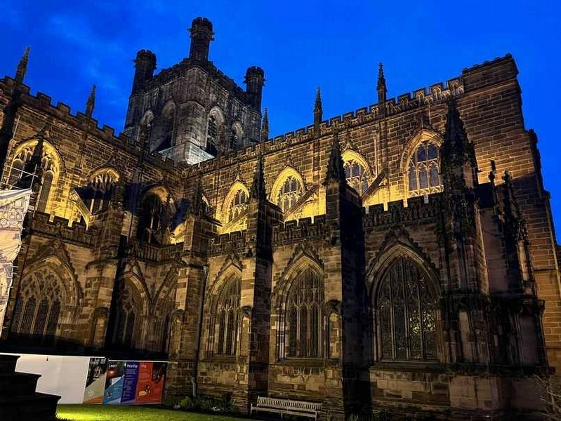
Photographed by Ray Gurganus, April 12, 2024
2. Chester Cathedral
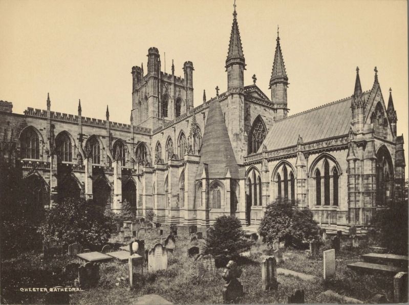
courtesy Harrison D. Horblit Collection of Early Photography, Houghton Library, Harvard University, circa 1905
3. Chester Cathedral
Credits. This page was last revised on June 19, 2026. It was originally submitted on July 1, 2024, by Ray Gurganus of Washington, District of Columbia. This page has been viewed 159 times since then and 27 times this year. Photos: 1, 2. submitted on July 1, 2024, by Ray Gurganus of Washington, District of Columbia. 3. submitted on July 4, 2024. • Andrew Ruppenstein was the editor who published this page.
