Hurricane in Washington County, Utah — The American Mountains (Southwest)
Hurricane Library/City Hall

Photographed by Jeremy Snow, June 28, 2024
1. Hurricane Library/City Hall Marker
This building was constructed in 1938-40 as a Works Progress Administration (WPA) project. The WPA was one of several New Deal programs designed to stimulate economic recovery during the Great Depression while providing needed public services and facilities. Over 230 public works buildings were constructed in Utah; approximately half of them retain their architectural integrity.
This building housed the city offices, library, police, and Hurricane Canal Company until the mid-1980s. The city then made it available to the Hurricane Valley Pioneer Heritage Park Foundation to develop as a museum.
The structure is built chiefly of hand-hewn sandstone that was quarried by construction workers from the banks of Berry Springs, about six miles west of Hurricane. The original estimated cost of construction was $22,300, but as the material cost was greatly reduced, the city was obligated to pay only $7,000.
Marker placed in 1992
Division of State History
Erected 1992 by Utah Division of State History.
Topics. This historical marker is listed in this topic list: Notable Buildings. A significant historical year for this entry is 1938.
Location. 37° 10.584′ N,
this page online

Regionally, this marker is in Color Country. It is also in the American Southwest, in the Mountain West, and on the Colorado Plateau. Globally, it is in North America, the Rocky Mountains, the Western Hemisphere, the Western World, and the Anglosphere. Historically, it finds itself in what was once New Spain and also Mexico’s Alta California.
Other nearby markers. At least 8 other markers are within walking distance of this marker: Isom's Corner (here, next to this marker); Homeward Bound (a few steps from this marker); Early Day Wood Beam Walking Hand Plow (a few steps from this marker); Smith Mesa (within shouting distance of this marker); The Town Named After a Buggy Incident (within shouting distance of this marker); The Roads to Utah’s Dixie (within shouting distance of this marker); Dixie Peddler Wagons (within shouting distance of
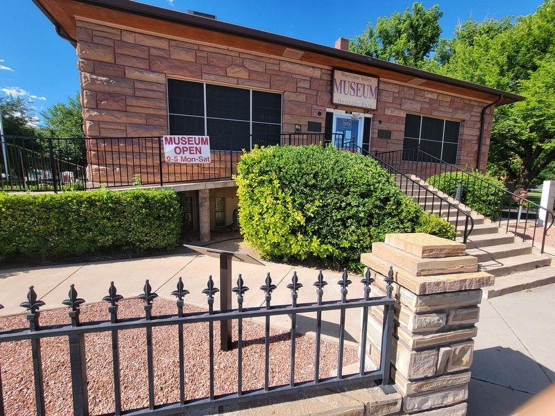
Photographed by Jeremy Snow, June 28, 2024
2. Hurricane Library/City Hall Marker
Also see . . . Hurricane Library--City Hall (Mountain West Digital Library). Utah National Register Nomination Form (Submitted on July 4, 2024.)
Credits. This page was last revised on July 4, 2024. It was originally submitted on July 2, 2024, by Jeremy Snow of Cedar City, Utah. This page has been viewed 166 times since then and 24 times this year. Photos: 1, 2. submitted on July 2, 2024, by Jeremy Snow of Cedar City, Utah. • Andrew Ruppenstein was the editor who published this page.
