Marker Logo
THE HISTORICAL
MARKER DATABASE
“Bite-Size Bits of Local, National, and Global History”
Riverfront in Missoula in Missoula County, Montana — The American West (Mountains)
 

Milwaukee Depot
 
 
Milwaukee Depot Marker image. Click for full size.
Photographed by Patricia Strat, June 28, 2024
1. Milwaukee Depot Marker
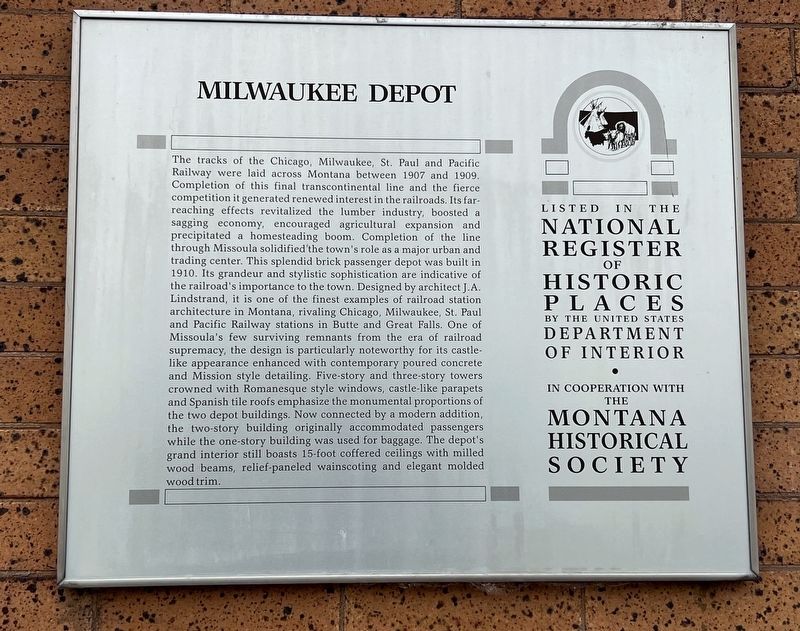
Inscription. The tracks of the Chicago, Milwaukee, St. Paul and Pacific Railway were laid across Montana between 1907 and 1909. Completion of this final transcontinental line and the fierce competition it generated renewed interest in the railroads. Its far-reaching effects revitalized the lumber industry, boosted a sagging economy, encouraged agricultural expansion and precipitated a homesteading boom. Completion of the line through Missoula solidified the town's role as a major urban and trading center. This splendid brick passenger depot was built in 1910. Its grandeur and stylistic sophistication are indicative of the railroad's importance to the town. Designed by architect J.A.Lindstrand, it is one of the finest examples of railroad station architecture in Montana, rivaling Chicago, Milwaukee, St. Paul and Pacific Railway stations in Butte and Great Falls. One of Missoula's few surviving remnants from the era of railroad supremacy, the design is particularly noteworthy for its castle-like appearance enhanced with contemporary poured concrete and Mission style detailing. Five-story and three-story towers crowned with Romanesque
Paid Advertisement
Click or scan to see
this page online
style windows, castle-like parapets and Spanish tile roofs emphasize the monumental proportions of the two depot buildings. Now connected by a modern addition, the two-story building originally accommodated passengers while the one-story building was used for baggage. The depot's grand interior still boasts 15-foot coffered ceilings with milled wood beams, relief-paneled wainscoting and elegant molded wood trim.
 
Topics and series. This historical marker is listed in these topic lists: ArchitectureIndustry & CommerceRailroads & Streetcars. In addition, it is included in the Montana National Register Sign Program series list. A significant historical year for this entry is 1910.
 
Location. 46° 52.058′ N, 113° 59.906′ W. Marker is in Missoula, Montana, in Missoula County. It is in Riverfront. It can be reached from Station Drive. The marker is visible from the paved "Kim Williams Trail" which was created on the former railway. Parking is available near the marker. Touch for map. Marker is at or near this postal address: 250 Station Drive, Missoula MT 59801, United States of America. Touch for directions.

Regionally, this marker
Milwaukee Depot Marker image. Click for full size.
Photographed by Patricia Strat, June 28, 2024
2. Milwaukee Depot Marker
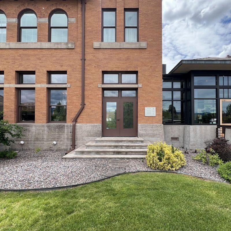
Marker visible in the distance
is in Western Montana and in Glacier Country. It is also in the American Mountain West and in the Lewis & Clark Corridor. Globally, it is in North America, the Rocky Mountains, the Western Hemisphere, the Western World, and the Anglosphere. Historically, it finds itself in what was once Rupert’s Land and also the Louisiana Purchase.

Other nearby markers. At least 8 other markers are within walking distance of this marker: Elrod Residence (about 300 feet away, measured in a direct line); Beacom Residence (about 400 feet away); Charles E. Johnson Residence (about 500 feet away); Parsons House (about 500 feet away); Northwest Passage (about 600 feet away); A Shortcut (about 600 feet away); Name That River (about 600 feet away); Danger Ahead! (about 600 feet away). Touch for a list and map of all markers in Missoula.
 
Milwaukee Depot Marker image. Click for full size.
Photographed by Patricia Strat, June 28, 2024
3. Milwaukee Depot Marker
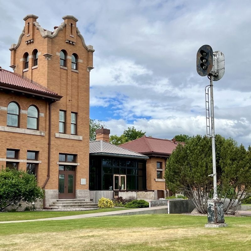
Marker visible in distance. Old railway signal light in the foreground.
Milwaukee Depot in Missoula, MT image. Click for full size.
Photographed by Patricia Strat, June 28, 2024
4. Milwaukee Depot in Missoula, MT
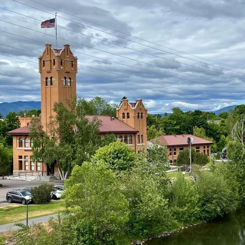
The former railway, now a paved pedestrian trail, is visible on lower left. The train signal is visible on the right. The Clark Fork River is in the foreground.
 
 
Credits. This page was last revised on July 3, 2024. It was originally submitted on July 2, 2024, by Patricia Strat of Oakton, Virginia. This page has been viewed 273 times since then and 28 times this year. Photos:   1, 2, 3, 4. submitted on July 2, 2024, by Patricia Strat of Oakton, Virginia. • Andrew Ruppenstein was the editor who published this page.

m=250115

CeraNet Cloud Computing sponsors the Historical Marker Database.
This website earns income from purchases you make after using our links to Amazon.com. We appreciate your support.
Paid Advertisement
Jul. 19, 2026