Columbia in Boone County, Missouri — The American Midwest (Upper Plains)
Rock Bridge Mills Millstone
Historic Nifong Park
| — | Boone County Historical Society | — |

Photographed by Jason Voigt, June 25, 2024
1. Rock Bridge Mills Millstone Marker
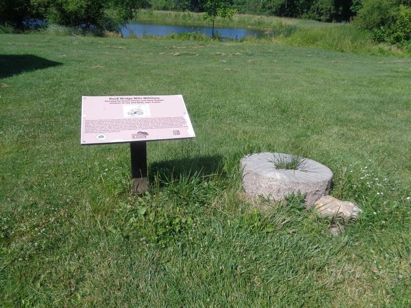
From around 1822 into the early years of the 20th century, a grist mill and accompanying distillery, owned and operated by several prominent families at various times, was located in what is now Rock Bridge Memorial State Park. This millstone is a runner stone from the last mill at Rock Bridge Mill when the mill was owned by the Heibel family. The runner was the top stone that rotated opposite the mating, fixed bed stone that remained fixed in place. Millstones were used to grind grains for use in baking, animal feed or, in this case, distilling spirits. This millstone is estimated to date to 1880 and weighs approximately 1,300 pounds. It has an 8" center through hole with four rynd notches. The rynd was a piece of iron crossing the hole in the upper millstone by which the stone was supported on the spindle. It also has two lift holes each an opposite sides of the stone by which it could be raised from the bed stone for maintenance.
Erected by Columbia Parks and Recreation.
Topics. This historical marker is listed in this topic
this page online
Location. 38° 54.398′ N, 92° 17.68′ W. Marker is in Columbia, Missouri, in Boone County. It can be reached from Ponderosa Street south of East Nifong Boulevard. Marker is located at Frank L. Nifong Memorial Park. Touch for map. Marker is at or near this postal address: 3801 Ponderosa St, Columbia MO 65201, United States of America. Touch for directions.

Regionally, this marker is in Little Dixie and in the Missouri River Corridor. It is also in the American Midwest, in the Lewis & Clark Corridor, and in the Corn Belt. Globally, it is in North America, the Western Hemisphere, the Western World, and the Anglosphere. Historically, it finds itself in what was once the territory of the Mississippian Culture, the Louisiana Purchase, and the Antebellum South.
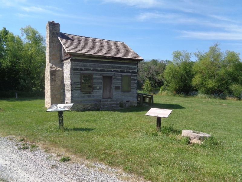
Other nearby markers. At least 8 other markers are within 3 miles of this marker, measured as the crow flies: The Gordon-Collins Log Cabin (here, next to this marker); The Easley Country Store (within shouting distance of this marker); The Ryland Farm House (within shouting distance of this marker);
Photographed by Jason Voigt, June 25, 2024
2. Rock Bridge Mills Millstone Marker
close-up of marker and the millstone
Another marker is no longer nearby. Jewell Cemetery (was approx. 2.4 miles away but has been replaced with another marker now near it).
Photographed by Jason Voigt, June 25, 2024
3. Rock Bridge Mills Millstone Marker
Credits. This page was last revised on July 2, 2024. It was originally submitted on July 2, 2024, by Jason Voigt of Glen Carbon, Illinois. This page has been viewed 336 times since then and 31 times this year. Photos: 1, 2, 3. submitted on July 2, 2024, by Jason Voigt of Glen Carbon, Illinois.
