Marker Logo
THE HISTORICAL
MARKER DATABASE
“Bite-Size Bits of Local, National, and Global History”
Columbia in Boone County, Missouri — The American Midwest (Upper Plains)
 

The Easley Country Store

Boone County History & Culture Center
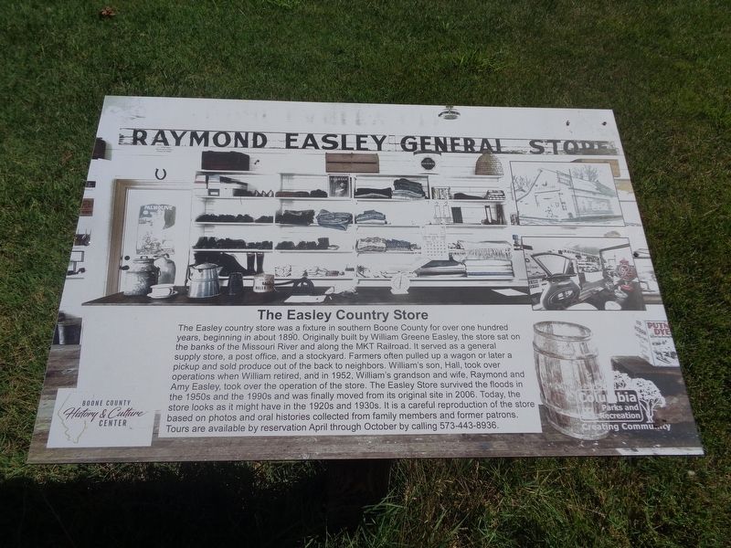
 
 
The Easley Country Store Marker image. Click for full size.
Photographed by Jason Voigt, June 25, 2024
1. The Easley Country Store Marker
Inscription. The Easley country store was a fixture in southern Boone County for over one hundred years, beginning in about 1890. Originally built by William Greene Easley, the store sat on the banks of the Missouri River and along the MKT Railroad. It served as a general supply store, a post office, and a stockyard. Farmers often pulled up a wagon or later a pickup and sold produce out of the back to neighbors. William's son, Hall, took over operations when William retired, and in 1952, William's grandson and wife, Raymond and Amy Easley, took over the operation of the store. The Easley Store survived the floods in the 1950s and the 1990s and was finally moved from its original site in 2006. Today, the store looks as it might have in the 1920s and 1930s. It is a careful reproduction of the store based on photos and oral histories collected from family members and former patrons. Tours are available by reservation April through October by calling 573-443-8936.
 
Erected by Columbia Parks and Recreation.
 
Topics. This historical marker is listed in this topic list: Industry & Commerce. A significant historical year for this entry is 1890.
 
Location. 38° 54.414′ N,
Paid Advertisement
Click or scan to see
this page online
92° 17.657′ W. Marker is in Columbia, Missouri, in Boone County. It can be reached from Ponderosa Street south of East Nifong Boulevard. Marker is located at Frank GL. Nifong Memorial Park. Touch for map. Marker is at or near this postal address: 3801 Ponderosa St, Columbia MO 65201, United States of America. Touch for directions.

Regionally, this marker is in Little Dixie and in the Missouri River Corridor. It is also in the American Midwest, in the Lewis & Clark Corridor, and in the Corn Belt. Globally, it is in North America, the Western Hemisphere, the Western World, and the Anglosphere. Historically, it finds itself in what was once the territory of the Mississippian Culture, the Louisiana Purchase, and the Antebellum South.

Other nearby markers. At least 8 other markers are within 3 miles of this marker, measured as the crow flies: The Ryland Farm House (a few steps from this marker); The Gordon-Collins Log Cabin (within shouting distance of this marker); Rock Bridge Mills Millstone (within shouting distance of this marker); Maplewood Barn and Theatre (about 700 feet away, measured in a direct
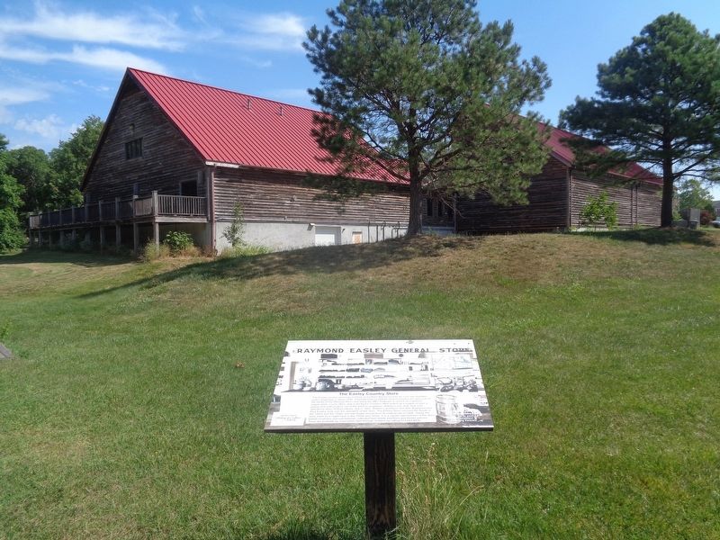
The Easley Country Store Marker image. Click for full size.
Photographed by Jason Voigt, June 25, 2024
2. The Easley Country Store Marker
line); Columbia (approx. 2.2 miles away); War Memorial (approx. 2.2 miles away); Jewell Cemetery State Historic Site (approx. 2.4 miles away); The F.L. Duley - M.E. Miller Erosion Plots (approx. 2.7 miles away). Touch for a list and map of all markers in Columbia.
 
Another marker is no longer nearby. Jewell Cemetery (was approx. 2.4 miles away but has been replaced with another marker now near it).
 
 
Credits. This page was last revised on July 2, 2024. It was originally submitted on July 2, 2024, by Jason Voigt of Glen Carbon, Illinois. This page has been viewed 756 times since then and 148 times this year. Photos:   1, 2. submitted on July 2, 2024, by Jason Voigt of Glen Carbon, Illinois.

m=250145

CeraNet Cloud Computing sponsors the Historical Marker Database.
This website earns income from purchases you make after using our links to Amazon.com. We appreciate your support.
Paid Advertisement
Sep. 3, 2026
