Studio City in Los Angeles in Los Angeles County, California — The American West (Pacific Coastal)
Campo de Cahuenga
Layers of History
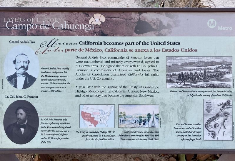
| — | Mexican California becomes part of the United States | — |
Photographed by Craig Baker, November 2, 2023
1. Campo de Cahuenga Marker
General Andrés Pico, commander of Mexican forces that were outnumbered and militarily overpowered, agreed to put down arms. He signed the truce with Lt. Col. John C. Frémont, a commander of American land forces. The Articles of Capitulation guaranteed Californios full rights under the U.S. Constitution.
A year later with the signing of the Treaty of Guadalupe Hidalgo, México gave up California, Arizona, New Mexico, and other territory that became the American Southwest.
General Andrés Pico, wealthy landowner and patriot, led the Mexican troops who were largely volunteers from the ranchos. He later served in the new state government as a senator (1860-1861).
Lt. Col. John Frémont, who first led exploratory expeditions to the West, had a distinguished career after the war. He was a U.S. senator from California and in 1856 ran for president of the U.S.
The Treaty of Guadalupe Hidalgo (1848) greatly expanded U.S. boundaries, for a cost of 15 million dollars.
Erected by Metro Los Angeles.
Topics. This historical marker is listed in these topic lists: Peace • War, Mexican-American. A significant historical year for this entry is 1856.
Location. 34° 8.39′ N,
this page online

Regionally, this marker is in California’s The Valley (the San Fernando Valley) and in the Transverse Ranges. It is also on the American Pacific Coast. Globally, it is in North America, on the Ring of Fire, in the Pacific Rim, in the Western Hemisphere, in the Western World, and in the Anglosphere. Historically, it finds itself in what was once New Spain and also Mexico’s Alta California.
Other nearby markers. At least 8 other markers are within walking distance of this marker: A different marker also named Campo de Cahuenga (a few steps from this marker); Treaty of Cahuenga (a few steps from this marker); a different marker also named Campo de Cahuenga (within shouting distance of this marker); New York Checker Cab (approx. 0.4 miles away); Alfred Hitchcock (approx.
Photographed by Craig Baker, November 2, 2023
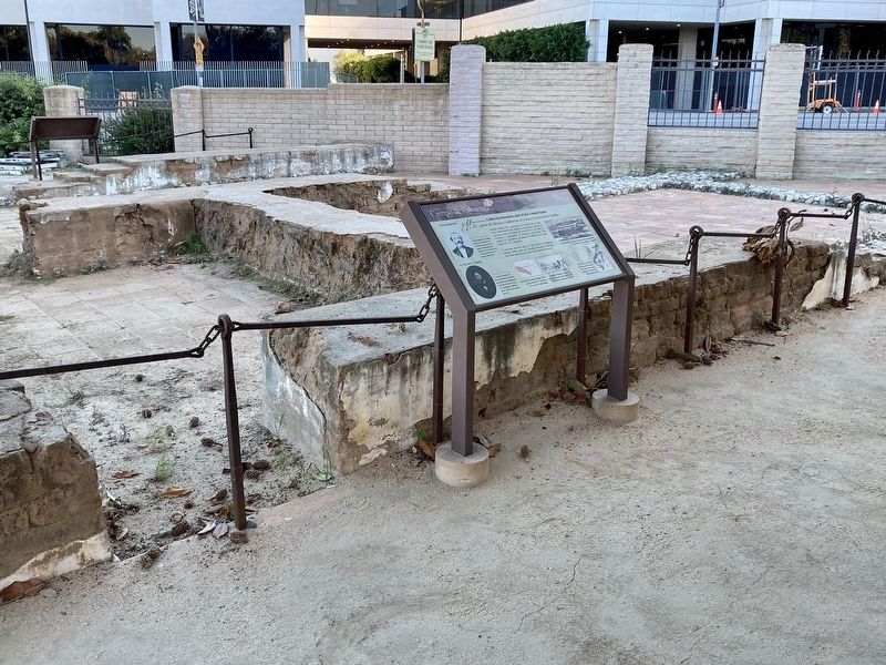
2. Campo de Cahuenga Ruins & Marker
Universal Studios in the background.
Credits. This page was last revised on July 4, 2024. It was originally submitted on July 3, 2024, by Craig Baker of Sylmar, California. This page has been viewed 185 times since then and 18 times this year. Photos: 1, 2. submitted on July 3, 2024, by Craig Baker of Sylmar, California.
