Camp Verde in Yavapai County, Arizona — The American Mountains (Southwest)
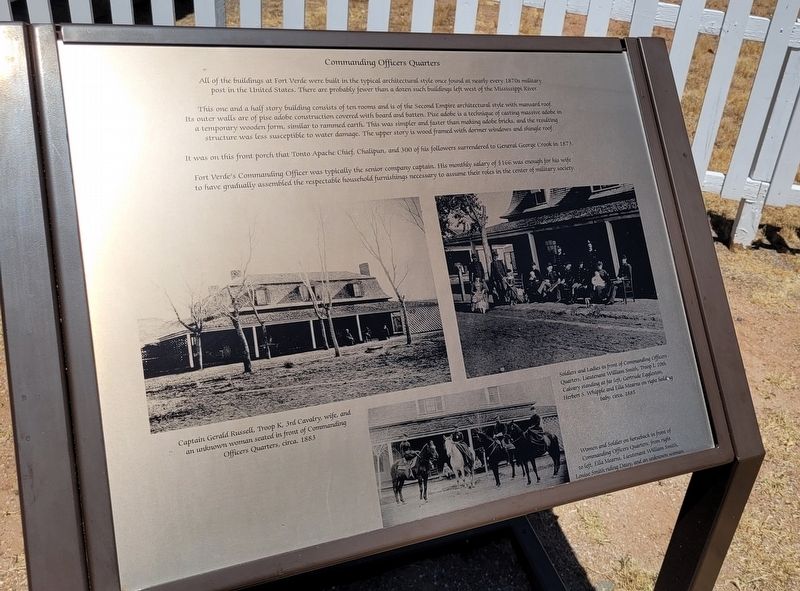
Commanding Officers Quarters
Photographed by James Hulse, June 19, 2024
1. Commanding Officers Quarters Marker
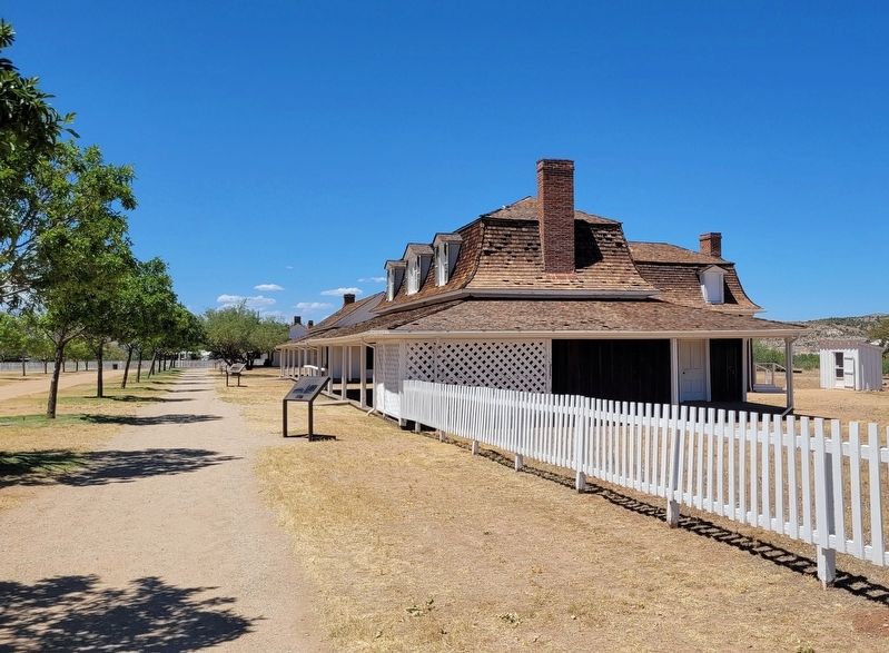
This one and a half story building consists of ten rooms and is of the Second Empire architectural style with mansard roof. Its outer walls are of pise adobe construction covered with board and batten. Pise adobe is a technique of casting massive adobe in a temporary wooden form, similar to rammed earth. This was simpler and faster than making adobe bricks, and the resulting structure was less susceptible to water damage. The upper story is wood framed with dormer windows and shingle roof.
It was on this front porch that Tonto Apache Chief, Chalipun, and 300 of his followers surrendered to General George Crook in 1873.
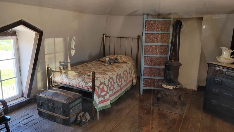
Fort Verde's Commanding Officer was typically the senior company captain. His monthly salary of $166 was enough for his wife to have gradually assembled the respectable household furnishings necessary to assume their roles in the center of military society.
Captions
Captain Gerald Russell, Troop K, 3rd Cavalry, wife, and an unknown woman seated in front of Commanding Officers Quarters, circa. 1883
Soldiers and Ladies in front of Commanding Officers Quarters, Lieutenant William Smith, Troop L 10th Calvary standing at far left, Gertrude Eggleston, Herbert S. Whipple and Ella Mearns on right holding baby, circa. 1885
Women and Soldier on horseback in front of Commanding Officers Quarters, from right to left, Ella Mearns, Lieutenant William Smith, Louise Smith riding Daisy, and an unknown woman.
Erected by Fort
this page online
Topics. This historical marker is listed in this topic list: Forts and Castles. A significant historical year for this entry is 1873.
Location. 34° 33.899′ N, 111° 51.129′ W. Marker is in Camp Verde, Arizona, in Yavapai County. It is on East Hollamon Street east of Woods Street. The marker is located on the grounds of the Fort Verde State Historic Park. Touch for map. Marker is at or near this postal address: 125 E Hollamon St, Camp Verde AZ 86322, United States of America. Touch for directions.

Regionally, this marker is in Arizona’s Verde Valley and in the Yavapai-Apache Nation. It is also in the American Southwest and in the Mountain West. Globally, it is in North America, the Western Hemisphere, the Western World, and the Anglosphere. Historically, it finds itself in what was once New Spain and also Mexico’s Alta California.
Other nearby markers. At least 8 other markers are within walking distance of this marker: Site of Married Officers' Quarters (within shouting distance of this marker); Bachelor Officers Quarters (within shouting distance of this marker); Officers’ Row (within shouting
Photographed by James Hulse, June 19, 2024
2. The Commanding Officers Quarters and Marker

Photographed by James Hulse, June 19, 2024
3. Living space in the Commanding Officers Quarters
Photographed by James Hulse, June 19, 2024
4. Upstairs bedroom in the Commanding Officers Quarters
Credits. This page was last revised on July 4, 2024. It was originally submitted on July 3, 2024, by James Hulse of Medina, Texas. This page has been viewed 252 times since then and 41 times this year. Photos: 1, 2, 3, 4. submitted on July 4, 2024, by James Hulse of Medina, Texas.
