Cricqueville-en-Bessin in Calvados, Normandy, France — Western Europe
Pointe du Hoc
Competence · Courage · Sacrifice
Photographed by J. Makali Bruton, June 5, 2024
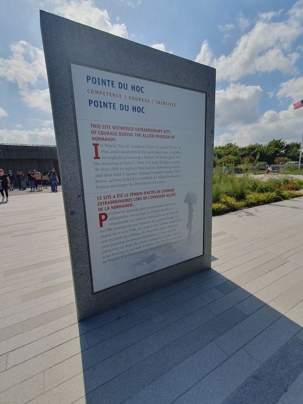
1. Pointe du Hoc Marker

This site witnessed extraordinary acts of courage during the Allied invasion of Normandy.
In World War II, German forces occupied Pointe du Hoc and transformed the quiet spot into a fortified stronghold protecting a battery of heavy guns. On the morning of June 6, 1944, US Army Rangers scaled 90-foot cliffs to capture this heavily defended position and then held it against repeated counterattacks. Their heroic actions helped to establish an Allied foothold in France and begin the liberation of Europe.
Reverse
These are the boys of Point du Hoc. These are the men who took the cliffs. These are the champions who helped free a continent. These are the heroes who helped end a war.
Ronald Reagan
President of the United States
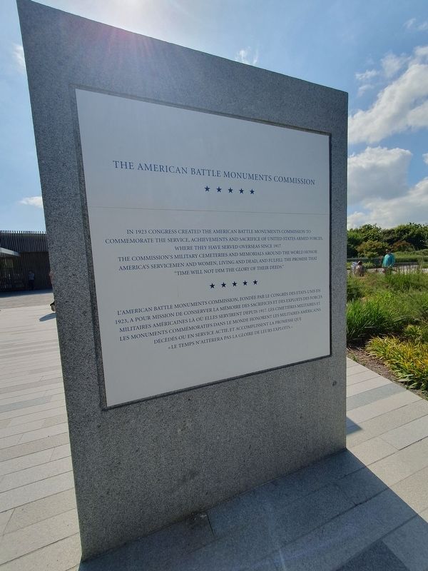
The American Battle Monuments Commission
In 1923 congress created the american battle monuments commission to commemorate the service, achievements and sacrifice of united states armed forces where they have served overseas since 1917. The commission's military cemeteries and memorials around the world honor america's servicemen and women, living and dead, and fulfill the promise
this page online
Reverse
Our debt to the heroic men and valiant women in the service of our country can never be repaid. They have earned ayour undying gratitude. America will never forget their sacrifices.
Harry S. Truman
President of the United States
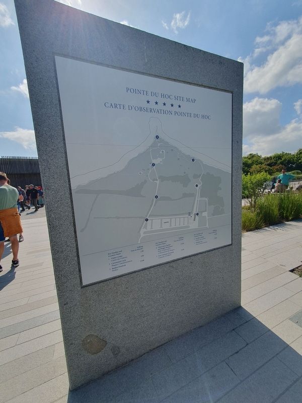
Pointe du Hoc Site Map
Reverse
For these men are lately drawn from the ways of peace. They fight not for the lust of conquest. They fight to end conquest. They fight to liberate. They year but for the end of battle, for their return to the haven of home.
Franklin D. Roosevelt
President of the United States
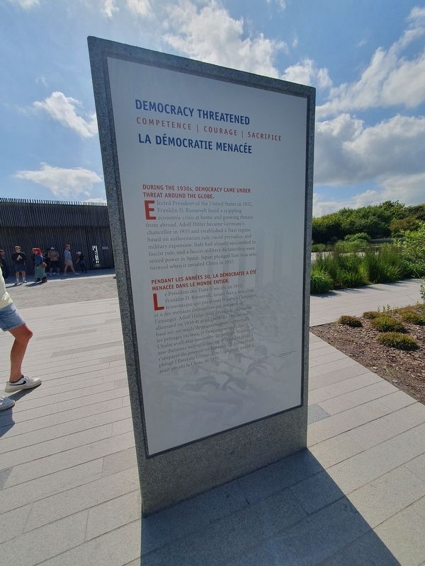
Democracy Threatened
During the 1930s, democracy came under threat around the globe.
Elected President of the United States in 1932, Franklin D. Roosevelt faced a crippling economic crisis at home and growing threats from abroad. Adolf Hitler became Germany's chancellor in 1933 and established a Nazi regime based on authoritarian rule, racial prejudice, and military expansion. Italy had already succumbed to fascist rule, and a fascist military dictatorship soon seized power in Spain. Japan plunged East Asia into turmoil when it invaded China in
Photographed by J. Makali Bruton, June 5, 2024
2. Pointe du Hoc Marker - American Battle Monuments Commission
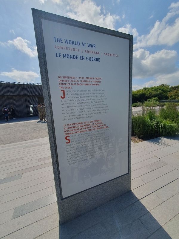
The World at War
On September 1, 1939, German troops invaded Poland, igniting a terrible conflict that soon spread around the globe.
Joining with Germany and Italy in the Axis alliance, Japan pursued military conquests and attacked Pearl Harbor on December 7, 1941. This brought the United States into the war. After years of brutal fighting, the Axis powers were thrown onto the defensive and Allied forces advanced in the Pacific, in the Mediterranean, and on the Eastern Front. By early 1944, Allied troops in Great Britain were preparing for the long-awaited liberation of Northern Europe.
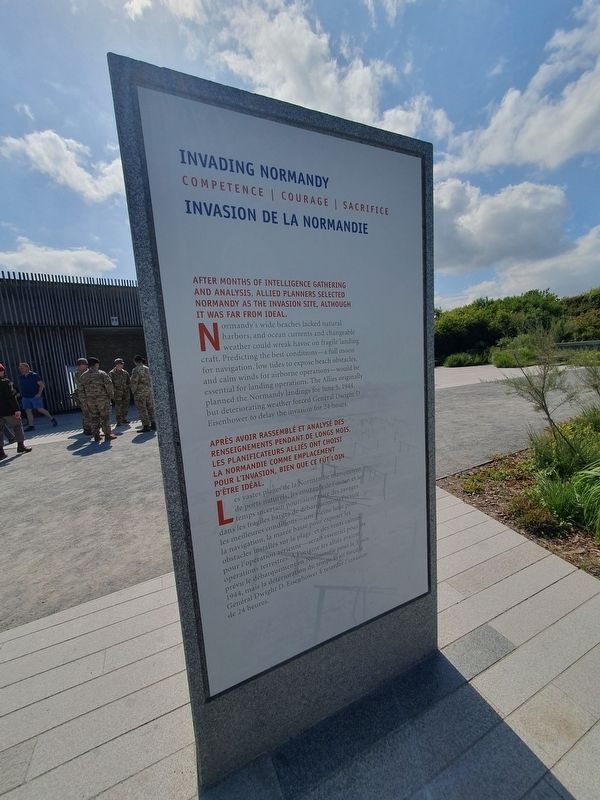
Invading Normandy
After months of intelligence gathering and analysis, Allied planners selected Normandy as the invasion site, although it was far from ideal.
Normandy's wide beaches lacked natural harbors, and ocean currents and changeable weather could wreak havoc on fragile landing craft. Predicting the best conditions-a full moon for navigation, low tides to expose beach obstacles, and calm winds for airborne operations--would be essential for landing operations. The Allies originally planned the Normandy landings for
Photographed by J. Makali Bruton, June 5, 2024
3. Pointe du Hoc Marker - Site Map
Pointe du Hoc
Ce site a été le témoin d'actes de courage extraordinaires lors de l'invasion Alliée de la Normandie.
Pendant la seconde guerre mondiale, les forces allemandes ont occupé la Pointe du Hoc et transformé cet endroit tranquille en un bastion fortifié protégeant une batterie de canons lourds. Le matin du 6 juin 1944, les rangers de l'armée américaine ont escaladé des falaises de 30 mètres pour capturer cette position fortement défendue et l'ont ensuite conservée en dépit de contre-attaques répétées. Leurs actes héroïques ont aidé à établir une tête de pont alliée en France et à commencer la libération de l'Europe.
L'American Battle Monuments Commission, fondée par le congres des etats unis en 1923, a pour mission de conserver la mémoire des sacrifices et des exploits des forces militaires américaines là où elles servirent depuis 1917. Les cimetières militaires et les monuments commemoratifs dans le monde honorent les militaires americains décédés ou en service actie, et accomplissent la promesse
Photographed by J. Makali Bruton, June 5, 2024
4. Pointe du Hoc Marker - Democracy Threatened
Carte d'Observation Pointe du Hoc
La Démocratie Menacée
Pendant les années 30, la démocratie a été menacée dans le monde entier.
Le Président des Etats-Unis elu en 1932, Franklin D. Roosevelt, faisait face à une crise économique qui paralysait le pays a l'inicien et à des menaces croissantes qui senaient de l'étranger. Adolf Hitler etait devele necher allemand en 1933 et avait graban ge na basé sur un mode de gouvernement autoritaire, les préjugés raciaus, et l'expansion unitalee L'Italie avait déjà succombe u pouvoir fasciste une dictature militaire fascing vagas farde s'emparer du pouvoir en Espage operat plongé l'Extreme Orient dins l'agitatio quand avait envahi la Chine en 1937.
Le Monde en Guerre
Le 1er septembre 1939, les troupes allemandes envahissent la Pologne, déclenchant un conflit terrible qui se propage rapidement dans le monde entier.
S'alliant à l'Allemagne et à l'Italie pour former l'Axe, le Japon poursuivit ses conquées militaires et attaqua Pearl Habour le décembre 1941. ce qui provoqua le tre en guerre des Etats-Unis. Après des années de obat
Photographed by J. Makali Bruton, June 5, 2024
5. Pointe du Hoc Marker - The World at War
Invasion de la Normandie
Après avoir rassemblé et analyse des renseignements pendant de longs mois les planificateurs allies ont choisi la normandie comme emplacement pour l'invasion, bien que ce fut loin d'être idéal
Les vastes plages de la Normandie agtient de ports naturels, les couran de focian et l temps incertain pourraient des ravages dans les fragiles barges de débardemenPeir les meilleures conditions-une pleine luge pon la navigation, la marée basse pour exposer les obstacles installés sur la plage, et des vents calm pour l'opération aérienne-serait essentiel pours opérations terrestres Aigine les allies avaient prévu le débarquementen Normandie pour le Sin 1944, mais la détérioration du temps ran force Général Dwight D. Eisenhower & retarder Finvasion de 24 heures.
Topics. This memorial is listed in this topic list: War, World II. A significant historical date for this entry is June 6, 1944.
Location. 49° 23.589′ N,
Photographed by J. Makali Bruton, June 5, 2024
6. Pointe du Hoc Marker - Invading Normandy

Regionally, it is in the North Atlantic Region, Europe, the European Union, Atlantic Europe, the Schengen Area, Western Europe, a coastal Mediterranean country, and the Western World. Historically, it finds itself in what was once a French colony and also the Roman Empire.
Other nearby markers. At least 8 other markers are within 3 kilometers of this marker, measured as the crow flies: Preparing to Invade (within shouting distance of this marker); Bravery Under Fire (within shouting distance of this marker); The Pointe-du-Hoc: the Feat of the 2nd Ranger Battalion (about 210 meters away, measured in a direct line); Ranger Casualties (about 210 meters away); a different marker also named Pointe du Hoc (approx. half a kilometer away);
Photographed by J. Makali Bruton, June 5, 2024
7. Pointe du Hoc Marker
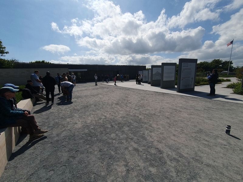
Note the site's museum and visitors center in the background to the east.
Regarding Pointe du Hoc. The first three panels of the memorial include a quote from a US President about Pointe du Hoc. The quotes are etched into the stone and relatively hard to notice or read. Note that translations of these quotes were not included in the French text.
Also see . . . Pointe du Hoc at ABMC. (Submitted on July 5, 2024.)
Credits. This page was last revised on July 5, 2024. It was originally submitted on July 5, 2024, by J. Makali Bruton of Washington, District of Columbia. This page has been viewed 187 times since then and 28 times this year. Photos: 1, 2, 3, 4, 5, 6, 7. submitted on July 5, 2024, by J. Makali Bruton of Washington, District of Columbia.
