Intramuros in Manila in Metropolitan Manila First District, Metro Manila, Philippines — Southeast Asia
Church of San Agustin
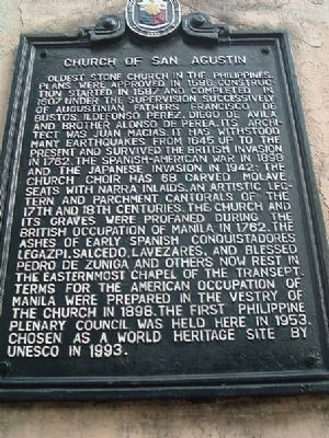
Photographed by I.G.V.Atajar, January 1, 2003
1. Church of San Agustin Marker
Erected 1994 by Philippine Historical Committee.
Topics. This historical marker is listed in
this page online
Location. 14° 35.36′ N, 120° 58.491′ E. Marker is in Manila, Metro Manila, in Metropolitan Manila First District. It is in Intramuros. It is on General Luna Street, on the right when traveling south. Touch for map. Marker is in this post office area: Manila, Metro Manila 1002, Philippines. Touch for directions.

Regionally, it is in Asia, specifically in Southeast Asia, in the Malay Archipelago, in the Pacific Ocean, in North Pacific, on the Ring of Fire, on the Pacific Rim, and in the Anglosphere. Historically, it finds itself in what was once a Spanish colony.
Other nearby markers. At least 8 other markers are within walking distance of this marker: San Agustin Church (a few steps from this marker); First Plenary Council of the Philippines (within shouting distance of this marker); Ad Maiorem Beatæ Mariæ Virginis Gloriam (within shouting distance of this marker); Plaza San Luis Complex (within shouting distance of this marker); Fr. George J. Willmann, S.J. (about 120 meters away, measured in a direct line); Colegio de Santa Isabel
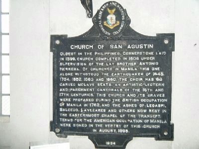
Photographed by I.G.V.Atajar, August 19, 2009
2. Original Historical Marker (1934)
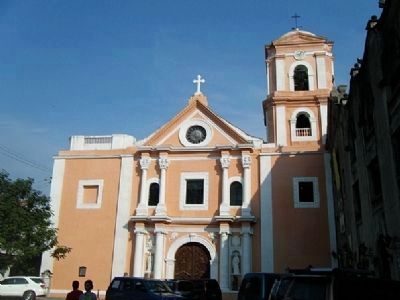
Photographed by I.G.V.Atajar, August 19, 2009
3. San Agustin Church
Credits. This page was last revised on February 12, 2022. It was originally submitted on December 1, 2009, by I.G.V.Atajar of San Jose, California. This page has been viewed 2,526 times since then and 102 times this year. Photos: 1, 2, 3. submitted on December 1, 2009, by I.G.V.Atajar of San Jose, California. • Syd Whittle was the editor who published this page.
