Ermita in Manila in Metropolitan Manila First District, Metro Manila, Philippines — Southeast Asia
Church of San Vicente de Paul
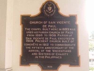
Photographed by I.G.V.Atajar, January 2, 2003
1. Church of San Vicente de Paul Marker
Erected 1935 by Historical Research and Markers Committee.
Topics. This historical marker is listed in this topic list: Religion & Religious Structures. A significant historical year for this entry is 1883.
Location. 14° 35.111′ N, 120° 59.123′ E. Marker is in Manila, Metro Manila, in Metropolitan Manila First District. It is in Ermita. It can be reached from San Marcelino Street. Touch for map. Marker is at or near this postal address: 971 San Marcelino St, Manila, Metro Manila 1000, Philippines. Touch for directions.

Regionally, it is in Asia, specifically in Southeast Asia, in the Malay Archipelago, in the Pacific Ocean, in North Pacific, on the Ring of Fire, on the Pacific Rim, and in the Anglosphere. Historically, it finds itself in what was once a Spanish colony.
Other nearby markers. At least 8 other markers are within
this page online
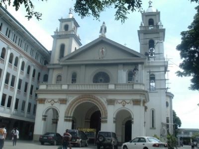
Photographed by I.G.V.Atajar, January 2, 2003
2. Church of San Vicente de Paul
Credits. This page was last revised on February 12, 2022. It was originally submitted on December 1, 2009, by I.G.V.Atajar of San Jose, California. This page has been viewed 2,123 times since then and 45 times this year. Photos: 1, 2. submitted on December 1, 2009, by I.G.V.Atajar of San Jose, California. • Syd Whittle was the editor who published this page.
