
City Centre West in York, England, United Kingdom — Northwestern Europe (the British Isles)
Baile Hill
| — | City Walls Trail | — |
Photographed by Ray Gurganus, April 16, 2024
1. Baile Hill Marker
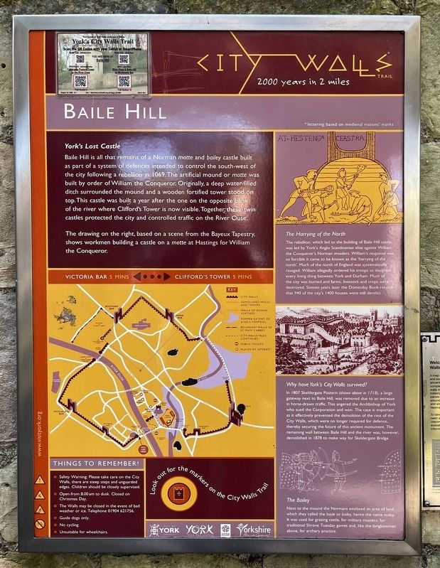
Baile Hill is all that remains of a Norman motte and bailey castle built as part of a system of defences intended to control the south west of the city following a rebellion in 1069. The artificial mound or motte was built by order of William the Conqueror. Originally, a deep water-filled ditch surrounded the mound and a wooden fortified tower stood on top. This castle was built a year after the one on the opposite bank of the river where Clifford's Tower is now visible. Together, these twin castles protected the city and controlled traffic on the River Ouse.
The drawing on the right, based on a scene from the Bayeux Tapestry, shows workmen building a castle on a motte at Hastings for William the Conqueror.
The Harrying of the North
The rebellion, which led to the building of Baile Hill castle, was led by York's Anglo Scandinavian elite against William the Conqueror's Norman invaders. William's response was so forcible it came to be known as the 'harrying of the north'. Much of the north of England was systematically ravaged. William allegedly ordered his troops to slaughter every living thing
this page online
Why have York's City Walls survived?
In 1807 Skeldergate Postern shown above in 1718), a large gateway next to Baile Hill was removed due to an increase in horse-drawn traffic. This angered the Archbishop of York who sued the Corporation and won. The case is important as it effectively prevented the demolition of the rest of the City Walls, which were no longer required for defence, thereby securing the future of this ancient monument. The remaining wall between Baile Hill and the river was however, demolished in 1878 to make way for Skeldergate Bridge.
The Bailey
Next to the mound the Normans enclosed an ares of land which they called the bayle or baley, hence the name today. It was used for grazing castle, for military musters, for traditional Shrove Tuesday games and, like the longbowmen above, for archery practice.
Erected by City of York Council.
Topics. This historical marker is listed in this topic list:
Photographed by Ray Gurganus, April 16, 2024
2. City Walls Walkway
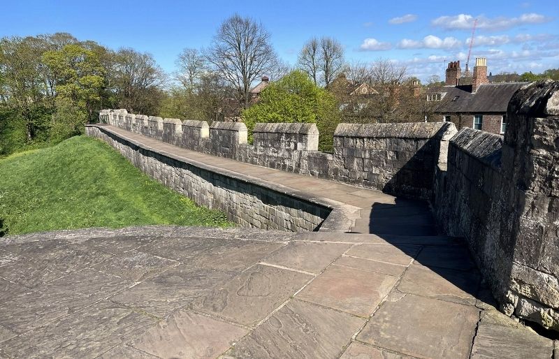
Location. 53° 57.242′ N, 1° 4.971′ W. Marker is in York, England. It is in City Centre West. It can be reached from no nearby street. On the City Walls walkway. Touch for map. Marker is in this post office area: York, England YO1 6HL, United Kingdom. Touch for directions.

Regionally, this marker is in England’s Yorkshire & The Humber. Globally, it is on the Atlantic Ocean, in the North Atlantic Region, in Europe, in Atlantic Europe, on one of the British Isles, in the Western World, and in the Anglosphere. Historically, it finds itself in what was once the Roman Empire.
Other nearby markers. At least 8 other markers are within walking distance of this marker: A Tale of Two Castles (about 90 meters away, measured in a direct line); What is This Tower? (about 90 meters away); Clifford’s Tower (about 240 meters away); Courthouse Memorial Stone (approx. 0.3 kilometers away); Cumberland House (approx. 0.3 kilometers away); Frankie Howerd (approx. 0.3 kilometers away); This Memorial Stone (approx. 0.3 kilometers away); Castlegate House (approx. 0.4 kilometers away). Touch for a list and map of all markers in York.
Credits. This page was last revised on June 25, 2026. It was originally submitted on July 7, 2024, by Ray Gurganus of Washington, District of Columbia. This page has been viewed 145 times since then and 21 times this year. Photos: 1, 2. submitted on July 7, 2024, by Ray Gurganus of Washington, District of Columbia. • Andrew Ruppenstein was the editor who published this page.
Editor’s want-list for this marker. photo of the marker within its surroundings • Can you help?
