
City Centre West in York, England, United Kingdom — Northwestern Europe (the British Isles)
What is This Tower?

Photographed by Ray Gurganus, April 16, 2024
1. What is This Tower? Marker
Archbishop Melton, and not the city authorities, controlled this area near Baile Hill. Edward ordered the archbishop to improve the walls here after an inspection of York's defences in 1327. The archbishop had the timber and earth was replaced in stone between 1327 and 1340.
Archaeological investigations were undertaken during conservation work here in 2001. They showed that the tower's stonework is not bonded into the stonework of the wall. That suggests the tower was added some years after the stone wall was built.
The archaeologists found five remaining courses (rows) of large magnesian limestone blocks from the medieval stone wall. These sat on top of a foundation of smaller, rough-faced pieces of magnesian limestone.
How has the tower changed?
The city walls stopped being used as a defensive structure by the 1800s. Parts of the walls began to be used as a walking route or promenade.
this page online
A new walkway was built inside the city walls here to create the promenade The tower was filled in and a new parapet added to it, it is made up of seven courses (rows) of magnesian limestone. They are much smaller, and the wall is thinner, than the medieval section below.
The City Corporation (city council) wanted to demolish the city walls in the early 1800s. Some people agreed that the walls hampered progress and were a health hazard. Others joined a public campaign to save the walls and gave money. Major restoration of the city walls began in 1829, creating the public walk we know today.
Topics. This historical marker is listed in this topic list: Forts and Castles. A significant historical year for this entry is 1327.
Location. 53° 57.21′ N, 1° 5.024′ W. Marker is in York, England. It is in City Centre West. It can be reached from no nearby street. On the City Wall Walkway. Touch for map. Marker is in this post office area: York, England YO1 6HL, United Kingdom. Touch for directions.

Regionally, this marker is in England’s Yorkshire & The Humber.
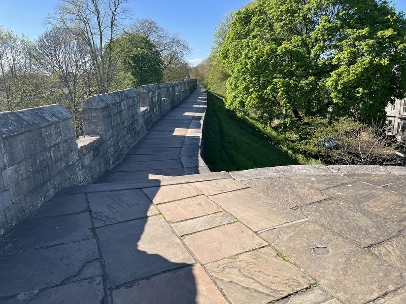
Photographed by Ray Gurganus, April 16, 2024
2. City Wall Walkway
Other nearby markers. At least 8 other markers are within walking distance of this marker: A Tale of Two Castles (here, next to this marker); Baile Hill (about 90 meters away, measured in a direct line); Clifford’s Tower (approx. 0.3 kilometers away); Courthouse Memorial Stone (approx. 0.4 kilometers away); Cumberland House (approx. 0.4 kilometers away); Frankie Howerd (approx. 0.4 kilometers away); This Memorial Stone (approx. 0.4 kilometers away); Castlegate House (approx. 0.4 kilometers away). Touch for a list and map of all markers in York.
Credits. This page was last revised on June 25, 2026. It was originally submitted on July 7, 2024, by Ray Gurganus of Washington, District of Columbia. This page has been viewed 106 times since then and 12 times this year. Photos: 1, 2. submitted on July 7, 2024, by Ray Gurganus of Washington, District of Columbia. • Andrew Ruppenstein was the editor who published this page.
