Hornbeck in Vernon Parish, Louisiana — The American South (West South Central)
Hornbeck, Louisiana
Photographed by Cajun Scrambler, July 4, 2024
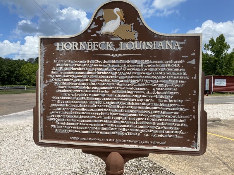
1. Hornbeck, Louisiana Marker
Hornbeck town site (Section 16, T 4N, 10W) was purchased in 1897 from the Kansas City Southern railroad for $8.640, by F.A. Hornbeck, agent of the Arkansas Town Site Company. In the same year the Hornbeck post office was established with Walter Carey and D. B. Pate serving as the first two postmasters. On October 21, 1902 Hornbeck was incorporated. Gov. William Wright Heard appointed the first mayor, W.M. Conerly, town marshal, W. Johnson and board of aldermen, whose first members were G.C. Leach, W. L. Maddox and John Carter. Prospering from both the railroad and timber industry Hornbeck by 1912 supported a bank, newspaper. five hotels five saloons, ten mercantile establishments and the town school (Home of the "Hornets"). However, in the same year the railroad roundhouse, critical to the town's prosperity, was moved to Leesville severely affecting area economy. Hornbeck's prosperity continued to ebb through the depression years of the 1930's but it returned in 1941 with the arrival of the US Army's "Louisiana Maneuvers" and the construction of Camp Polk. With the construction of the Toledo Bend Reservoir in
this page online
Erected 2002 by Hornbeck Centennial Celebration.
Topics. This historical marker is listed in these topic lists: Industry & Commerce • Settlements & Settlers. A significant historical date for this entry is October 21, 1902.
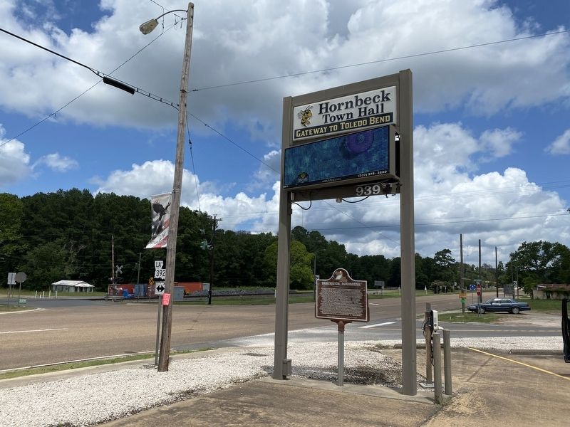
Location. 31° 19.536′ N, 93° 23.92′ W. Marker is in Hornbeck, Louisiana, in Vernon Parish. It is on Shreveport Highway/Hammond Street (U.S. 171) near Port Arthur Avenue (State Route 392). Touch for map. Marker is at or near this postal address: 939 Hammond St, Hornbeck LA 71439, United States of America. Touch for directions.

Regionally, this marker is in Central Louisiana. It is also in the American South, specifically in the Deep South, and in the Piney Woods. Globally, it is in North America, a Gulf of Mexico state, the Western Hemisphere, the Western World, and the Anglosphere. Historically, it finds itself in what was once the territory of the Mississippian Culture, the Louisiana Purchase, one of the Confederate States of America, and the Antebellum South.
Other nearby markers. At least 8 other markers are within 15 miles of this
Photographed by Cajun Scrambler, July 4, 2024
2. Hornbeck, Louisiana Marker
More about this marker. Located at the Hornbeck Town Hall.
Credits. This page was last revised on March 10, 2025. It was originally submitted on July 7, 2024, by Cajun Scrambler of Assumption, Louisiana. This page has been viewed 645 times since then and 66 times this year. Photos: 1, 2. submitted on July 7, 2024, by Cajun Scrambler of Assumption, Louisiana.
