Evergreen Park in Palo Alto in Santa Clara County, California — The American West (Pacific Coastal)
Uncle Jim’s Cabin
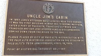
Photographed by Syd Whittle, November 20, 2015
1. Uncle Jim’s Cabin Marker
Erected 1969 by City of Palo Alto and Palo Alto Historical Society. (Marker Number 007.)
Topics. This historical marker is listed in this topic list: Industry & Commerce. A significant historical year for this entry is 1853.
Location. 37° 25.513′ N, 122° 8.734′ W. Marker is in Palo Alto, California, in Santa Clara County. It is in Evergreen Park. It is on California Street near El Camino Real (California Highway 82), on the right when traveling east. The marker is mounted on the California Street side of the building located at the intersection. Touch for map. Marker is at or near this postal address: 2401 El Camino Real, Palo Alto CA 94306, United States of America. Touch for directions.

Regionally, this marker is in the San Francisco Bay Area, in Silicon Valley, and on the Coast Ranges. It is also on the American Pacific Coast. Globally, it is in North America, on
this page online
Other nearby markers. At least 8 other markers are within 2 miles of this marker, measured as the crow flies: Mayfield School (about 700 feet away, measured in a direct line); Town and Gown (approx. 0.2 miles away); Herring Box School (approx. 0.2 miles away); a different marker also named Herring Box School (approx. 0.2 miles away); The Crossroads of Mayfield (approx. 0.2 miles away); Play Ball! (approx. 0.2 miles away); Homesite of Sarah Wallis (approx. one mile away); The Gordon Hampton Oak (approx. 1.1 miles away). Touch for a list and map of all markers in Palo Alto.
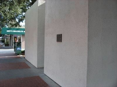
Photographed by Syd Whittle, November 20, 2015
2. Uncle Jim’s Cabin Marker
Credits. This page was last revised on July 9, 2024. It was originally submitted on May 7, 2016, by Syd Whittle of Mesa, Arizona. This page has been viewed 905 times since then and 123 times this year. Last updated on July 7, 2024, by Sam Skeen of State College, Pennsylvania. Photos: 1, 2. submitted on May 7, 2016, by Syd Whittle of Mesa, Arizona. • J. Makali Bruton was the editor who published this page.
