Cripple Creek in Teller County, Colorado — The American Mountains (Southwest)
Bowen Building 1896
| — | The Gold Belt Tour | — |

Photographed by Mark Parker, July 1, 2024
1. Bowen Building 1896 Marker
The building was designed to have three interior spaces with the upper floor accessed via a staircase centered in the main entrance. Decorative brick work, raised parapet with the building name, and the entrance set right of center distinguish the building.
Topics and series. This historical marker is listed in this topic list: Industry & Commerce. In addition, it is included in the Colorado, Cripple Creek Gold Belt Tour series list. A significant historical year for this entry is 1896.
Location. 38° 44.81′ N, 105° 10.541′ W. Marker is in Cripple Creek, Colorado, in Teller County. It is at the intersection of Bennett Drive (Colorado Route 67) and North Third Street, on the right when traveling west on Bennett Drive. Touch for map. Marker is at or near this postal address: 321 Bennett Drive, Cripple Creek CO 80813, United States of
this page online

Regionally, this marker is in the Colorado High Rockies and in Pikes Peak Region. It is also in the American Mountain West. Globally, it is in North America, the Rocky Mountains, the Western Hemisphere, the Western World, and the Anglosphere.
Other nearby markers. At least 8 other markers are within walking distance of this marker: Cripple Creek City Hall 1898 (a few steps from this marker); Fairley Bros. & Lampman Building (within shouting distance of this marker); Becker & Nolon Building (within shouting distance of this marker); Pittsburg Building 1896 (within shouting distance of this marker); J.S. Neall Block 1896 (within shouting distance of this marker); Weinberg Block 1896 (within shouting distance of this marker); Gold Mining Stock Exchange (about 300 feet away, measured in a direct line); "The Old Homestead House" of Myers Avenue (about 300 feet away). Touch for a list and map of all markers in Cripple Creek.
More about this marker. Marker is to the right of The Cheshire Cat window

Photographed by Mark Parker, July 1, 2024
2. Bowen Building 1896 Marker
Located to the right of The Cheshire Cat window
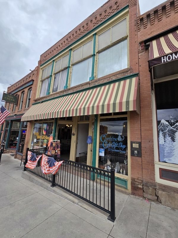
Photographed by Mark Parker, July 1, 2024
3. Bowen Building
Credits. This page was last revised on July 9, 2024. It was originally submitted on July 7, 2024, by Mark Parker of Hickory, North Carolina. This page has been viewed 218 times since then and 37 times this year. Photos: 1, 2, 3. submitted on July 7, 2024, by Mark Parker of Hickory, North Carolina. • Andrew Ruppenstein was the editor who published this page.
