
Bouresches in Aisne, Upper France, France — Western Europe
Eglise en 1919
Church in 1919
Photographed by J. Makali Bruton, June 8, 2024
1. Eglise en 1919 Marker

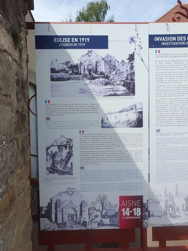
Le croisement de la route de Belleau et de Vaux. L'église en ruines. On voit le coin de l'école, non touchée et indemne. Les gravas ne sont pas encore déblayés mais les rues sont dégagées. On remarque qu'elles ne sont pas défoncées par les cratères : l'artillerie qui a détruit les maisons ne devait pas comporter de mortiers à tir vertical.
Selon une tradition locale, le canon qui a détruit l'église aurait été placé sur la route de Lucy pour débusquer des tireurs allemands cachés le clocher qui auraient descendus des américains qui abreuvaient leurs chevaux ou refaisait le ravitaillement en eau (les fontaines de Torcy et Belleau étant obstruées de cadavres en décomposition.) A faible distance, en visant le clocher, le canon (sans doute un 75) sans toucher le mur du pignon ouest, aurait pulvérisé le clocheton de 1870 et tombant dans la nef, aurait soufflé le plafond en lattis plâtré et la charpente...Cela expliquerait que les murs soient restés intacts...et que l'école distante de quelques dizaines de mètres ne soit pas atteinte.... Cette explication romanesque, est présentée différemment dans les
this page online
Etat de l'église en 1919. Déblaiement de la maison prés de l'abreuvoir.
L'intérieur de l'église après le bombardement par les américains. Etat en fin d'été 1918, avant tout déblaiement.
Church in 1919
The crossroads of the Belleau and de Vaux roads. The church in ruins. We can observe a part of the school, untouched and unharmed. The rubbles are no yet cleared but the roads are cleared. It is remarkable that these are not smashed down with craters: The artillery which destroyed houses probably did not include mortars with high angle fire.
According to a local tradition, the gun which destroyed the church was located on the Lucy road in order to chase away the German snipers hidden in the Bell Tower who killed American soldiers who watered their horses or completed their water supply (The Torcy and Belleau fountains were blocked with decomposed bodies.) From short
Photographed by J. Makali Bruton, June 8, 2024
2. Eglise en 1919 Marker
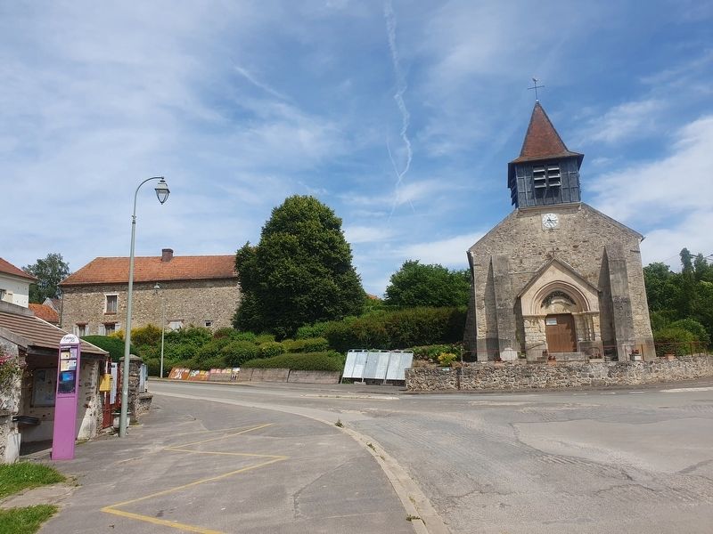
The marker is to the left near a light pole in this view of the reconstructed church of Bouresches.
State of the Church in 1919. Clearing of the house next to the Watering place.
Inside of the church after the American bombing. State of the church at the end of the summer 1928 before clearing.
Topics. This historical marker is listed in these topic lists: Religion & Religious Structures • War, World I. A significant historical year for this entry is 1919.
Location. 49° 3.752′ N, 3° 18.51′ E. Marker is in Bouresches, Hauts-de-France (Upper France), in Aisne. It is at the intersection of Route D1390 and Place Saint-Lubin, on the right when traveling south on Route D1390. Touch for map. Marker is in this post office area: Bouresches, Hauts-de-France 02400, France. Touch for directions.

Regionally, it is in the North Atlantic Region, Europe, the European Union, Atlantic Europe, the Schengen Area, Western Europe, a coastal Mediterranean country, and the Western World. Historically, it finds itself in what was once a French colony and also the Roman Empire.
Other nearby markers. At least 8 other markers are within 3 kilometers of this marker, measured as the crow flies: Un Peu de Histoire / Invasion des Cosaques (here, next to this marker); La Bataille de Bouresches (within shouting distance of this marker); Belleau Wood Marine Memorial (approx. 1.8 kilometers away); Belleau Wood USMC Operations Map (approx. 1.8 kilometers away); Belleau Wood Medal of Honor Recipients (approx. 1.8 kilometers away); Belleau Wood USMC Interpretive Panel #1 (approx. 1.8 kilometers away); Belleau Wood USMC Interpretive Panel #2 (approx. 1.8 kilometers away); Belleau Wood USMC Interpretive Panel #3 (approx. 1.8 kilometers away). Touch for a list and map of all markers in Bouresches.
Credits. This page was last revised on July 8, 2024. It was originally submitted on July 8, 2024, by J. Makali Bruton of Washington, District of Columbia. This page has been viewed 136 times since then and 17 times this year. Photos: 1, 2. submitted on July 8, 2024, by J. Makali Bruton of Washington, District of Columbia.
