Bethlehem in Northampton County, Pennsylvania — The American Northeast (Mid-Atlantic)
Iron Production
Photographed by William Fischer, Jr., June 30, 2024
1. Iron Production Marker
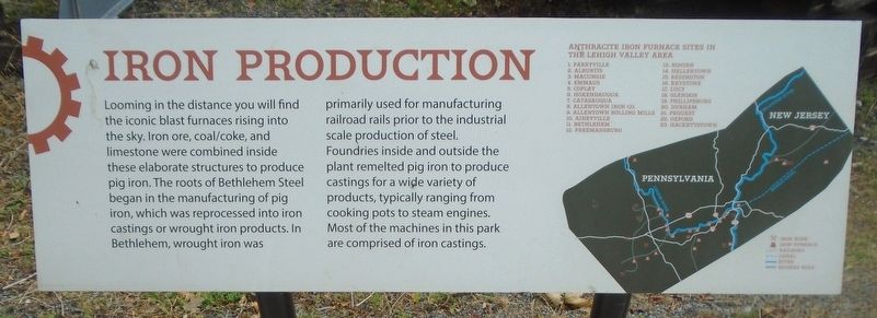
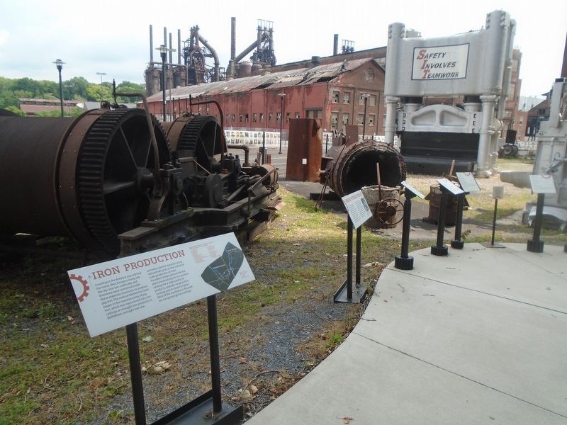
Looming in the distance you will find the iconic blast furnaces rising into the sky. Iron ore, coal/coke, and limestone were combined inside these elaborate structures to produce pig iron. The roots of Bethlehem Steel began in the manufacturing of pig iron, which was reprocessed into iron castings or wrought iron products. In Bethlehem, wrought iron was primarily used for manufacturing railroad rails prior to the industrial scale production of steel.
Foundries inside and outside the plant remelted pig iron to produce castings for a wide variety of products, typically ranging from cooking pots to steam engines. Most of the machines in this park are comprised of iron castings.
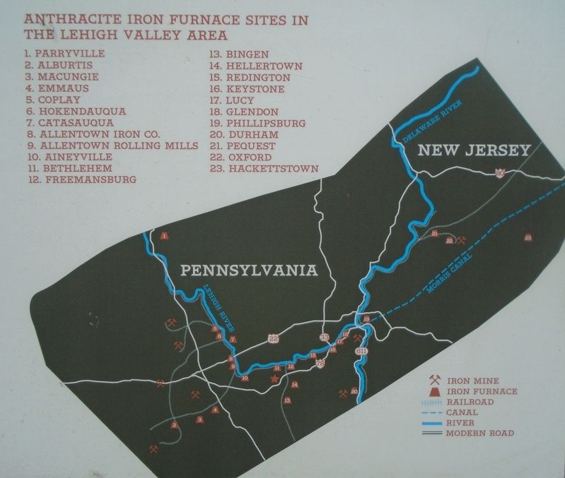
ANTHRACITE IRON FURNACE SITES IN THE LEHIGH VALLEY AREA [Map and Legend]
Erected by National Museum of Industrial History.
Topics. This historical marker is listed in this topic list: Industry & Commerce.
Location. 40° 36.774′ N, 75° 22.199′ W. Marker is in Bethlehem, Pennsylvania, in Northampton County. It is at the intersection of 3rd Street and Pierce Street, on the left when traveling
this page online

Regionally, this marker is in Southeast Pennsylvania and in Lehigh Valley. It is also in the American Northeast and in the Mid-Atlantic. Globally, it is in North America, the Western Hemisphere, the Western World, and the Anglosphere. Historically, it finds itself in what was once the Haudenosaunee (Iroquois) Confederacy and also one of the original Thirteen Colonies.
Other nearby markers. At least 8 other markers are within walking distance of this marker: Forging & Finished Products (here, next to this marker); Air Compressor (here, next to this marker); Hoisting Engine No. 5 (here, next to this marker); "Dinky" Locomotive (here, next to this marker); Ingot Mold (here, next to this marker); Moving Around The Plant (here, next to this marker); Bending Press (here, next to this marker); Ladles (here, next to this marker). Touch for a list and map of all markers in Bethlehem.
Also see . . .
1. The Bethlehem Iron Company (Bethlehem Area Public Library).
Photographed by William Fischer, Jr., June 30, 2024
2. Iron Production Map on Marker
2. Bethlehem Steel: The Rise and Fall of an Industrial Titan (Roth, Pennsylvania History, 2020). (Submitted on July 10, 2024, by William Fischer, Jr. of Reynoldsburg, Ohio.)
3. National Museum of Industrial History. (Submitted on July 10, 2024, by William Fischer, Jr. of Reynoldsburg, Ohio.)
Photographed by William Fischer, Jr., June 30, 2024
3. Iron Production Marker
Credits. This page was last revised on July 10, 2024. It was originally submitted on July 10, 2024, by William Fischer, Jr. of Reynoldsburg, Ohio. This page has been viewed 133 times since then and 18 times this year. Photos: 1, 2, 3. submitted on July 10, 2024, by William Fischer, Jr. of Reynoldsburg, Ohio.
