Winter Hill in Somerville in Middlesex County, Massachusetts — The American Northeast (New England)
Gilman Square
Photographed by Marc Posner, April 8, 2024
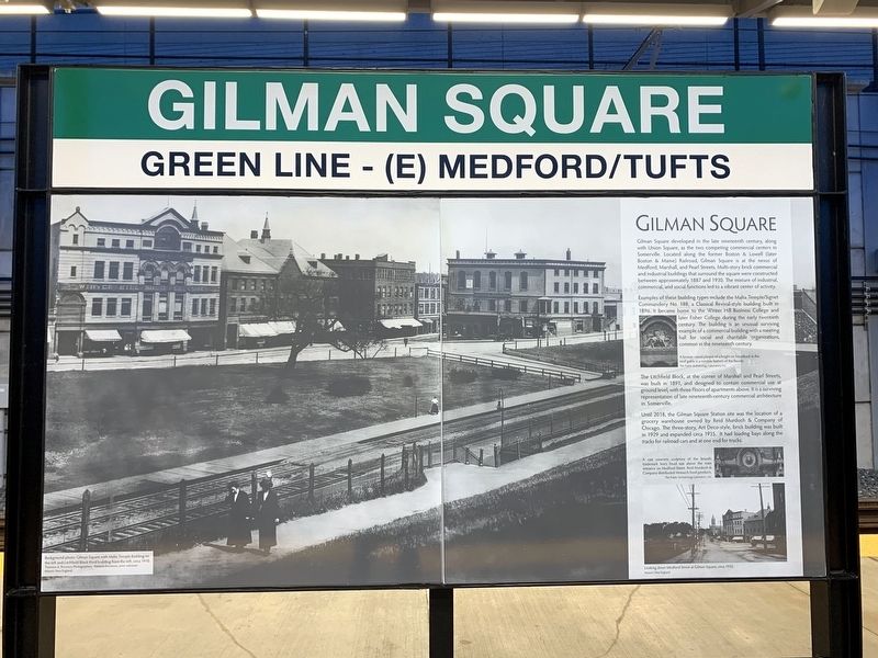
1. Gilman Square Marker
Gilman Square developed in the late nineteenth century, along with Union Square, as the two competing commercial centers in Somerville. Located along the former Boston & Lowell (later Boston & Maine) Railroad, Gilman Square is at the nexus of Medford, Marshall, and Pearl Streets. Multi-story brick commercial building that surround the square were constructed between approximately 1887 and 1930. The mixture of industrial, commercial, and social functions led to a vibrant center of activity.
Examples of these building types include the Malta Temple/Signet Commandry No. 188, a Classical Revival-Style building built in 1896. It became hoe to the Winter Hill Business College and later Fisher College during the early twentieth century. The building is an unusual surviving example of a commercial building with a meeting hall for social and charitable organizations, common in the nineteenth century.
The Litchfield Block, at the corner of Marshall and Pearl Streets, was built in 1891, and designed to contain commercial use at ground level, with three floors of apartments above. It is a surviving representation of late nineteenth-century
this page online
Until 2018, the Gilman Square Station site was the location of a grocery warehouse owned by Reid Murdoch & Company of Chicago. The three-story, Art Deco-style, brick building was built in 1929 and expanded circa 1935. It had loading bays along the tracks for railroad cars and at one end for trucks.
( photo captions )
— A bronze raised plaque of a knight on horseback. In the roof gable is a notable feature of the facade. The Public Archaeology Laboratory, Inc.
— A cast concrete sculpture of the brand’s trademark lion’s head was above the main entrance on Medford Street. Reid Murdoch and Company distributed Monarch food products.
— Looking down Medford Street at Gilman Square, circa 1935. Historic New England.
Erected by Massachusetts Bay Transportation Authority.
Topics. This historical marker is listed in this topic list: Notable Buildings.
Location. 42° 23.276′ N, 71° 5.807′ W. Marker is in Somerville, Massachusetts, in Middlesex County. It is in Winter Hill. It can be reached from School Stret near Montrose Street when traveling
Photographed by Marc Posner, June 21, 2024
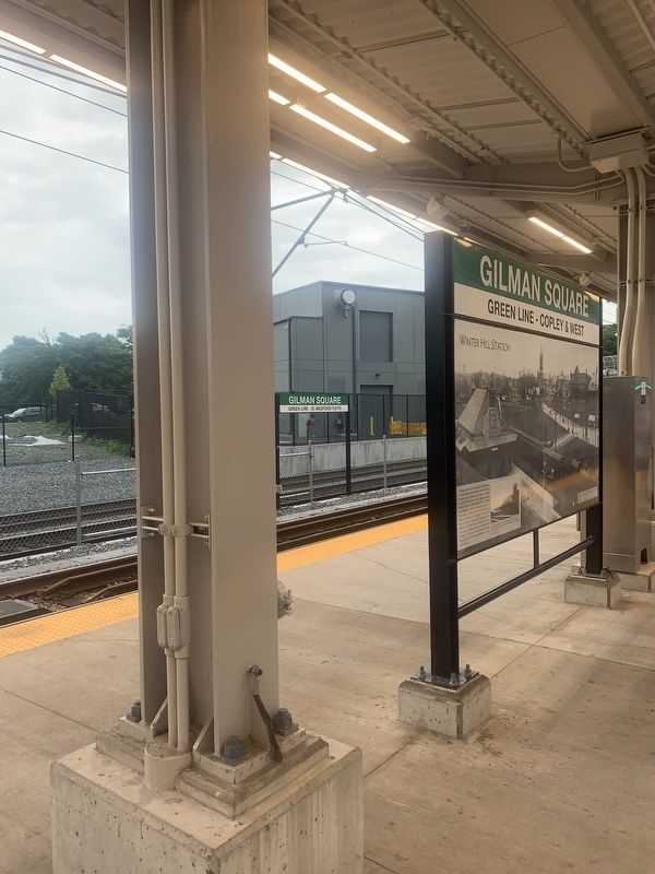
2. Marker on MBTA station platform

Regionally, this marker is in Historic Boston and specifically in Greater Boston. It is also in the American Northeast, in New England, and on the Eastern Seaboard. Globally, it is in the North Atlantic Region, North America, the Western Hemisphere, the Western World, and the Anglosphere. Historically, it finds itself in what was once one of the original Thirteen Colonies.
Other nearby markers. At least 8 other markers are within walking distance of this marker: Winter Hill Station (a few steps from this marker); The First Congregational Unitarian Society in Somerville (about 500 feet away, measured in a direct line); George Dilboy (about 600 feet away); Edward Leathers Community Park (approx. 0.2 miles away); Edward L. Leathers (approx. 0.2 miles away); The French Redoubt (approx. 0.2 miles away); Central Hill Playground (approx. 0.2 miles away); Hoyt-Sullivan Playground (approx. 0.3 miles away). Touch for a list and map of all markers in Somerville.
Credits. This page was last revised on July 14, 2024. It was originally submitted on July 10, 2024, by Marc Posner of Somerville, Massachusetts. This page has been viewed 641 times since then and 80 times this year. Photos: 1, 2. submitted on July 10, 2024, by Marc Posner of Somerville, Massachusetts. • Michael Herrick was the editor who published this page.
