Ermita in Manila in Metropolitan Manila First District, Metro Manila, Philippines — Southeast Asia
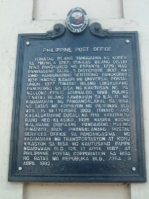
Philippine Post Office
Photographed by I.G.V.Atajar, January 5, 2003
1. Philippine Post Office Marker
In Tagalog:
Itinatag bilang tanggapan ng koreo sa Maynila 1767; Itinaas bilang distritong Pangkoreo ng Espanya, 1779; Nag panibagong tatag, 5 Disyembere 1837; Naging pangunahing sentrong pangkoreo, 1838, naging kasapi ng Universal Postal Union, 1877. Itinatag bilang lingkurang pangkoreo sa bisa ng Kautusan ng Pangulong Emilio Aguinaldo, 1898. Muling itinatag bilang kawanihan sa ilalim ng Kagawaran ng Pangangalakal sa bisa ng batas ng Komisyon ng Pilipinas Blg. 426, 15 Setyembre 1902. Itinayo ang kasalukuyang gusali na may arkitekturang Neo-Klasiko, 1926. Nasira noong ikalawang digmaang pandaigdig; muling ipinatayo, 1946. Pinangalanang Postal Services Office sa pangangasiwa ng Kagawaran ng Transportasyon at Komunikasyon sa bisa ng Kautusang pampangasiwaan Blg. 125, 13 Abril 1987; at Philippine Postal Corporation sa bisa bg Batas ng Republika blg. 7354, 3 Abril 1992.
Rough English translation:
Established as a post office in Manila in 1767; elevated to a postal district of Spain, 1779; modernized, 5 December 1837; became a postal center, 1838, became a member of the Universal Postal Union, 1877. Established as a postal
this page online
Erected 1994 by National Historical Institute.
Topics and series. This historical marker is listed in this topic list: Charity & Public Work. In addition, it is included in the Postal Mail and Philately series list. A significant historical date for this entry is April 13, 1987.
Location. 14° 35.721′ N, 120° 58.753′ E. Marker is in Manila, Metro Manila, in Metropolitan Manila First District. It is in Ermita. It can be reached from Magallanes Drive. Touch for map. Marker is in this post office area: Manila, Metro Manila 1000, Philippines. Touch for directions.

Regionally,
Photographed by I.G.V.Atajar, January 5, 2003
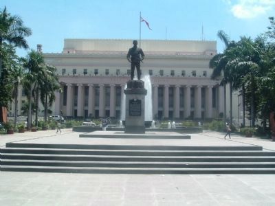
2. Philippine Post Office and Liwasang Bonifacio Monument
Other nearby markers. At least 8 other markers are within walking distance of this marker: Andres Bonifacio (about 90 meters away, measured in a direct line); In Memory of the Victims of Military Sexual Slavery during the Second World War (about 120 meters away); Manila Metropolitan Theater (about 180 meters away); Mother Francisca del Espiritu Santo (approx. 0.3 kilometers away); College of San Juan de Letran (approx. 0.3 kilometers away); William J. Burke (approx. 0.4 kilometers away); Beaterio-Colegio de Santa Catalina (approx. 0.4 kilometers away); Hospital de San Juan de Dios (approx. 0.4 kilometers away). Touch for a list and map of all markers in Manila.
Photographed by I.G.V.Atajar, January 1, 2003
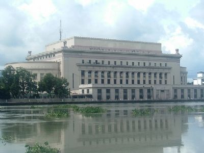
3. Philippine Post Office from the Pasig River
Credits. This page was last revised on June 5, 2024. It was originally submitted on December 3, 2009, by I.G.V.Atajar of San Jose, California. This page has been viewed 3,471 times since then and 77 times this year. Photos: 1, 2, 3. submitted on December 3, 2009, by I.G.V.Atajar of San Jose, California. • Kevin W. was the editor who published this page.
