Carlisle in Cumbria, England, United Kingdom — Northwestern Europe (the British Isles)
The Captain's Tower

Photographed by Ray Gurganus, April 11, 2024
1. The Captain's Tower Marker
This building is very similar to a gatehouse of a castle in another part of his empire, Chateau-sur-Epte, built in about 1180 to defend the duchy of Normandy - see the image below.
The gatehouse at Carlisle was remodelled in the late 14th century: an upper storey was added and a portcullis installed to defend it. You can still see the groove in which the portcullis ran to your left.
In the 12th Century the castle's Inner Bailey was lined with a series of buildings which originally formed a residence for the sheriffs of Cumberland, and were also intended to be used by the king on occasional royal visits. Edward I's wife, Margaret, stayed here, and in the 14th 15th and 16th centuries the Inner Bailey was the official residence of the Lord Warden of the West March. In later centuries the medieval buildings were heavily altered
this page online
A. The Militia Store was built on the site of the great hall. The kitchen was to the left, out of sight.
B. The Regimental Museum (centre) was adapted in the 18th century from the original chamber block.
C. The Keep was originally intended as a residential building also, but has been adapted for various different purposes.
Topics. This historical marker is listed in this topic list: Forts and Castles. A significant historical year for this entry is 1180.
Location. 54° 53.834′ N, 2° 56.477′ W. Marker is in Carlisle, England, in Cumbria. It can be reached from Church Street. Touch for map. Marker is at or near this postal address: Church St, Carlisle, England CA2 5RT, United Kingdom. Touch for directions.

Regionally, this marker is in North West England. It is also in British Border Reivers Country. Globally, it is on the Atlantic Ocean, in the North Atlantic Region, in Europe, in Atlantic Europe, on one of the British Isles, in the Western World, and in the Anglosphere. Historically, it finds itself in what was once the Roman Empire.
Other nearby markers. At least 6 other markers are within 8 kilometers
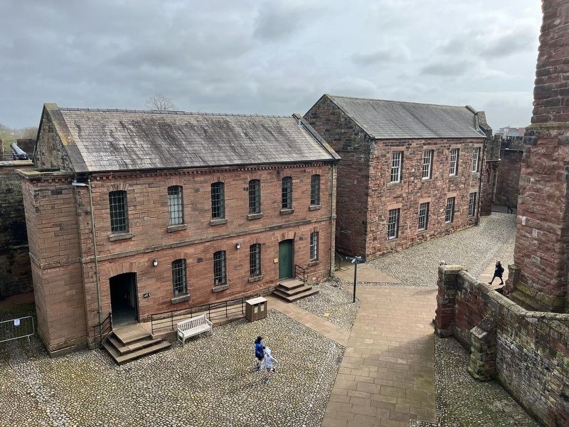
Photographed by Ray Gurganus, April 11, 2024
2. Carlisle Castle Courtyard
Credits. This page was last revised on July 24, 2024. It was originally submitted on July 11, 2024, by Ray Gurganus of Washington, District of Columbia. This page has been viewed 135 times since then and 18 times this year. Photos: 1, 2. submitted on July 11, 2024, by Ray Gurganus of Washington, District of Columbia. • Bill Pfingsten was the editor who published this page.
