West End in Cincinnati in Hamilton County, Ohio — The American Midwest (Great Lakes)
Cathedral Basilica of St. Peter in Chains

Photographed by Grant & Mary Ann Fish, July 6, 2024
1. Cathedral Basilica of St. Peter in Chains Marker
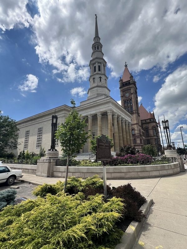
The Cathedral of St. Peter In Chains has ministered to Catholics in Ohio for more than 175 years. In 1840, Bishop John Baptist Purcell recognized the need for a cathedral to serve his growing catholic immigrant community and asked architect Henry Walter to draw up designs in neo-classic Greek style. The cornerstone was laid in 1841 and the Cathedral of St. Peter in Chains was dedicated November 2, 1845. It was promptly nicknamed the “White Angel” for its white marble façade. Abandoned in 1938 due to deteriorating conditions, it was renovated during the 1950s, and rededicated as the cathedral on November 3, 1957. The Cathedral of St. Peter in Chains was listed on the National Register of Historic Places in 1973. The Pope designated it a Minor Basilica in 2020.
Erected 2023 by Cathedral Basilica of St. Peter in Chains and Ohio History Connection. (Marker Number 103-31.)
Topics and series. This historical marker is listed in this topic list: Religion & Religious Structures. In addition, it is included in the Ohio Historical Society / The Ohio History Connection series list. A significant historical date for this entry is November 2, 1845.
Location. 39° 6.2′ N,
this page online

Regionally, this marker is in the American Midwest and in the Ohio River Valley. Globally, it is in North America, the Western Hemisphere, the Western World, and the Anglosphere. Historically, it finds itself in what was once the Haudenosaunee (Iroquois) Confederacy, the territory of the Mississippian Culture, and the Northwest Territory.
Other nearby markers. At least 8 other markers are within walking distance of this marker: Rabbi Isaac Mayer Wise and the Plum Street Temple (within shouting distance of this marker); International Typographical Union (about 300 feet away, measured in a direct line); Cincinnati Bell Telephone Building (about 400 feet away); Covenant - First Presbyterian Church (about 500 feet away); William Henry Harrison (about 600 feet away); George Washington Williams (about
Photographed by Grant & Mary Ann Fish, July 6, 2024
2. Marker with the cathedral in the background
Cincinnati City Hall is visible behind the cathedral
Credits. This page was last revised on July 12, 2024. It was originally submitted on July 11, 2024, by Grant & Mary Ann Fish of Galloway, Ohio. This page has been viewed 434 times since then and 56 times this year. Photos: 1, 2. submitted on July 11, 2024, by Grant & Mary Ann Fish of Galloway, Ohio. • J. Makali Bruton was the editor who published this page.
