
Winchester in Hampshire, England, United Kingdom — Northwestern Europe (the British Isles)
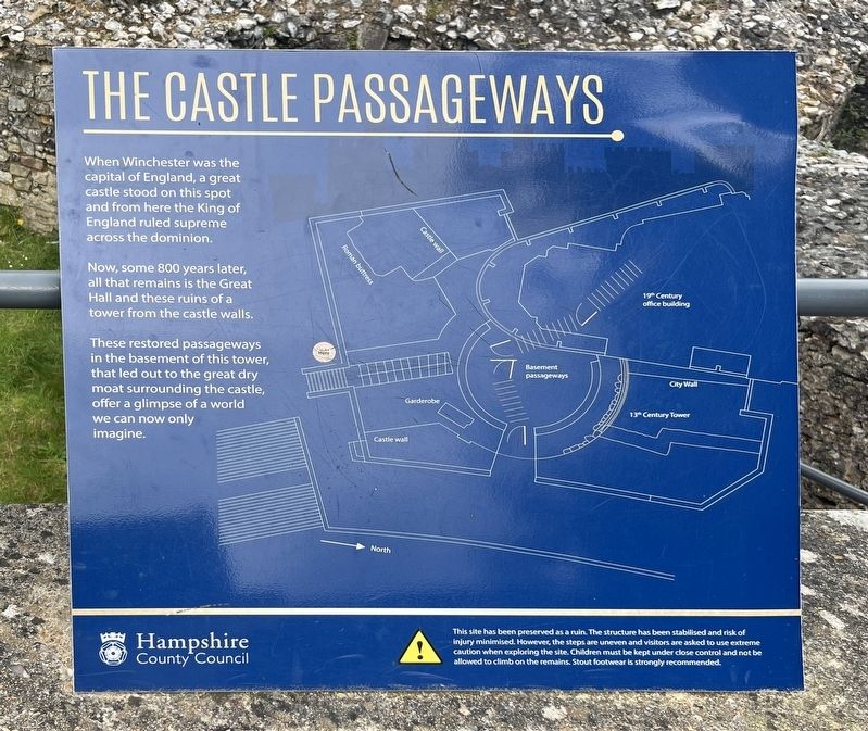
The Castle Passageways
Photographed by Ray Gurganus, April 2, 2024
1. The Castle Passageways Marker
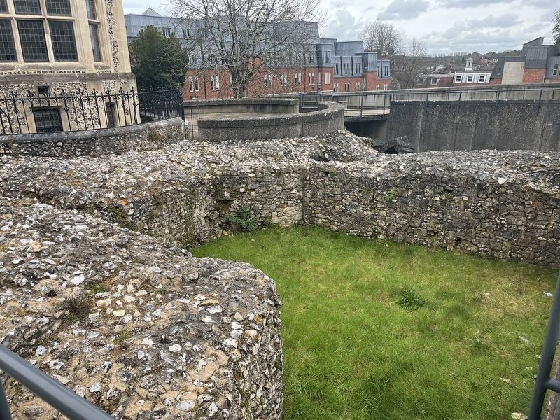
Now, some 800 years later, all that remains is the Great Hall and these ruins of a tower from the castle walls.
These restored passageways in the basement of this tower, that led out to the great dry moat surrounding the castle, offer a glimpse of a world we can now only imagine.
Erected by Hampshire County Council.
Topics. This historical marker is listed in this topic list: Forts and Castles.
Location. 51° 3.78′ N, 1° 19.173′ W. Marker is in Winchester, England, in Hampshire. It can be reached from High Street. In the courtyard between the Great Hall and the castle ruins. Touch for map. Marker is in this post office area: Winchester, England SO23 8UH, United Kingdom. Touch for directions.

Regionally, this marker is in the Greater South East. Globally, it is on the Atlantic Ocean, in the North Atlantic Region, in Europe, in Atlantic Europe, on one of the British Isles, in the Western World, and in the
this page online
Other nearby markers. At least 8 other markers are within walking distance of this marker: Queen Eleanor's Garden (within shouting distance of this marker); Wall of King's House (within shouting distance of this marker); South African War 1899 - 1902 (approx. 0.2 kilometers away); Winchester Guildhall (approx. 0.3 kilometers away); Godbegot (approx. 0.3 kilometers away); William The Conqueror's Palace (approx. 0.3 kilometers away); City Cross (Butter Cross) (approx. 0.3 kilometers away); Lady Lisle (approx. 0.4 kilometers away). Touch for a list and map of all markers in Winchester.
Photographed by Ray Gurganus, April 2, 2024
2. The Castle Ruins
Credits. This page was last revised on July 13, 2024. It was originally submitted on July 11, 2024, by Ray Gurganus of Washington, District of Columbia. This page has been viewed 473 times since then and 62 times this year. Photos: 1, 2. submitted on July 11, 2024, by Ray Gurganus of Washington, District of Columbia. • Andrew Ruppenstein was the editor who published this page.
Editor’s want-list for this marker. photo of the marker within its surroundings • Can you help?
