Natchez in Natchitoches Parish, Louisiana — The American South (West South Central)
Rivers, Rails and Roads
Photographed by Cajun Scrambler, July 5, 2024
1. Rivers, Rails and Roads Marker
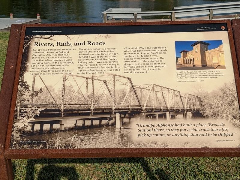
The region did not see railway service until the Natchitoches Railroad was established in 1887. By 1898 it was operating as the Natchitoches & Red River Valley Railway, which was incorporated into the Texas & Pacific Railway in 1900. The Brevelle Station, built by Alphonse Prud'homme, was a stop on the line until 1914.
After World War I, the automobile, which had been introduced as early as 1910 when Phanor Prud'homme purchased his Model T Ford, became more commonplace. The introduction of the automobile along with the completion of the Bermuda Bridge allowed people to visit neighbors, family, and to attend social events.
Photo Captions
1927 the Texas & Pacific Railway constructed depot in Natchitoches to service its spur to the city This depot serves as a visitor center and headquarters for Cane River Creole National Historical Park
"Grandpa
this page online
Erected by National Park Service, Department of the Interior, Cane River Creole National Historical Park.
Topics. This historical marker is listed in these topic lists: Bridges & Viaducts • Railroads & Streetcars.
Location. 31° 39.776′ N, 93° 0.059′ W. Marker is in Natchez, Louisiana, in Natchitoches Parish. It is on Louisiana 119. Touch for map. Marker is at or near this postal address: 1401 LA-119, Natchez LA 71456, United States of America. Touch for directions.

Regionally, this marker is in Central Louisiana. It is also in the American South, specifically in the Deep South, and in the Piney Woods. Globally, it is in North America, a Gulf of Mexico state, the Western Hemisphere, the Western World, and the Anglosphere. Historically, it finds itself in what was once New Spain, the Viceroyalty of New France, the territory of the Mississippian Culture, the Louisiana Purchase, one of the Confederate
Photographed by Cajun Scrambler, July 5, 2024
2. Rivers, Rails and Roads Marker
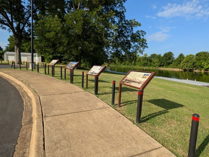
Other nearby markers. At least 8 other markers are within walking distance of this marker: The Battle of Bermuda Bridge (here, next to this marker); Plantation to Recreation (here, next to this marker); Plantation to Park (here, next to this marker); Building Bermuda Bridge (a few steps from this marker); Quarters Community (about 800 feet away, measured in a direct line); Escaped! Freedom Seekers in 1863-1864 (about 800 feet away); The Helaire Family of Oakland / The Shields Family of Oakland (about 800 feet away); Jujube Trees (about 800 feet away). Touch for a list and map of all markers in Natchez.
More about this marker. Located at the Shell Beach Ramp
Credits. This page was last revised on July 12, 2024. It was originally submitted on July 11, 2024, by Cajun Scrambler of Assumption, Louisiana. This page has been viewed 217 times since then and 14 times this year. Photos: 1, 2. submitted on July 11, 2024, by Cajun Scrambler of Assumption, Louisiana.
