Bury St Edmunds in Suffolk, England, United Kingdom — Northwestern Europe (the British Isles)
The Eastern End
Photographed by Ray Gurganus, March 27, 2024
1. The Eastern End Marker
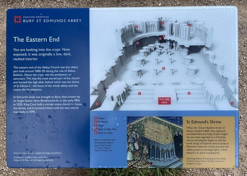
This eastern end of the Abbey Church was the oldest part built around 1080-95 during the rule of Abbot Baldwin. Above the crypt was the presbytery or sanctuary. This was the most sacred part of the church and housed the high altar, behind which was the shrine of St Edmund-the focus of the whole abbey and the reason for its existence.
St Edmund's body was brought to Bury, then known by its Anglo-Saxon name Beodricsworth, in the early 900s. In 1020, King Cnut built a circular stone church to house the shrine, and it remained there until the new church was ready in 1095.
1. Chapel
2. Presbytery
3. Crypt
4. Steps to High Altar
5. Stairs to Crypt
St Edmund's Shrine
When the 'Great Heathen Army' of Danes invaded in 869, they captured and killed Edmund, King of East Anglia. He was soon regarded as a Christian martyr and pilgrims began to visit his tomb. Kings of England came to pray at Edmund's elaborate shrine and gave the abbey property and legal rights, which helped it to grow in popularity.
Erected by English
this page online
Topics. This historical marker is listed in this topic list: Religion & Religious Structures. A significant historical year for this entry is 1080 CE.
Location. 52° 14.636′ N, 0° 43.193′ E. Marker is in Bury St Edmunds, England, in Suffolk. It can be reached from Abbeygate Street. Touch for map. Marker is in this post office area: Bury St Edmunds, England IP33 1YA, United Kingdom. Touch for directions.

Regionally, this marker is in East Anglia. Globally, it is on the Atlantic Ocean, in the North Atlantic Region, in Europe, in Atlantic Europe, on one of the British Isles, in the Western World, and in the Anglosphere. Historically, it finds itself in what was once the Roman Empire.
Other nearby markers. At least 8 other markers are within walking distance of this marker: The Magna Carta (here, next to this marker); Cnut's Church and its Successor (within shouting distance of this marker); The Heart of the Church (within shouting distance of this marker); The Chapter House (within shouting distance of this marker); St Edmunds Abbey (about 90 meters away, measured in a direct line); The Cloister (about 90 meters away);
Photographed by Ray Gurganus, March 27, 2024
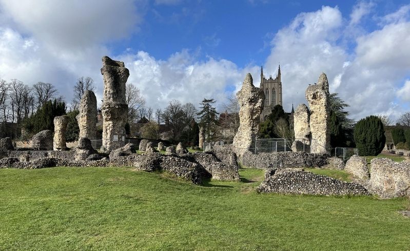
2. Bury St Edmunds Abbey Ruins
Credits. This page was last revised on July 21, 2024. It was originally submitted on July 12, 2024, by Ray Gurganus of Washington, District of Columbia. This page has been viewed 115 times since then and 12 times this year. Photos: 1, 2. submitted on July 12, 2024, by Ray Gurganus of Washington, District of Columbia. • Andrew Ruppenstein was the editor who published this page.
Editor’s want-list for this marker. photo of the marker within its surroundings • Can you help?
