Bury St Edmunds in Suffolk, England, United Kingdom — Northwestern Europe (the British Isles)
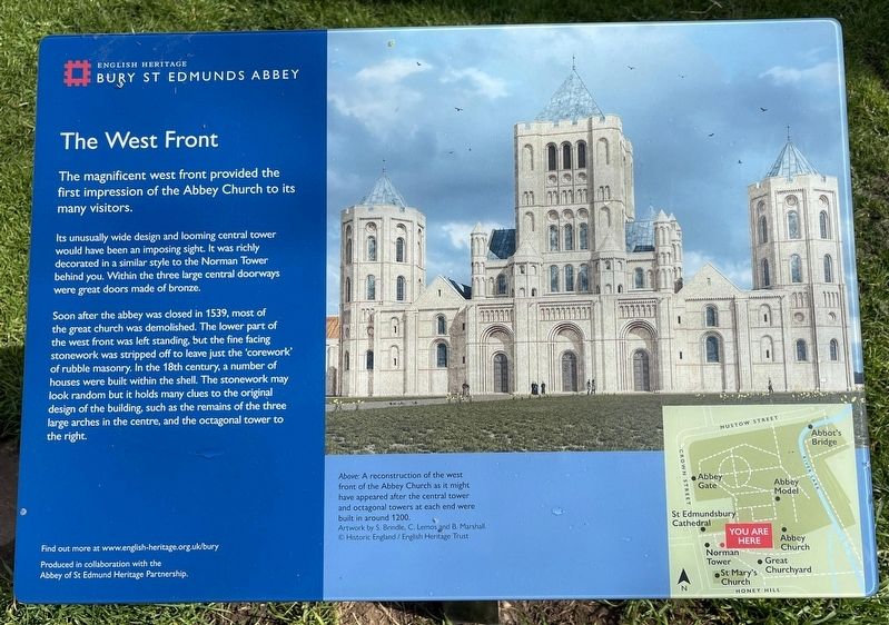
The West Front
Photographed by Ray Gurganus, March 27, 2024
1. The West Front Marker
Its unusually wide design and looming central tower would have been an imposing sight. It was richly decorated in a similar style to the Norman Tower behind you. Within the three large central doorways were great doors made of bronze.
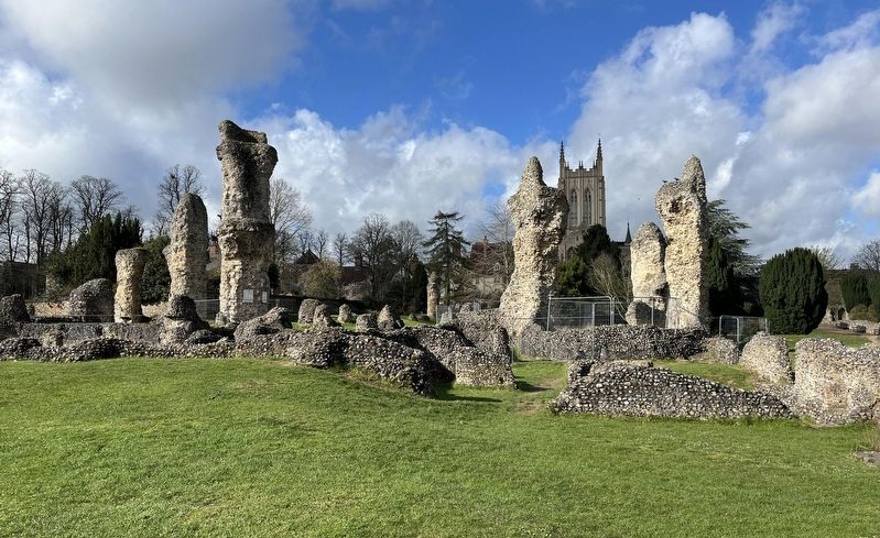
Soon after the abbey was closed in 1539, most of the great church was demolished. The lower part of the west front was left standing, but the fine facing stonework was stripped off to leave just the 'corework' of rubble masonry. In the 18th century, a number of houses were built within the shell. The stonework may look random but it holds many clues to the original design of the building, such as the remains of the three large arches in the centre, and the octagonal tower to the right.
Erected by English Heritage.
Topics. This historical marker is listed in these topic lists: Architecture • Religion & Religious Structures.
Location. 52° 14.61′ N, 0° 43.028′ E. Marker is in Bury St Edmunds, England, in Suffolk. It can be reached
this page online

Regionally, this marker is in East Anglia. Globally, it is on the Atlantic Ocean, in the North Atlantic Region, in Europe, in Atlantic Europe, on one of the British Isles, in the Western World, and in the Anglosphere. Historically, it finds itself in what was once the Roman Empire.
Other nearby markers. At least 8 other markers are within walking distance of this marker: Lewis Nockalls Cottingham (a few steps from this marker); The Church Gate (within shouting distance of this marker); Captain Bartholomew Gosnold (within shouting distance of this marker); The Cloister (about 90 meters away, measured in a direct line); The Chapter House (about 150 meters away); Charles Dickens (about 150 meters away); The Heart of the Church (about 150 meters away); The Abbey of St Edmund (about 150 meters away). Touch for a list and map of all markers in Bury St Edmunds.
Photographed by Ray Gurganus, March 27, 2024
2. Bury St Edmunds Abbey Ruins
Credits. This page was last revised on July 15, 2024. It was originally submitted on July 12, 2024, by Ray Gurganus of Washington, District of Columbia. This page has been viewed 103 times since then and 12 times this year. Photos: 1, 2. submitted on July 12, 2024, by Ray Gurganus of Washington, District of Columbia. • Andrew Ruppenstein was the editor who published this page.
