Natchez in Natchitoches Parish, Louisiana — The American South (West South Central)
Building Bermuda Bridge
Photographed by Cajun Scrambler, July 5, 2024
1. Building Bermuda Bridge Marker
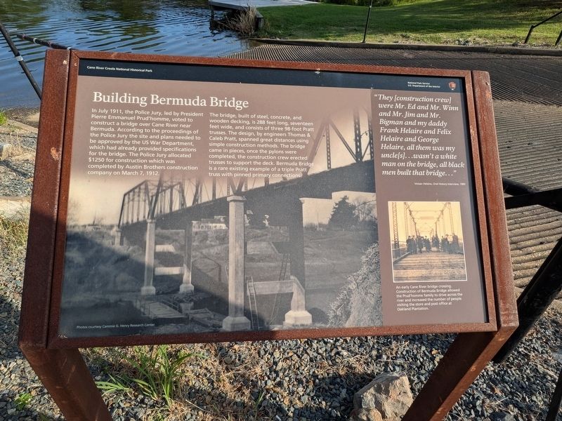
In July 1911, the Police Jury, led by President Pierre Emmanuel Prud'homme, voted to construct a bridge over Cane River near Bermuda. According to the proceedings of the Police Jury the site and plans needed to be approved by the US War Department, which had already provided specifications for the bridge. The Police Jury allocated $1250 for construction which was completed by Austin Brothers construction company on March 7, 1912.
The bridge, built of steel, concrete, and wooden decking, is 288 feet long, seventeen feet wide, and consists of three 98-foot Pratt trusses. The design, by engineers Thomas & Caleb Pratt, spanned great distances using simple construction methods. The bridge came in pieces, once the pylons were completed, the construction crew erected trusses to support the deck. Bermuda Bridge is a rare existing example of a triple Pratt, truss with pinned primary connections.
Inset Captions
"They [construction crew] were Mr. Ed and Mr. Winn and Mr. Jim and Mr. Bigman and my daddy Frank Helaire and Felix Helaire and George Helaire, all them was my uncle[s]...wasn't a white man on the bridge, all black men built that bridge..."
An Early Cane River bridge crossing. Construction of Bermuda Bridge allowed the Prud'homme family to drive across the river and increased the number of people visiting the store and post office at Oakland Plantation.
Erected by National
this page online
Topics. This historical marker is listed in this topic list: Bridges & Viaducts. A significant historical date for this entry is March 7, 1912.
Location. 31° 39.781′ N, 93° 0.06′ W. Marker is in Natchez, Louisiana, in Natchitoches Parish. It is on Louisiana 119. Touch for map. Marker is at or near this postal address: 1401 LA-119, Natchez LA 71456, United States of America. Touch for directions.

Regionally, this marker is in Central Louisiana. It is also in the American South, specifically in the Deep South, and in the Piney Woods. Globally, it is in North America, a Gulf of Mexico state, the Western Hemisphere, the Western World, and the Anglosphere. Historically, it finds itself in what was once New Spain, the Viceroyalty of New France, the territory of the Mississippian Culture, the Louisiana Purchase, one of the Confederate States of America, and the Antebellum South.
Other nearby markers. At least 8 other markers are within walking distance of this marker: The Battle of Bermuda Bridge (here, next to this marker); Rivers, Rails and Roads
Photographed by Cajun Scrambler, July 5, 2024
2. Building Bermuda Bridge Marker
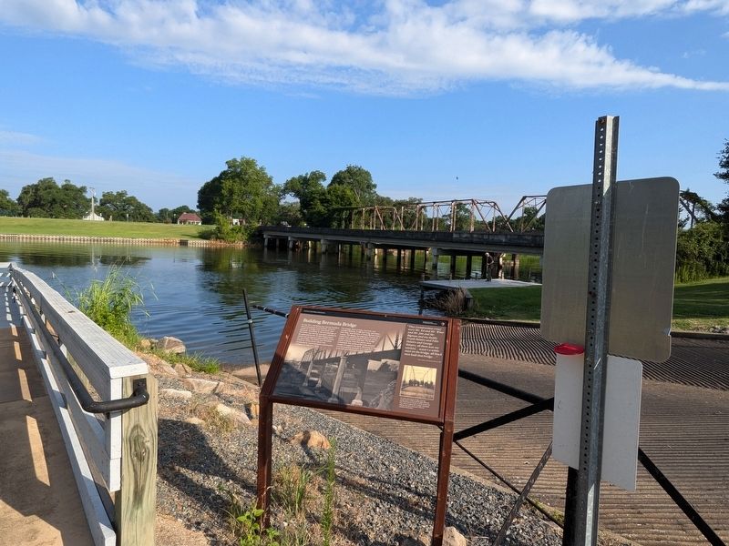
More about this marker. Located at the Shell Beach Boat Ramp
Credits. This page was last revised on July 12, 2024. It was originally submitted on July 12, 2024, by Cajun Scrambler of Assumption, Louisiana. This page has been viewed 291 times since then and 38 times this year. Photos: 1, 2. submitted on July 12, 2024, by Cajun Scrambler of Assumption, Louisiana.
