
Old Colorado City in Colorado Springs in El Paso County, Colorado — The American Mountains (Southwest)
The Original Colorado City
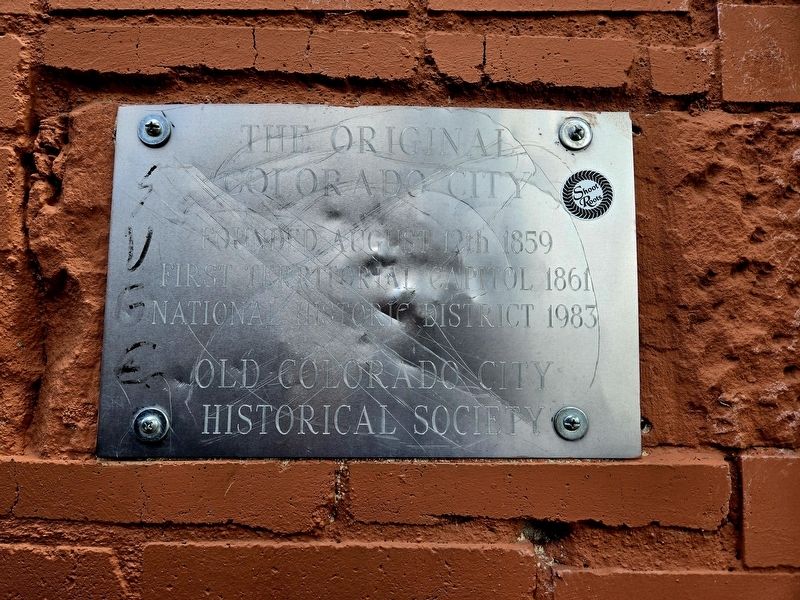
Photographed by Mark Parker, July 3, 2024
1. The Original Colorado City Marker
Founded August 12th, 1859
First Territorial Capitol 1861
National Historic District 1983
Erected by Old Colorado City Historical Society.
Topics. This historical marker is listed in this topic list: Settlements & Settlers. A significant historical date for this entry is December 8, 1859.
Location. 38° 50.863′ N, 104° 51.793′ W. Marker is in Colorado Springs, Colorado, in El Paso County. It is in Old Colorado City. It can be reached from West Colorado Avenue just north of South 25th Street, on the right when traveling north. Business location is Mountain Man Nut & Fruit Co. Touch for map. Marker is at or near this postal address: 2514 West Colorado Avenue, Colorado Springs CO 80904, United States of America. Touch for directions.

Regionally, this marker is in Colorado’s Front Range and in Pikes Peak Region. It is also in the American Mountain West. Globally, it is in North America, the Rocky Mountains, the Western Hemisphere, the Western World, and the Anglosphere. Historically, it finds itself in what was once the Comanchería.
Other nearby markers. At least 8 other markers are within walking distance of this
this page online
More about this marker. Marker is at "Brent's Path", an alley that leads from West Colorado Avenue to public parking behind the buildings. It is on the north facing brick wall of Mountain Man Nut & Fruit Co.

Photographed by Mark Parker, July 3, 2024
2. The Original Colorado City Marker
Location just past the entrance to Brent's Path on the right. The alley is on the north side of West Colorado Avenue between Stella and Beau's and Mountain Man Nut & Fruit Co.
Credits. This page was last revised on July 14, 2024. It was originally submitted on July 12, 2024, by Mark Parker of Hickory, North Carolina. This page has been viewed 161 times since then and 15 times this year. Photos: 1, 2. submitted on July 12, 2024, by Mark Parker of Hickory, North Carolina. • Andrew Ruppenstein was the editor who published this page.
