
Old Colorado City in Colorado Springs in El Paso County, Colorado — The American Mountains (Southwest)
Colorado City, First Territorial Capital
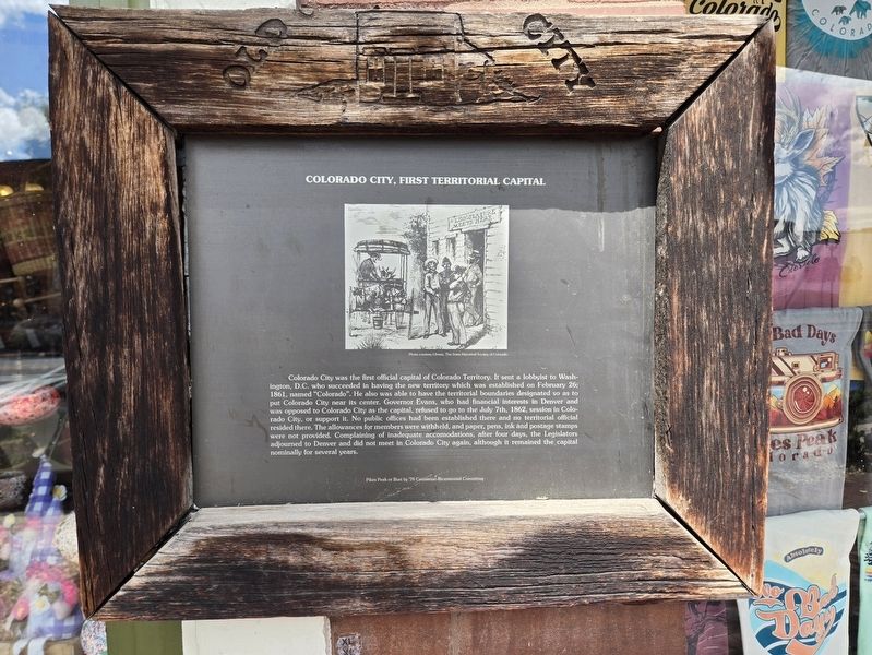
Photographed by Mark Parker, July 3, 2024
1. Colorado City, First Territorial Capital Marker
(photo caption)
Photo courtesy Library, the State Historical Society of Colorado
Erected by Pikes Peak or Bust, '76 Centennial-Bicentennial Committee.
Topics. This historical marker is listed in these topic lists: Government & Politics
this page online
Location. 38° 50.879′ N, 104° 51.819′ W. Marker is in Colorado Springs, Colorado, in El Paso County. It is in Old Colorado City. It is on West Colorado Avenue south of South 26th Street, on the right when traveling north. Marker is at Colorado Tees and Olive Tree Traders. Touch for map. Marker is at or near this postal address: 2524 West Colorado Avenue, Colorado Springs CO 80904, United States of America. Touch for directions.

Regionally, this marker is in Colorado’s Front Range and in Pikes Peak Region. It is also in the American Mountain West. Globally, it is in North America, the Rocky Mountains, the Western Hemisphere, the Western World, and the Anglosphere. Historically, it finds itself in what was once the Comanchería.
Other nearby markers. At least 8 other markers are within walking distance of this marker: The Original Colorado City (within shouting distance of this marker); Templeton Block (about 300 feet away, measured in a direct line); Log House (about 700 feet away); Carnegie Library (about 700 feet away); Birth of a Town (about

Photographed by Mark Parker, July 3, 2024
2. Colorado City, First Territorial Capital Marker
Credits. This page was last revised on July 14, 2024. It was originally submitted on July 12, 2024, by Mark Parker of Hickory, North Carolina. This page has been viewed 293 times since then and 40 times this year. Photos: 1. submitted on July 12, 2024, by Mark Parker of Hickory, North Carolina. 2. submitted on July 13, 2024, by Mark Parker of Hickory, North Carolina. • Andrew Ruppenstein was the editor who published this page.
