Brownwood in Brown County, Texas — The American South (West South Central)
Camp Bowie Parade Ground Flagpole
Photographed by James Hulse, May 30, 2024
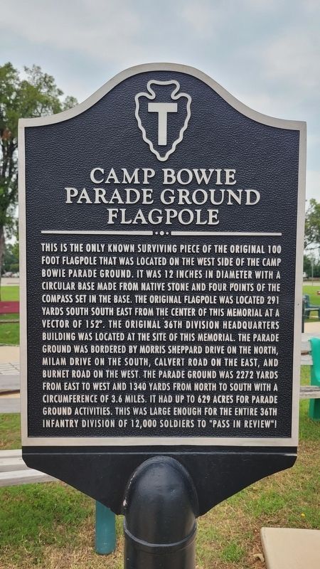
1. Camp Bowie Parade Ground Flagpole Marker
Inscription.
Camp Bowie Parade Ground Flagpole. . This is the only known surviving piece of the original 100 foot flagpole that was located on the west side of the Camp Bowie Parade Ground. It was 12 inches in diameter with a circular base made from native stone and four points of the compass set in the base. The original flagpole was located 291 yards south south east from the center of this memorial at a vector of 152°. The original 36th Division Headquarters building was located at the site of this memorial. The parade ground was bordered by Morris Sheppard Drive on the north, Milam Drive on the south, Calvert Road on the east, and Burnet Road on the west. The parade ground was 2272 yards from east to west and 1340 yards from north to south with a circumference of 3.6 miles. It had up to 629 acres for parade ground activities. This was large enough for the entire 36th Infantry Division of 12,000 soldiers to "Pass in review"!
This is the only known surviving piece of the original 100 foot flagpole that was located on the west side of the Camp Bowie Parade Ground. It was 12 inches in diameter with a circular base made from native stone and four points of the compass set in the base. The original flagpole was located 291 yards south south east from the center of this memorial at a vector of 152°. The original 36th Division Headquarters building was located at the site of this memorial. The parade ground was bordered by Morris Sheppard Drive on the north, Milam Drive on the south, Calvert Road on the east, and Burnet Road on the west. The parade ground was 2272 yards from east to west and 1340 yards from north to south with a circumference of 3.6 miles. It had up to 629 acres for parade ground activities. This was large enough for the entire 36th Infantry Division of 12,000 soldiers to "Pass in review"!
Topics. This memorial is listed in this topic list: Military. A significant day of the year for for this entry is May 31.
Location. 31° 40.675′ N, 98° 59.496′ W. Memorial is in Brownwood, Texas, in Brown County. It is at the intersection of Crockett Drive and Memorial Park Drive, on the right when traveling north on Crockett Drive. The marker is located at the northwest section of the Camp Bowie Memorial Park. Touch for map. Memorial is at or near this postal address: 2710 Crockett Dr, Brownwood TX 76801, United States of America. Touch for directions.

Regionally, this memorial is in Big Country. Globally, it is in North America, a Gulf of Mexico state, the Western Hemisphere, the Western World, and the Anglosphere. Historically, it finds itself in what was once New Spain, the Comancherνa, the Republic of Texas, and one of the Confederate States of America.
Other nearby markers. At least 8 other markers are within walking distance
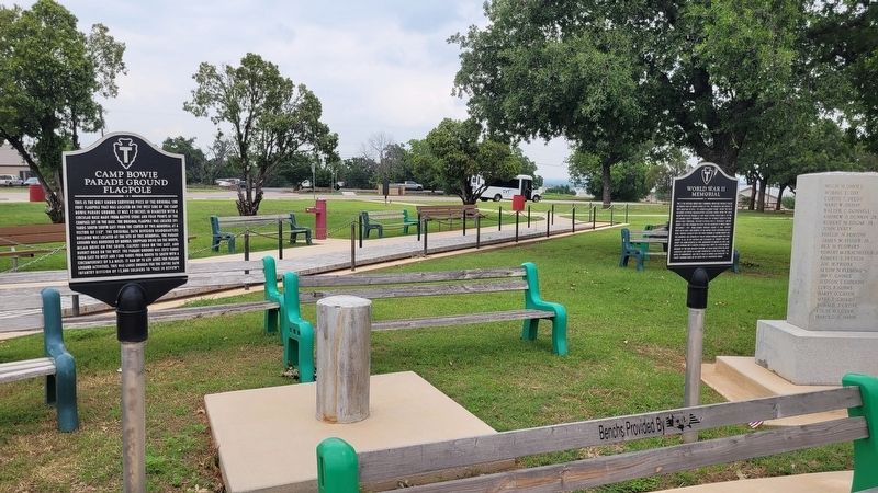
2. Small section of the Camp Bowie Parade Ground Flagpole and Marker (left side)
Credits. This page was last revised on July 13, 2024. It was originally submitted on July 13, 2024, by James Hulse of Medina, Texas. This page has been viewed 177 times since then and 15 times this year. Photos:1, 2. submitted on July 13, 2024, by James Hulse of Medina, Texas.