Brownstown Township in Jackson County, Indiana — The American Midwest (Great Lakes)
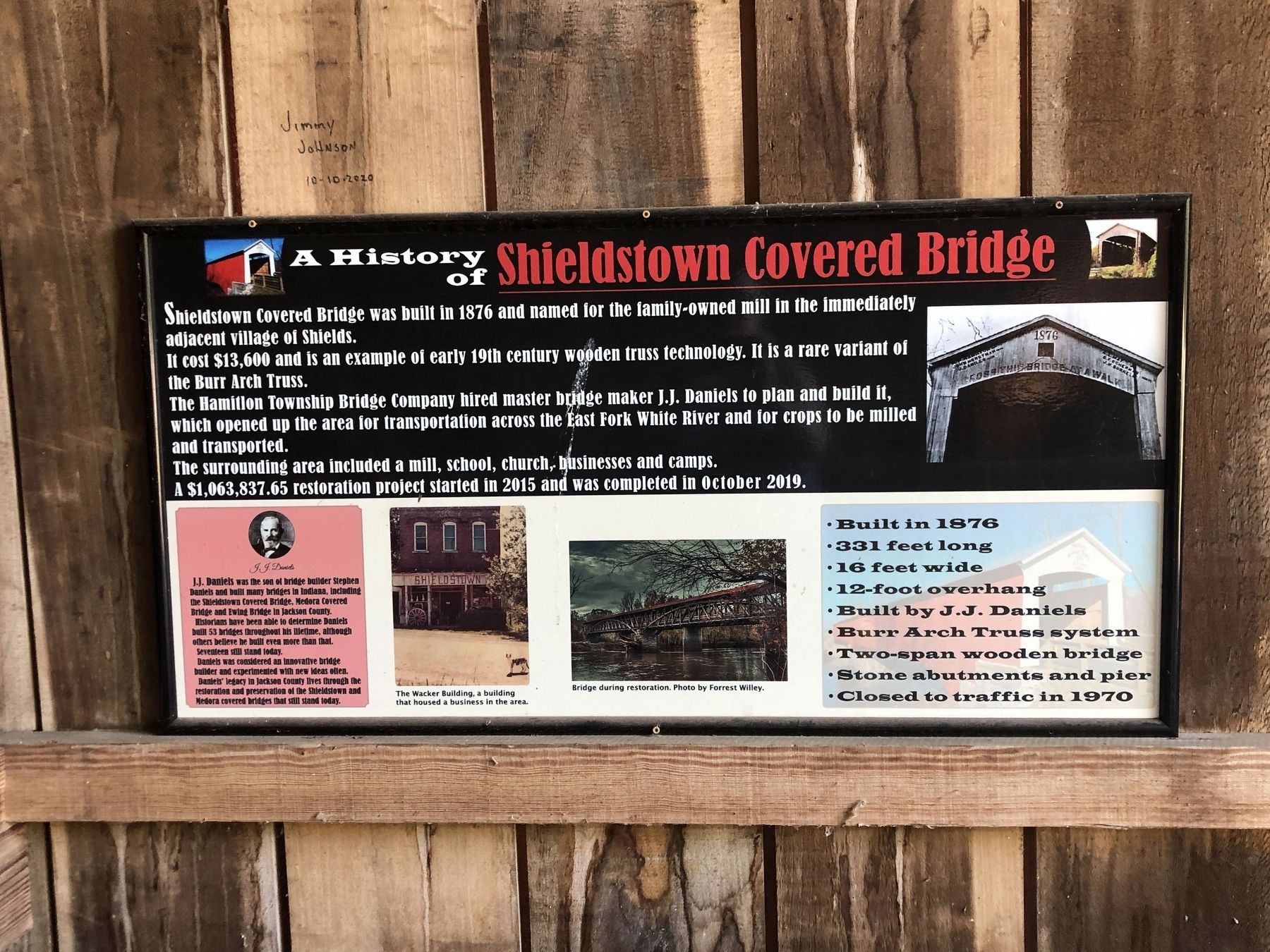
A History of Shieldstown Covered Bridge
Photographed by Duane and Tracy Marsteller, June 16, 2024
1. A History of Shieldstown Covered Bridge Marker
It cost $13,600 and is an example of early 19th century wooden truss technology. It is a rare variant of the Burr Arch Truss.
The Hamilton Township Bridge Company hired master bridge maker J.J. Daniels to plan and build it, which opened up the area for transportation across the East Fork White River and for crops to be milled and transported.
The surrounding area included a mill, school, church, businesses and camps.
A $1,063,837.65 restoration project started in 2015 and was completed in October 2019.
[Box, lower left corner] J.J. Daniels was the son of bridge builder Stephen Daniels and built many bridges in Indiana, including the Shieldstown Covered Bridge, Medora Covered Bridge and Ewing Bridge in Jackson County. Historians have been able to determine Daniels built 53 bridges throughout his lifetime, although others believe he built even more than that. Seventeen still stand today. Daniels was considered an innovative bridge builder and experimented with new ideas often. Daniels'
this page online
[At a glance box, lower right corner]
• Built in 1876
• 331 feet long
• 16 feet wide
• 12-foot overhang
• Built by J.J. Daniels
• Burr Arch Truss system
• Two-span wooden bridge
• Stone abutments and pier
• Closed to traffic in 1970
[Captions]
• The Wacker Building, a building that housed a business in the area.
• Bridge during restoration. Photo by Forrest Willey.
Topics and series. This historical marker is listed in this topic list: Bridges & Viaducts. In addition, it is included in the National Register of Historic Places (NRHP) series list. A significant historical year for this entry is 1876.
Location. 38° 54.892′ N, 86° 0.131′ W. Marker is near Brownstown, Indiana, in Jackson County. It is in Brownstown Township. It is on East County Road 200 North 0.9 miles west of U.S. 50, on the right when traveling west. Touch for map. Marker is at or near this postal address: 1917 E County Rd 200 N, Seymour IN 47274, United States of America. Touch for directions.

Regionally, this marker

Photographed by Duane and Tracy Marsteller, June 16, 2024
2. A History of Shieldstown Covered Bridge Marker
Other nearby markers. At least 8 other markers are within 5 miles of this marker, measured as the crow flies: Shieldstown Bridge (within shouting distance of this marker); Sons Of The American Revolution Memorial (approx. 3.2 miles away); The Freedom Tree (approx. 3.3 miles away); Jackson County W.W. I Veterans Memorial (approx. 3.3 miles away); All Veterans Honor Roll Memorial (approx. 3.3 miles away); In Memory of Col. John Ketcham / Time Capsule (approx. 3.3 miles away); 10 O'Clock Indian Treaty Line (approx. 4.2 miles away); Indian Treaty Corner (approx. 4.2 miles away). Touch for a list and map of all markers in Brownstown.
Also see . . . Shields' Mill Covered Bridge (PDF). National Register of Historic Places nomination for the bridge, which was listed in 2019. (Prepared by Fleeta Arthur; via Indiana State Historic Architectural and Archaeological Research Database)

Photographed by Duane and Tracy Marsteller, June 16, 2024
3. The Shieldstown Covered Bridge
Credits. This page was last revised on July 13, 2024. It was originally submitted on July 13, 2024, by Duane and Tracy Marsteller of Murfreesboro, Tennessee. This page has been viewed 641 times since then and 93 times this year. Photos: 1, 2, 3. submitted on July 13, 2024, by Duane and Tracy Marsteller of Murfreesboro, Tennessee.
