College Hill in Providence in Providence County, Rhode Island — The American Northeast (New England)
Who Built John Brown's House?
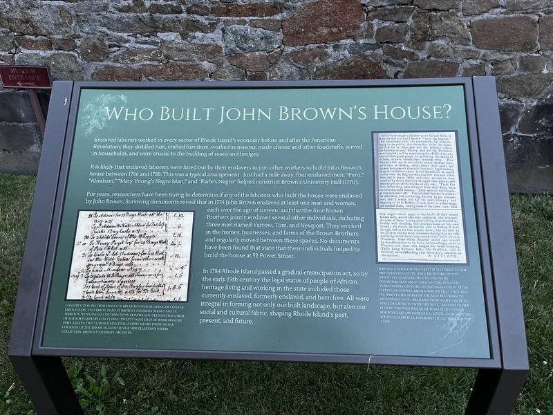
Enslaved laborers worked in every sector of Rhode Island's economy before and after the American Revolution: they distilled rum, crafted furniture, worked as masons, made cheese and other foodstuffs, served in households, and were crucial to the building of roads and bridges.
It is likely that enslaved laborers were hired out by their enslavers to join other workers to build John Brown's house between 1786 and 1788. This was a typical arrangement. Just half a mile away, four enslaved men, "Pero," "Abraham," "Mary Young's Negro Man," and "Earle's Negro" helped construct Brown's University Hall (1770).
For years, researchers have been trying to determine if any of the laborers who built the house were enslaved by John Brown. Surviving documents reveal that in 1774 John Brown enslaved at least one man and woman, each over the age of sixteen, and that the four Brown Brothers jointly enslaved several other individuals, including three men named Yarrow, Tom, and Newport. They worked in the homes, businesses, and farms of the Brown Brothers and regularly moved between these spaces. No documents have been found that state
this page online
In 1784 Rhode Island passed a gradual emancipation act, so by the early 19th century the legal status of people of African heritage living and working in the state included those currently enslaved, formerly enslaved, and born free. All were integral to forming not only our built landscape, but also our social and cultural fabric, shaping Rhode Island's past, present and future.
[Captions:]
Construction records from 1770 related to the building of College Edifice (now University Hall) at Brown University show that in addition to financial contributions, donors also pledged the labor of their bondspeople including twenty-nine days of work done by Pero, a sixty-two year old man enslaved by Henry Paget. Image courtesy of the Rhode Island College Miscellaneous Papers Collection, Brown University Archives.
Writing under the pseudonym "A Citizen" in the Providence Gazette, John Brown recounts when five enslaved men living in his household ran away around 1786, the same year construction began on his mansion. After fleeing to Boston, Brown writes that they fell on hard times. Three of the men returned to Providence, one—believed to be Amboy Brown—stayed in Boston "with his wife," and the other fled to Virginia where he was later hanged for burglary. Providence Gazette and Country Journal, March 14, 1789. RIHS Collections, RHIX17 4720B
Topics.
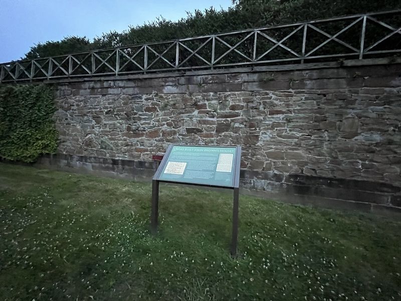
Location. 41° 49.375′ N, 71° 24.193′ W. Marker is in Providence, Rhode Island, in Providence County. It is in College Hill. It is on Power Street just west of Brown Street, on the right when traveling west. Touch for map. Marker is at or near this postal address: 52 Power St, Providence RI 02906, United States of America. Touch for directions.

Regionally, this marker is in Rhode Island’s Blackstone Valley and on Narragansett Bay. It is also in the American Northeast, in New England, and on the Eastern Seaboard. Globally, it is in the North Atlantic Region, North America, the Western Hemisphere, the Western World, and the Anglosphere. Historically, it finds itself in what was once one of the original Thirteen Colonies.
Other nearby markers. At least 8 other markers are within walking distance of this marker: John Brown House (here, next to this marker); The Olmsted Plan (within shouting distance of this marker); The Path Before Us (about 300 feet away,
Photographed by Arthur W. LeBoeuf, circa 1937
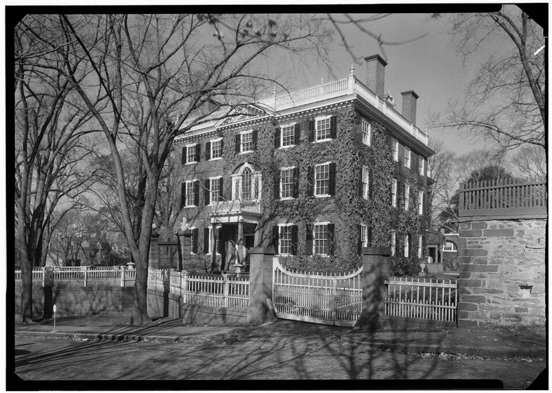
3. John Brown House (1937), image courtesy of the Historic American Buildings Survey
The Historic American Buildings Survey supplemental material for the John Brown House describes it as follows: "Brick with brownstone trim, large square main block plus rear wing, three stories, hipped roof with flat deck, modillion cornice with turned balustrade, Chinese lattice work balustrade on upper deck, five-bay facade with pedimented projecting center bay, Doric entrance porch under Palladian window, central hall plan, one of the most elegantly decorated houses of this period in America. Built 1786-1788; Joseph Brown, architect."
Additional keywords. human trafficking
Credits. This page was last revised on July 14, 2024. It was originally submitted on July 14, 2024, by Devry Becker Jones of Washington, District of Columbia. This page has been viewed 147 times since then and 24 times this year. Photos: 1, 2. submitted on July 14, 2024, by Devry Becker Jones of Washington, District of Columbia. 3. submitted on June 12, 2012.
