College Hill in Providence in Providence County, Rhode Island — The American Northeast (New England)
The Olmsted Plan
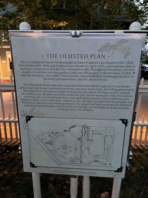
The sons of fame Central Park landscape architect Frederick Law Olmsted (1822-1903), John Charles (1852-1903) and Frederick Law Olmsted Jr. (1870-1951), inherited their fathers landscape architectural firm after his retirement in 1895. Throughout Providence, the firm designed more than sixty-five gardens, with over 200 projects in Rhode Island. In 1902, financier Marsden J. Petry (1850-1935) hired the Olmsted Brothers to redesign the lawn of his newly purchased home, the John Brown House.
The Olmsted Brothers' plan drew inspiration from their father's approach to landscape architecture and design: curvilinear pathways, specimen trees, vistas, and rolling greensward. Their plan for Perry's lawn included the proposed placement of a large sundial, multiple new plants, a circular path around the southwest plot, and the extension of the brownstone retaining wall and colonial-style fence surrounding the property. These additions were meant to create a more naturalistic aesthetic to the cityscape viewable from the property and bring more cohesion to the existing elements. The elegant and lush landscape the Olmsteds created
this page online
Topics. This historical marker is listed in this topic list: Architecture. A significant historical year for this entry is 1895.
Location. 41° 49.385′ N, 71° 24.238′ W. Marker is in Providence, Rhode Island, in Providence County. It is in College Hill. It can be reached from Benefit Street just north of Power Street, on the right when traveling north. Touch for map. Marker is at or near this postal address: 332 Benefit St, Providence RI 02903, United States of America. Touch for directions.

Regionally, this marker is on Narragansett Bay. It is also in the American Northeast, in New England, and on the Eastern Seaboard. Globally, it is in the North Atlantic Region, North America, the Western Hemisphere, the Western World, and the Anglosphere. Historically, it finds itself in what was once one of the original Thirteen Colonies.
Other nearby markers. At least 8 other markers are within walking distance of this marker: The Path Before Us (within shouting distance of this marker); John Brown House (within shouting
Additional keywords. landscape architecture
Credits. This page was last revised on July 14, 2024. It was originally submitted on July 14, 2024, by Devry Becker Jones of Washington, District of Columbia. This page has been viewed 150 times since then and 24 times this year. Photos: 1, 2. submitted on July 14, 2024, by Devry Becker Jones of Washington, District of Columbia.
Editor’s want-list for this marker. Clear, daylight photos of the marker and its context. • Can you help?
