Harvard in Clay County, Nebraska — The American Midwest (Upper Plains)
Midair Collision of B-17 Bombers
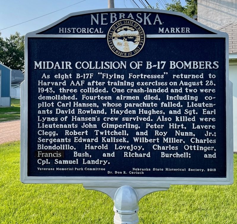
Photographed by Mark Hilton, July 11, 2024
1. Midair Collision of B-17 Bombers Marker
Erected 2013 by Nebraska State Historical Society, Veterans Memorial Park Committee, Dr. Don R. Gerlach. (Marker Number 494.)
Topics and series. This historical marker is listed in these topic lists: Air & Space • War, World II. In addition, it is included in the Nebraska State Historical Society series list. A significant historical date for this entry is August 28, 1943.
Location. 40° 37.131′ N, 98° 5.797′ W. Marker is in Harvard, Nebraska, in Clay County. It is on East Walnut Street east of North Clay Avenue, on the right when traveling
this page online

Regionally, this marker is in the Smoky Hills and in Eastern Nebraska. It is also in the American Midwest, in the Corn Belt, and on the prairies. Globally, it is in North America, the Western Hemisphere, the Western World, and the Anglosphere. Historically, it finds itself in what was once the Louisiana Purchase.
Other nearby markers. At least 8 other markers are within 7 miles of this marker, measured as the crow flies: Harvard Army Air Field (here, next to this marker); Harvard Veterans Memorial (a few steps from this marker); Harvard's 1915 Carnegie Library (about 300 feet away, measured in a direct line); Harvard Jail (about 500 feet away); Woodmen Hall (about 600 feet away); St. John’s Episcopal Church (approx. 0.2 miles away); Harvard (approx. ¼ mile away); Clay Center (approx. 6.8 miles away). Touch for a list and map of all markers in Harvard.

Photographed by Mark Hilton, July 11, 2024
2. Midair Collision of B-17 Bombers Marker on left.
Credits. This page was last revised on July 14, 2024. It was originally submitted on July 14, 2024, by Mark Hilton of Montgomery, Alabama. This page has been viewed 231 times since then and 37 times this year. Photos: 1, 2. submitted on July 14, 2024, by Mark Hilton of Montgomery, Alabama.
