Harvard in Clay County, Nebraska — The American Midwest (Upper Plains)
Harvard's 1915 Carnegie Library
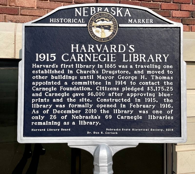
Photographed by Mark Hilton, July 11, 2024
1. Harvard's 1915 Carnegie Library Marker
Erected by Nebraska State Historical Society, Harvard Library Board, Dr. Don R. Gerlach. (Marker Number 507.)
Topics and series. This historical marker is listed in this topic list: Notable Buildings. In addition, it is included in the Carnegie Libraries, and the Nebraska State Historical Society series lists. A significant historical month for this entry is February 1916.
Location. 40° 37.161′ N, 98° 5.841′ W. Marker is in Harvard, Nebraska, in Clay County. It is on North Clay Avenue north of Walnut Street, on the left when traveling north. Touch for map. Marker is in this post office area: Harvard NE 68944, United States of America. Touch for directions.

Regionally,
this page online
Other nearby markers. At least 8 other markers are within 7 miles of this marker, measured as the crow flies: Harvard Veterans Memorial (within shouting distance of this marker); Harvard Army Air Field (about 300 feet away, measured in a direct line); Midair Collision of B-17 Bombers (about 300 feet away); St. John’s Episcopal Church (about 600 feet away); Harvard Jail (about 600 feet away); Woodmen Hall (about 600 feet away); Harvard (approx. 0.3 miles away); Clay Center (approx. 6.9 miles away). Touch for a list and map of all markers in Harvard.
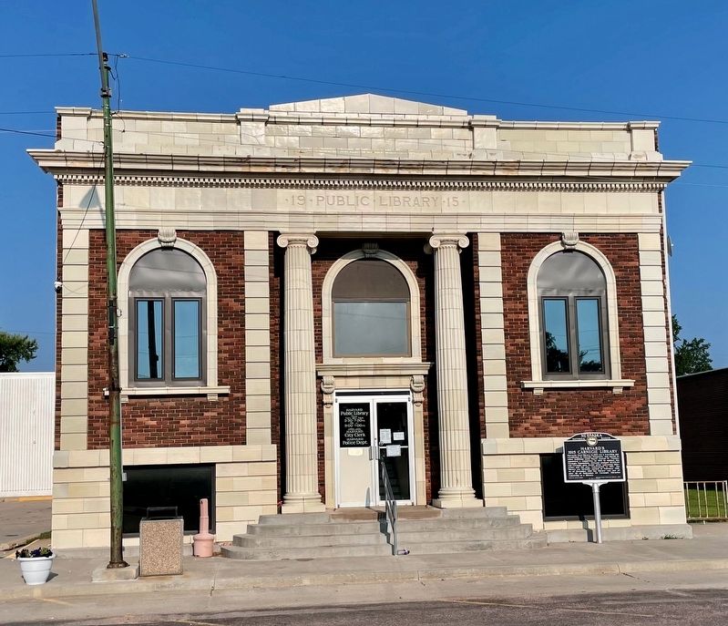
Photographed by Mark Hilton, July 11, 2024
2. Harvard's 1915 Carnegie Library Marker
The building also hosts the City Clerk & Police Dept.
Credits. This page was last revised on July 14, 2024. It was originally submitted on July 14, 2024, by Mark Hilton of Montgomery, Alabama. This page has been viewed 302 times since then and 60 times this year. Photos: 1, 2. submitted on July 14, 2024, by Mark Hilton of Montgomery, Alabama.
