Government Plaza in Springfield in Greene County, Missouri — The American Midwest (Upper Plains)
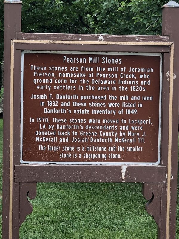
Pearson Mill Stones
Photographed by Duane and Tracy Marsteller, June 29, 2024
1. Pearson Mill Stones Marker
These stones are from the mill of Jeremiah Pierson, namesake of Pearson Creek, who ground corn for the Delaware Indians and early settlers in the area in the 1820s.
Josiah F. Danforth purchased the mill and land in 1832 and these stones were listed in Danforth's estate inventory of 1849.
In 1970, these stones were moved to Lockport, LA by Danforth's descendants and were donated back to Greene County by Mary J. McKerall and Josiah Danforth McKerall III.
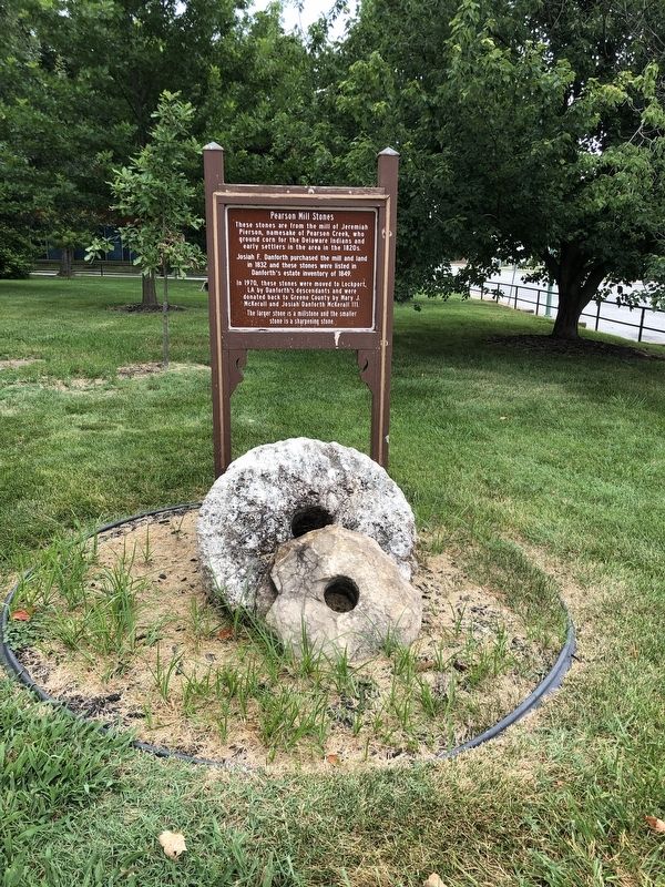
The larger stone is a millstone and the smaller stone is a sharpening stone.
Topics. This historical marker is listed in this topic list: Industry & Commerce. A significant historical year for this entry is 1832.
Location. 37° 13.057′ N, 93° 17.489′ W. Marker is in Springfield, Missouri, in Greene County. It is in Government Plaza. It can be reached from East Central Street near North Robberson Avenue, on the right when traveling west. Marker is on the grounds of the Historic Greene County Courthouse. Touch for map. Marker is at or near this postal address: 1443 N Robberson Ave, Springfield MO 65802, United States of America. Touch for directions.

Regionally, this
this page online
Other nearby markers. At least 8 other markers are within walking distance of this marker: Replica of the Statue of Liberty (a few steps from this marker); Pillars on Public Square (within shouting distance of this marker); Bailey School (approx. 0.2 miles away); Benton Avenue A.M.E. Church (approx. ¼ mile away); Stone Chapel (approx. ¼ mile away); Fairbanks Hall (approx. ¼ mile away); Alberta's Hotel (approx. ¼ mile away); Civil War Entrenchments (approx. 0.3 miles away). Touch for a list and map of all markers in Springfield.
Regarding Pearson Mill Stones. Excerpt from History of Greene County, Missouri (1883), Return Ira Holcombe, Editing Historian:
One of the very first mills in all Southwest Missouri was that built by old Jerry Pearson, somewhere between the years 1828 and 1831. The DelawareIndians were in possession of the county then, and from them Mr. Pearson obtained permission to build his mill. Pearson was from Tennessee. He located near the large spring, which is near the residence of Mrs. Letitia Powell, on section 5. The water from this spring forms Pearson creek, and it was this creek that turned the mill. Some idea may be gained of the volume of water that flows from the old Pearson spring (now called the Powell spring) by this circumstance.Photographed by Duane and Tracy Marsteller, June 29, 20242. Pearson Mill Stones Marker
Pearson also set up a distillery afterwards, along in the '30's somewhere, and this establishment was near the mill; but the first still-house in the township was set up by John Burden, at the Burden spring. The hollow where it was situated is still called “still-house hollow.”
Pearson's mill was an important institution in its day. It ground the corn of the settlers for a radius of several miles. The Campbells, the Fulbrights, the Rountrees, and others from Springfield came here for their grinding, until the little horse-mill was started — which was afterward owned by Judge Hendrick. The capacity of Pearson's mill was not large — perhaps fifty bushels a day, and quite often its patrons remained over night waiting their turns.
Credits. This page was last revised on March 3, 2026. It was originally submitted on July 14, 2024, by Duane and Tracy Marsteller of Murfreesboro, Tennessee. This page has been viewed 1,576 times since then and 176 times this year. Photos: 1, 2. submitted on July 14, 2024, by Duane and Tracy Marsteller of Murfreesboro, Tennessee.
