
Near Rulo in Richardson County, Nebraska — The American Midwest (Upper Plains)
Point of Beginning, Public Land Surveys of the Sixth Principal Meridian
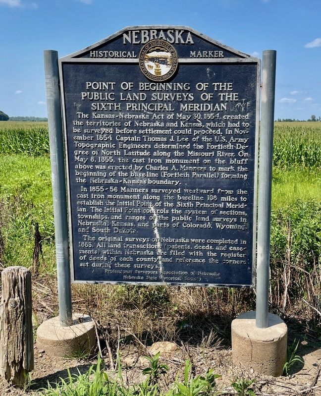
Photographed by Mark Hilton, July 11, 2024
1. Point of Beginning, Public Land Surveys of the Sixth Principal Meridian Marker
The Kansas-Nebraska Act of May 30, 1854 created the territories of Nebraska and Kansas, which had to be surveyed before settlement could proceed. In November 1854, Captain Thomas J. Lee of the U.S. Army Topographic Engineers determined the Fortieth Degree of North Latitude along the Missouri River. On May 8, 1855, the cast iron monument on the bluff above was erected by Charles A. Manners to mark the beginning of the base line (Fortieth Parallel) forming the Nebraska - Kansas boundary.
In 1855-56 Manners surveyed westward from the cast iron monument along the base line 108 miles to establish the Initial Point of the Sixth Principal Meridian. The Initial Point controls the system of section, townships, and ranges of the public land surveys in Nebraska, Kansas, and parts of Colorado, Wyoming, and South Dakota.
The original surveys of Nebraska were completed in 1883. All land transactions (patents, deeds, and easements) within Nebraska are filed with the register of deeds of each county and reference the corners set during these surveys.
Erected by Nebraska State Historical Society, Professional Surveyors Association
this page online
Topics and series. This historical marker is listed in this topic list: Political Subdivisions. In addition, it is included in the Nebraska State Historical Society series list. A significant historical date for this entry is May 30, 1854.
Location. 40° 0.003′ N, 95° 19.872′ W. Marker is near Rulo, Nebraska, in Richardson County. It is on Nebraska Route 7, on the right when traveling north. Located just across the NE/KS state line in Nebraska. Touch for map. Marker is in this post office area: Rulo NE 68431, United States of America. Touch for directions.

Regionally, this marker is in Eastern Nebraska. It is also in the American Midwest, in the Lewis & Clark Corridor, in the Corn Belt, and on the prairies. Globally, it is in North America, the Western Hemisphere, the Western World, and the Anglosphere. Historically, it finds itself in what was once the Louisiana Purchase.
Other nearby markers. At least 8 other markers are within 3 miles of this marker, measured as the crow flies: Our System of Land Surveys (within shouting distance of this marker in Kansas); The Cast Iron Monument (within shouting

Photographed by Mark Hilton, July 11, 2024
2. Point of Beginning, Public Land Surveys of the Sixth Principal Meridian Marker
Looking into Nebraska from Kansas.

Photographed by Mark Hilton, July 11, 2024
3. Point of Beginning, Public Land Surveys of the Sixth Principal Meridian Marker
Looking into Doniphan County, Kansas and the Kansas Glacial Hills Byway.

Photographed by Jason Voigt, October 27, 2025
4. Cast iron monument (mentioned on the marker)
To access the monument, a trailhead is 125 yards north from the marker. The monument can be accessed at the end of a trail from there.
Credits. This page was last revised on November 8, 2025. It was originally submitted on July 15, 2024, by Mark Hilton of Montgomery, Alabama. This page has been viewed 482 times since then and 88 times this year. Photos: 1, 2, 3. submitted on July 15, 2024, by Mark Hilton of Montgomery, Alabama. 4. submitted on November 8, 2025, by Jason Voigt of Glen Carbon, Illinois.
