Newport in Newport County, Rhode Island — The American Northeast (New England)
Townsend Industrial School
55 Broadway
| — | Kay Street-Catherine Street-Old Beach Road Historic District | — |
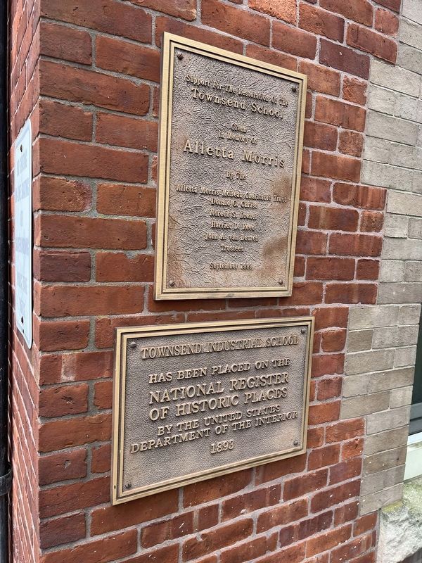
has been placed on the
National Register
of Historic Places
by the United States
Department of the Interior
1893
Topics. This historical marker is listed in these topic lists: Architecture • Education. A significant historical year for this entry is 1893.
Location. 41° 29.518′ N, 71° 18.665′ W. Marker is in Newport, Rhode Island, in Newport County. It is on Broadway. Touch for map. Marker is at or near this postal address: 55 Broadway, Newport RI 02840, United States of America. Touch for directions.

Regionally, this marker is on Rhode Island’s Narragansett Bay and in Newport and Aquidneck Island. It is also in the American Northeast, in New England, and on the Eastern Seaboard. Globally, it is in the North Atlantic Region, North America, the Western Hemisphere, the Western World, and the Anglosphere. Historically, it finds itself in what was once one of the original Thirteen Colonies.
Other nearby markers. At least 8 other markers are within walking distance of this marker: The Vietnam Crisis (within shouting distance of this marker); World War II (within shouting
this page online
Regarding Townsend Industrial School. This building is on the national Register of Historic Places only by virtue of its inclusion in the
Kay Street–Catherine Street–Old Beach Road Historic District:
"Thompson Middle School (1893-94, 2002): A large, L-plan complex with four distinct-but-joined components... Built to serve young people not destined for the more academic program at Rogers High School (located in a now-demolished building next door from 1906 until 1957), the original building here became Thompson Middle School in the mid-20th century."
Also see . . . Kay Street–Catherine Street–Old Beach Road Historic District. Wikipedia entry:
Links to National Register of Historic Places Nomination Form

Credits. This page was last revised on July 17, 2024. It was originally submitted on July 15, 2024, by Devry Becker Jones of Washington, District of Columbia. This page has been viewed 158 times since then and 11 times this year. Photos: 1, 2. submitted on July 15, 2024, by Devry Becker Jones of Washington, District of Columbia.
