Belknap in Louisville in Jefferson County, Kentucky — The American South (East South Central)
Douglass Loop Trolley Turnaround
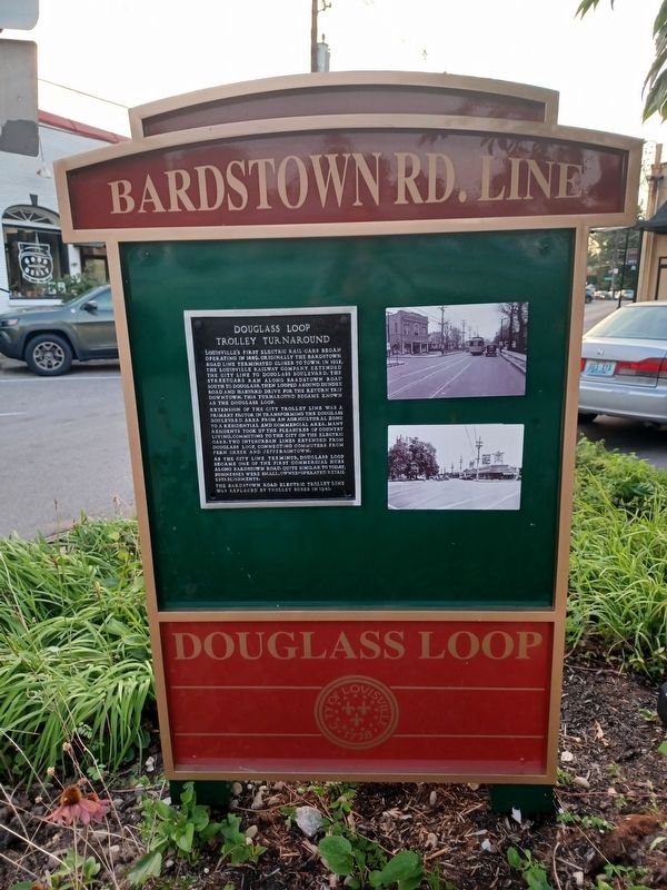
Photographed by Alison G Schureck, July 16, 2024
1. Douglas Loop Trolley Turnaround Marker
Extension of the city trolley line was a primary factor in transforming the Douglass Boulevard area from an agricultural zone to a residential and commercial area. Many residents took up the pleasures of country living, commuting to the city on the electric cars. Two interurban lines extended from Douglass Loop, connecting commuters from Fern Creek and Jeffersontown.
As the city line terminus, Douglass Loop became one of the first commercial hubs along Bardstown Road. Quite similar to today, businesses were small, owner-operated retail establishments.
The Bardstown Road electric trolley line was replaced by trolley buses in 1941.
Erected by City of Louisville.
Topics. This historical marker is listed in
this page online
Location. 38° 13.428′ N, 85° 41.61′ W. Marker is in Louisville, Kentucky, in Jefferson County. It is in Belknap. It is at the intersection of Dundee Road and Harvard Drive, on the left when traveling south on Dundee Road. Right behind Graeter's parking lot on Douglass Loop. Touch for map. Marker is at or near this postal address: 2204 Bardstown Road, Louisville KY 40205, United States of America. Touch for directions.

Regionally, this marker is in the American South, specifically in the Upper South, and in the Ohio River Valley. Globally, it is in North America, the Western Hemisphere, the Western World, and the Anglosphere. Historically, it finds itself in what was once the territory of the Mississippian Culture and also the Antebellum South.
Other nearby markers. At least 8 other markers are within 2 miles of this marker, measured as the crow flies: Humphrey-McMeekin House (approx. half a mile away); Lewis and Clark in Kentucky Trough Spring / Trough Spring (approx. half a mile away); The Commodore (approx. ¾ mile away); Enid Yandell (1869-1934) / Renowned Woman Sculptor

Photographed by Richard Hawkins, July 11, 2025
2. Douglass Loop Trolley Turnaround Marker
Intersection of Harvard and Dundee
Additional keywords. Trolleys, Transportation
Credits. This page was last revised on July 13, 2025. It was originally submitted on July 16, 2024, by Alison G Schureck of Louisville, Kentucky. This page has been viewed 363 times since then and 73 times this year. Photos: 1. submitted on July 16, 2024, by Alison G Schureck of Louisville, Kentucky. 2. submitted on July 11, 2025, by Richard Hawkins of Phelan, California. • James Hulse was the editor who published this page.
