Isenbruch in Selfkant in Heinsberg, North Rhine-Westphalia, Germany — Central Europe
Das Ende des Ersten Weltkrieges errinnert
⎯⎯⎯
The End of the First World War Commemorated
Photographed by Andrew Ruppenstein, July 14, 2024
1. Das Ende des Ersten Weltkrieges errinnert / The End of the First World War Commemorated Marker

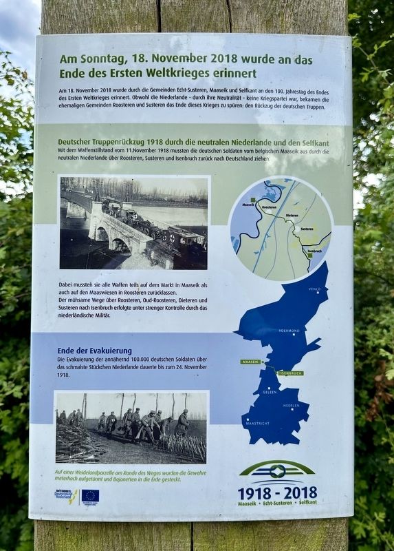
Am Sonntag, 18. November 2018 wurde an das Ende des Ersten Weltkrieges erinnert
Am 18. November 2018 wurde durch die Gemeinden Echt-Susteren, Maaseik und Selfkant an den 100. Jahrestag des Endes des Ersten Weltkrieges erinnert. Obwohl die Niederlande durch ihre Neutralität keine Kriegspartei war, bekamen die ehemaligen Gemeinden Roosteren und Susteren das Ende dieses Krieges zu spüren: den Rückzug der deutschen Truppen.
Deutscher Truppenrückzug 1918 durch die neutralen Niederlande und den Selfkant Mit dem Waffenstillstand vom 11.November 1918 mussten die deutschen Soldaten vom belgischen Maaseik aus durch die neutralen Niederlande über Roosteren, Susteren und Isenbruch zurück nach Deutschland ziehen.
Dabei mussten sie alle Waffen teils auf dem Markt in Maaseik als auch auf den Maaswiesen in Roosteren zurücklassen.
Der mühsame Wege über Roosteren, Oud-Roosteren, Dieteren und Susteren nach Isenbruch erfolgte unter strenger Kontrolle durch das niederländische Militär.
Ende der Evakuierung
Die Evaluierung der annähernd 100.000 deutschen Soldaten über das schmalste Stückchen Niederlande dauerte bis zum 24. November 1918.
On Sunday, November 18, 2018, the end of the First World War was commemorated
On November
this page online
German troop retreat in 1918 through the neutral Netherlands and the Selfkant
With the armistice of November 11, 1918, the German soldiers had to move from Maaseik in Belgium through the neutral Netherlands via Roosteren, Susteren and Isenbruch back to Germany.
They had to leave all their weapons behind, partly on the market in Maaseik and partly on the Maas meadows in Roosteren.
The arduous journey via Roosteren, Oud-Roosteren, Dieteren and Susteren to Isenbruch took place under strict supervision by the Dutch military.
End of the evacuation
The evacuation of the almost 100,000 German soldiers across the narrowest stretch of the Netherlands lasted until November 24, 1918.
Erected 2018.
Topics. This historical marker is listed in these topic lists: Peace • War, World I. A significant historical date for this entry is November 18, 2018.
Location. 51° 3.003′ N, 5° 51.988′ E. Marker is in Selfkant, Nordrhein-Westfalen
Photographed by Andrew Ruppenstein, July 14, 2024
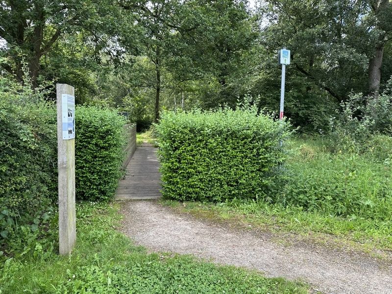
2. The End of the First World War Commemorated Marker - wide view
The marker is located at the east end of a pedestrian/cyclist bridge over the (Rodebach / Rode Beek) creek, i.e., going from Germany (marker side) into the Netherlands. The marker does not indicate where exactly the German Army crossed, although it was almost certainly not more than a few hundred meters from the marker location.

Regionally, this marker is in the German Rhineland. Globally, it is in Europe, the European Union, Atlantic Europe, Central Europe, the Schengen Area, Western Europe, and the Western World. Historically, it finds itself in what was once the Roman Empire, the Holy Roman Empire, and the former West Germany.
Other nearby markers. At least 8 other markers are within 14 kilometers of this marker, measured as the crow flies: Grenze? Was soll‘s! / Border? What the heck! (within shouting distance of this marker); Kazemat / Casemate (approx. 0.6 kilometers away in Netherlands); Susteren World War II Liberation Memorial (approx. 2 kilometers away in Netherlands); Susteren Slachtoffers Tweede Wereldoorlog / Victims of WWII (approx. 2 kilometers away in Netherlands);
Photographed by Andrew Ruppenstein, July 14, 2024
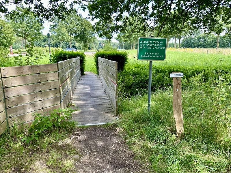
3. The End of the First World War Commemorated Marker - international view
This view is from the other side of the bridge, looking east from Dutch territory into Germany, with the top of the marker barely visible.
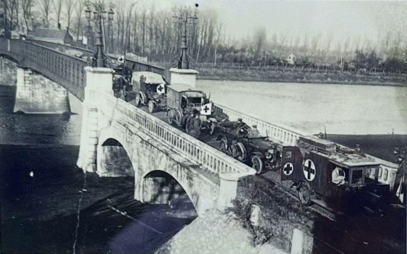
November 1918
4. Marker inset photo: German troops evacuating
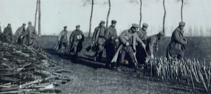
November 1918
5. Marker inset photo: German soldiers abandoning their guns…
and sticking their bayonets into the ground.
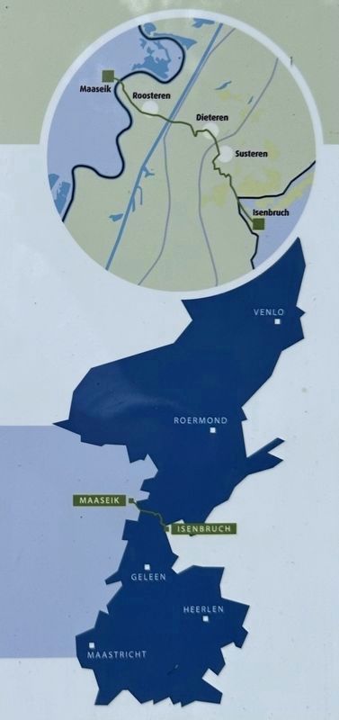
6. Marker inset: Map of the Dutch Province of Limburg showing the evacuation route of the German troops
On the blown-up portion of the map the approximate location of the marker site can be seen, where the green evacuation line crosses the black border line, just west of Isenbruch. The width of the Dutch province of Limburg at that location is about 5 kilometers.
Credits. This page was last revised on July 17, 2024. It was originally submitted on July 17, 2024, by Andrew Ruppenstein of Lamorinda, California. This page has been viewed 119 times since then and 16 times this year. Photos: 1, 2, 3, 4, 5, 6. submitted on July 17, 2024, by Andrew Ruppenstein of Lamorinda, California.
