Madison Township near Carthage in Jasper County, Missouri — The American Midwest (Upper Plains)
Red Oak II, Missoura
Route 66 Roadside Attraction
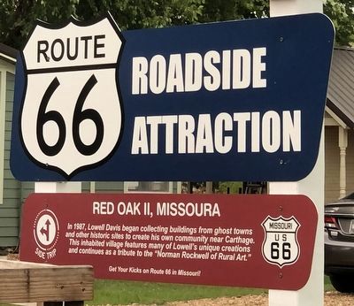
Photographed by Duane and Tracy Marsteller, June 29, 2024
1. Red Oak II, Missoura Marker
Topics and series. This historical marker is listed in this topic list: Arts, Letters, Music. In addition, it is included in the Route 66 Roadside Attractions series list. A significant historical year for this entry is 1987.
Location. 37° 12.663′ N, 94° 16.6′ W. Marker is near Carthage, Missouri, in Jasper County. It is in Madison Township. It is on County Loop 122 0.1 miles south of Kafir Road, on the right when traveling south. Touch for map. Marker is at or near this postal address: 10853 County Loop 122, Carthage MO 64836, United States of America. Touch for directions.

Regionally, this marker is in Southwest Missouri. It is also in the American Lewis & Clark Corridor and in the Corn Belt. Globally, it is in North America, the Western Hemisphere, the Western World, and the Anglosphere. Historically, it finds itself in what was once the territory
this page online
Other nearby markers. At least 8 other markers are within walking distance of this marker: The Parsonage at Red Oak II (a few steps from this marker); Garfield Wiley Cabin (within shouting distance of this marker); Hornback Cabin (within shouting distance of this marker); George Hornback Cabin (within shouting distance of this marker); Dalton Gang Homestead (within shouting distance of this marker); Red Oak II Train Station (within shouting distance of this marker); Fort Hooker (about 300 feet away, measured in a direct line); White Oak Creek Civil War House/Red Barn (about 300 feet away). Touch for a list and map of all markers in Carthage.
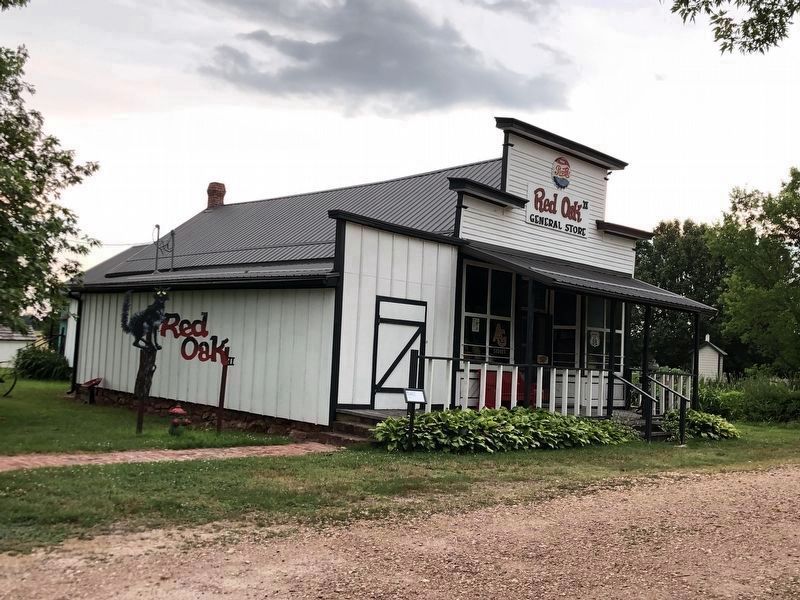
Regarding Red Oak II, Missoura. It is a re-creation of an early 20th century small town that pays homage to Davis' childhood town of Red Oak, Mo., which was located 18 miles to the east. Davis, a renowned Americana artist, moved several buildings from there and other small Missouri ghost towns to his farm in order to preserve and restore them. Red Oak II includes a general store, an active church, several houses,
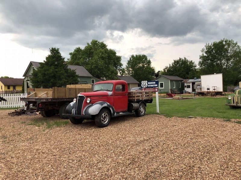
Photographed by Duane and Tracy Marsteller, June 29, 2024
2. Red Oak II, Missoura Marker
Marker is behind the red pickup truck.
Also see . . .
1. Red Oak 2 (Route 66 Pt. 2) - Missouri Life TV Season 5. Good ol' Lowell Davis has lived along Route 66 almost his entire life. We sat down with him near Carthage, Missouri to hear first-hand his experience of the rise, fall, and resurgence of Route 66. Having grown up in a small town swallowed up by the changing economy during the introduction of the interstate system, he re-established and re-built his hometown of Red Oak. (Missouri Life, uploaded Feb. 25, 2020) (Submitted on July 18, 2024, by Duane and Tracy Marsteller of Murfreesboro, Tennessee.)
2. Welcome to Red Oak II Missoura Website. Homepage includes links to a biography of artist Lowell Davis, a history of his Red Oak II community and details about some restored buildings within it. (Submitted on July 18, 2024, by Duane and Tracy Marsteller of Murfreesboro, Tennessee.)
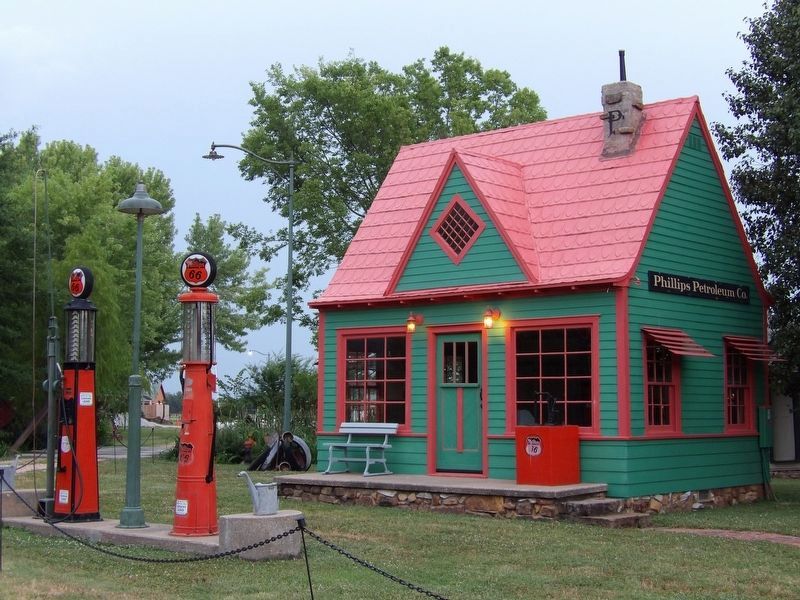
Photographed by Duane and Tracy Marsteller, March 21, 2019
3. Red Oak II
This 1920s Phillips Petroleum station is among the buildings that Davis restored. It originally was located along U.S. Route 66 in Avilla, Mo.

Photographed by Duane and Tracy Marsteller, June 29, 2024
4. Red Oak II
Davis' great-grandfather worked in this blacksmith shop, formerly located in the original Red Oak, Mo.
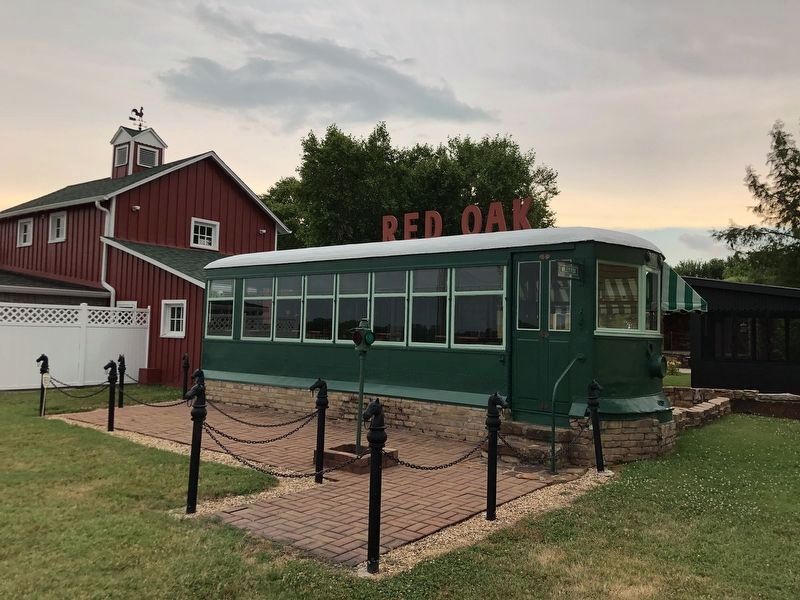
Photographed by Duane and Tracy Marsteller, June 29, 2024
5. Red Oak II
A c. 1920s streetcar turned into a diner.
Photographed by Duane and Tracy Marsteller, June 29, 2024
6. Red Oak II
Davis' father operated this general store in the original Red Oak. It was where Davis discovered and developed his artistic talents as a boy.
Credits. This page was last revised on July 18, 2024. It was originally submitted on July 18, 2024, by Duane and Tracy Marsteller of Murfreesboro, Tennessee. This page has been viewed 312 times since then and 60 times this year. Photos: 1, 2, 3, 4, 5, 6. submitted on July 18, 2024, by Duane and Tracy Marsteller of Murfreesboro, Tennessee.
